MyTopo
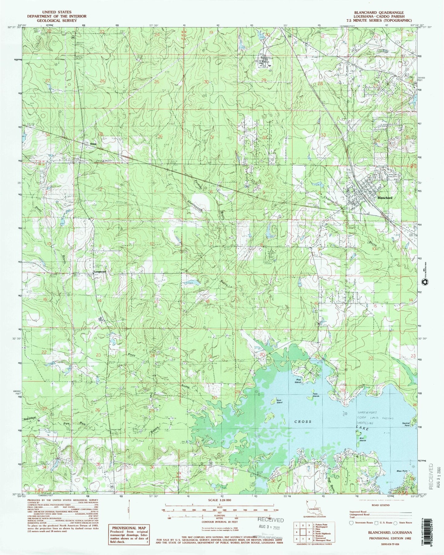
Classic USGS Blanchard Louisiana 7.5'x7.5' Topo Map
Couldn't load pickup availability
Historical USGS topographic quad map of Blanchard in the state of Louisiana. Map scale may vary for some years, but is generally around 1:24,000. Print size is approximately 24" x 27"
This quadrangle is in the following counties: Caddo.
The map contains contour lines, roads, rivers, towns, and lakes. Printed on high-quality waterproof paper with UV fade-resistant inks, and shipped rolled.
Contains the following named places: Bird Islands, Blackwells Pond Dam, Blanchard, Blanchard Elementary School, Blanchard Lake Dam, Blanchard Police Department, Blanchard Post Office, Blanchard United Methodist Church, Bolinger Hillsppl, Caddo Parish, Dune Estates, Evening Star Lake Dam, Evening Star School, First Baptist Church of Blanchard, Fordney Bayou, Greenmoor Park, Gum Island, Hidden Acres, Hidden Harbor Estates, Jack P Timmons Elementary School, Lakeshore North, Larey Gardens, Longwood, Millwood Estates, Moss Point, Mount Zion Cemetery, North Club Estates, North Park Estates, Page Bayou, Paw Paw Bayou, Pine Island, Piney Bayou, Pleasant Grove, Pleasant Grove Lake Dam, Pleasant Grove School, Reed Spring School, Republican Bayou, Richard Fleming Park, Sharpe Pond Dam, Shettleworth Bayou, Shipp, South Shore Estates, Squirrel Point, Starlight Baptist Church, Starlight School, Tater Patch Ultralight Flightpark, Town of Blanchard, Twin Islands, Walker Hill Baptist Church, Walker Hill Cemetery, Walnut Bayou Gas Field, Walter Jacobs Park