MyTopo
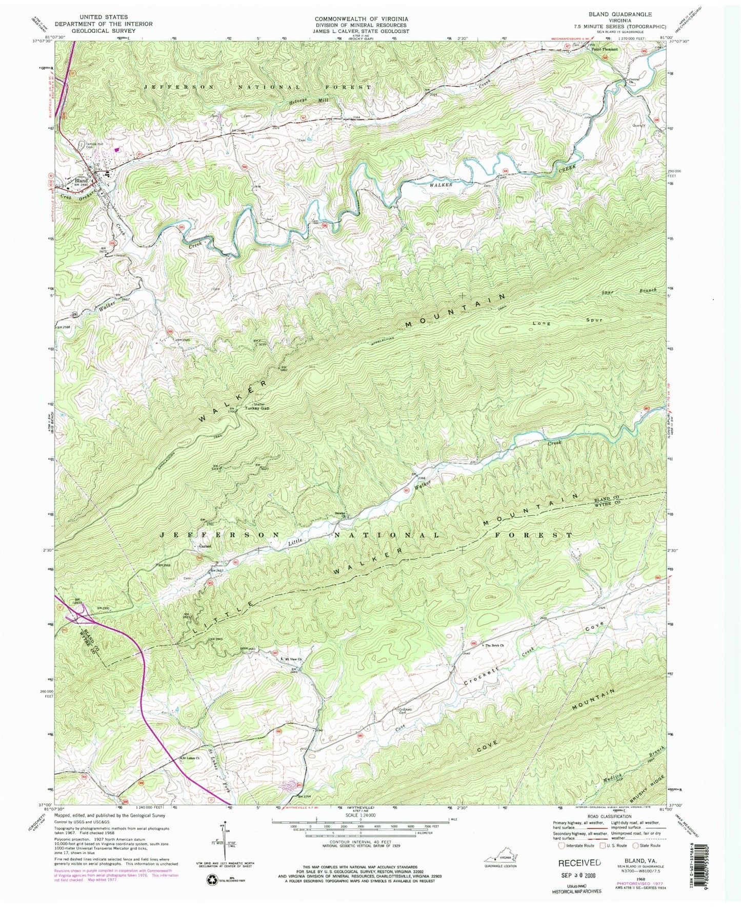
Classic USGS Bland Virginia 7.5'x7.5' Topo Map
Couldn't load pickup availability
Historical USGS topographic quad map of Bland in the state of Virginia. Map scale is 1:24000. Print size is approximately 24" x 27"
This quadrangle is in the following counties: Bland, Wythe.
The map contains contour lines, roads, rivers, towns, and lakes. Printed on high-quality waterproof paper with UV fade-resistant inks, and shipped rolled.
Contains the following named places: Bland, Bland Census Designated Place, Bland County Courthouse, Bland County Sheriff's Office, Bland County Volunteer Fire Department, Bland County Volunteer Rescue Squad, Bland Elementary School, Bland High School, Bland Post Office, Bob King Branch, Carnot, Central Church, Church Branch, Crab Orchard Creek, Creed Branch, Crockett Cemetery, District 2, Helveys Mill Creek, Little Creek School (historical), Long Spur, Mount View Church, Mountain View Cemetery, Newberry Chapel (historical), Newberrys Mill (historical), Point Pleasant, Polly Branch, Poplar Spring Branch, Saint Lukes Cemetery, Saint Lukes Church, Seddon District (historical), Strader Church, Sunnyside School (historical), Surrat Branch, Temple Hill Cemetery, The Brick Church, The Brick Church Cemetery, The Flatwoods, Town Creek, Town Ridge, Turkey Gap, Walker Creek Church (historical), Walker Creek School (historical), Waterfall Branch