MyTopo
Classic USGS Blandburg Pennsylvania 7.5'x7.5' Topo Map
Couldn't load pickup availability
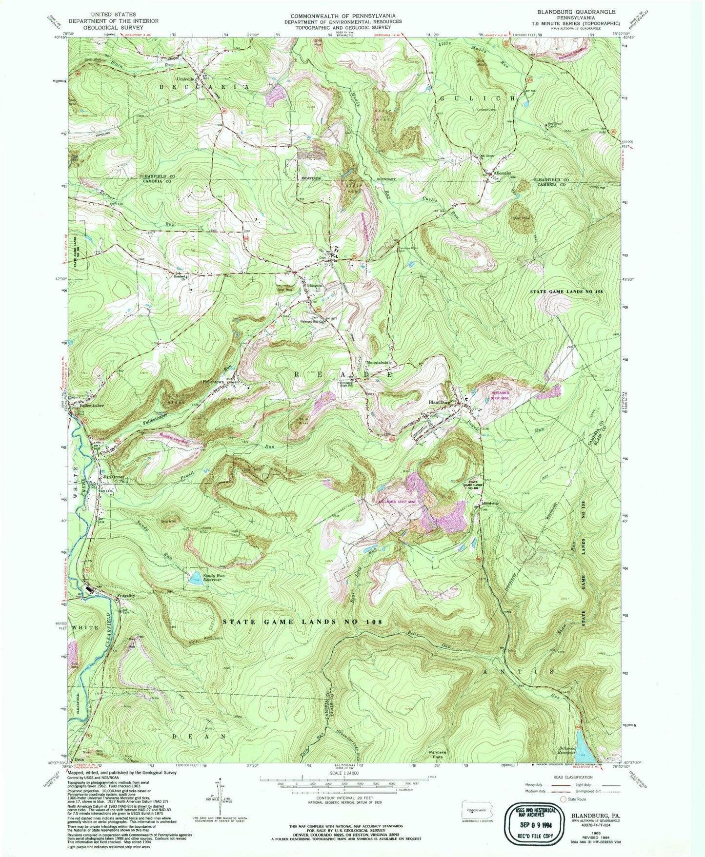
Historical USGS topographic quad map of Blandburg in the state of Pennsylvania. Typical map scale is 1:24,000, but may vary for certain years, if available. Print size: 24" x 27"
This quadrangle is in the following counties: Blair, Cambria, Clearfield.
The map contains contour lines, roads, rivers, towns, and lakes. Printed on high-quality waterproof paper with UV fade-resistant inks, and shipped rolled.
Contains the following named places: Allemans, Bear Loop Run, Bellwood Reservoir, Blandburg, Cambria Mills Cemetery, Criswell Cemetery, Curtis Run, Fallentimber, Glasgow, Mountaindale, Oak Grove Church, Pleasant Hill Church, Powell Run, Roseland Church, Sandy Run, Sandy Run Reservoir, Shaw Run, State Game Lands Number 158, Tubb Run, Utahville, Van Ormer, Green Springs Run, Sandy Run Dam, Hollentown, Fallentimber Run, Williams School (historical), Dakota School (historical), Collier, Cambria Mills School, Heverly, Figart, Bear Loop, Frugality, Lloydville, Reade Township High School, Glasgow Post Office, Township of Reade, Blandburg Census Designated Place, Reade Township Fire Company Station 63, Blandburg Post Office, Utahville Cemetery, Pleasant Hill United Methodist Church Cemetery, Roseland Church Cemetery, Mount Zion Lutheran Cemetery, Allemansville Cemetery