MyTopo
Classic USGS Blandford Massachusetts 7.5'x7.5' Topo Map
Couldn't load pickup availability
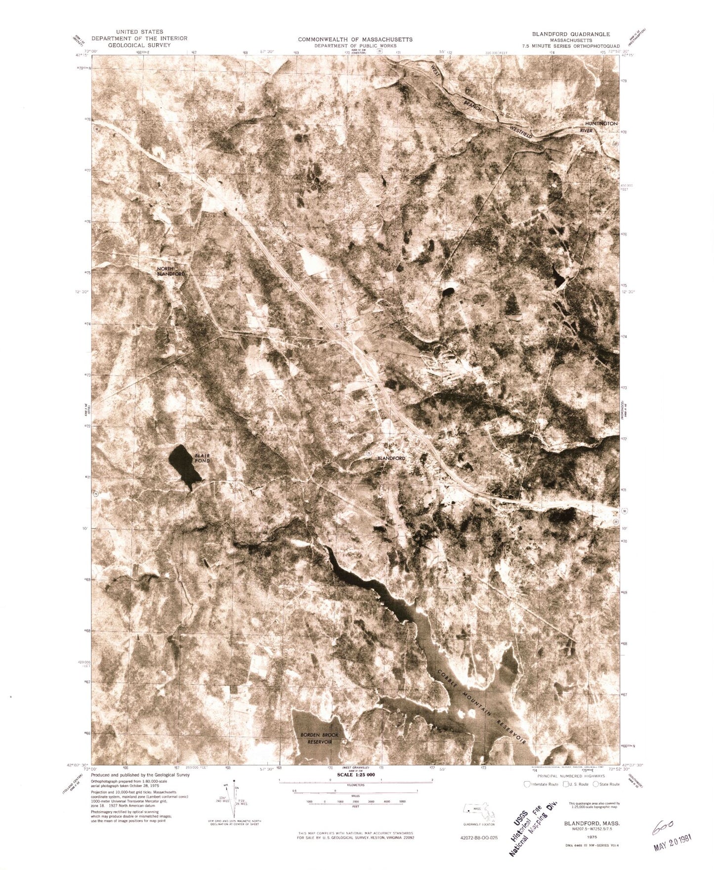
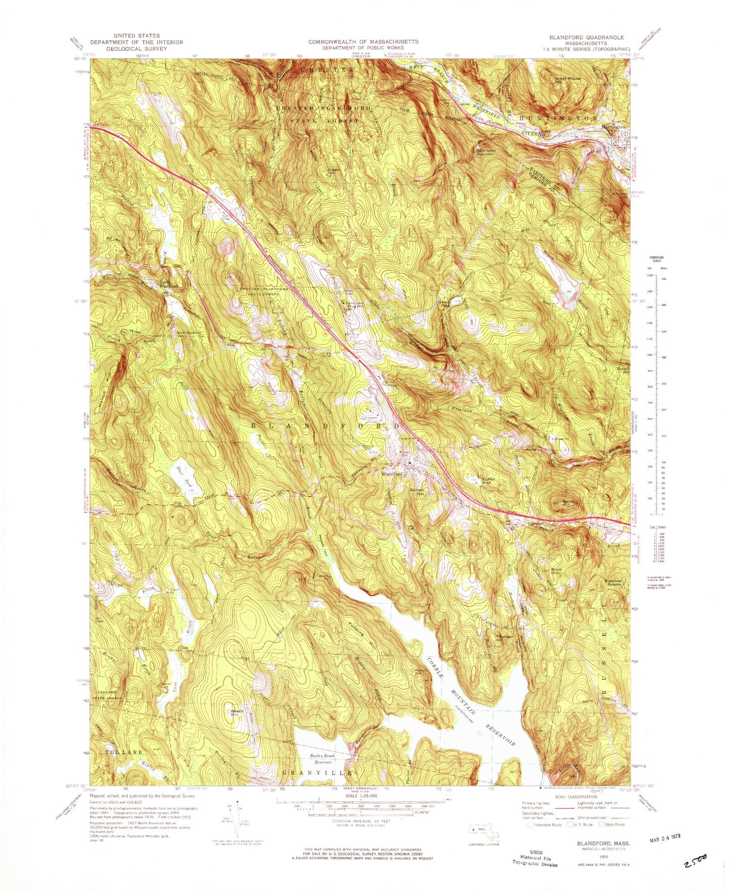
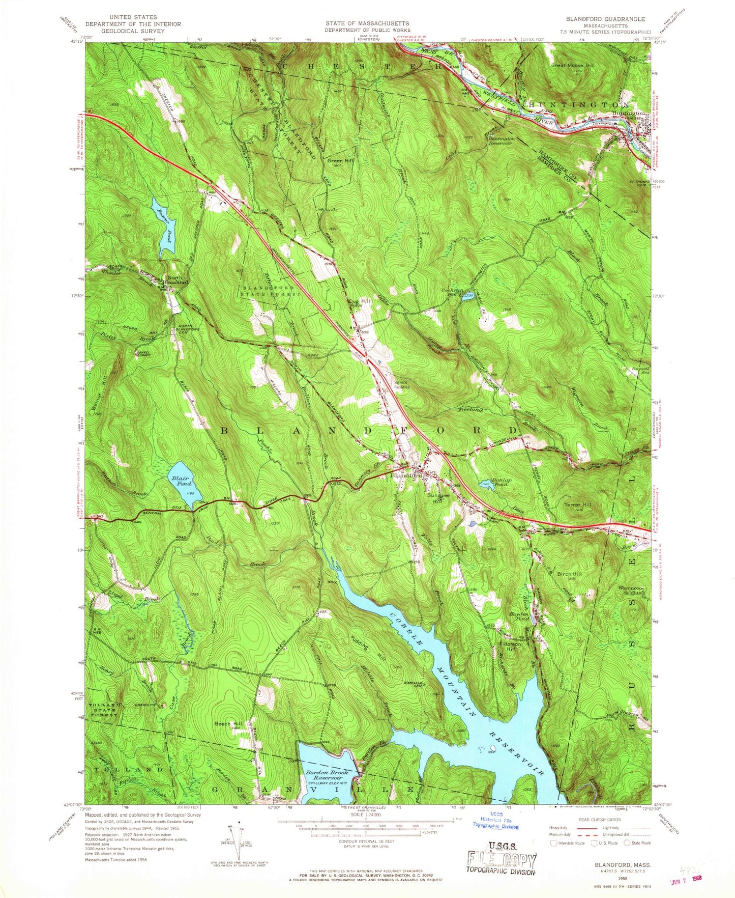
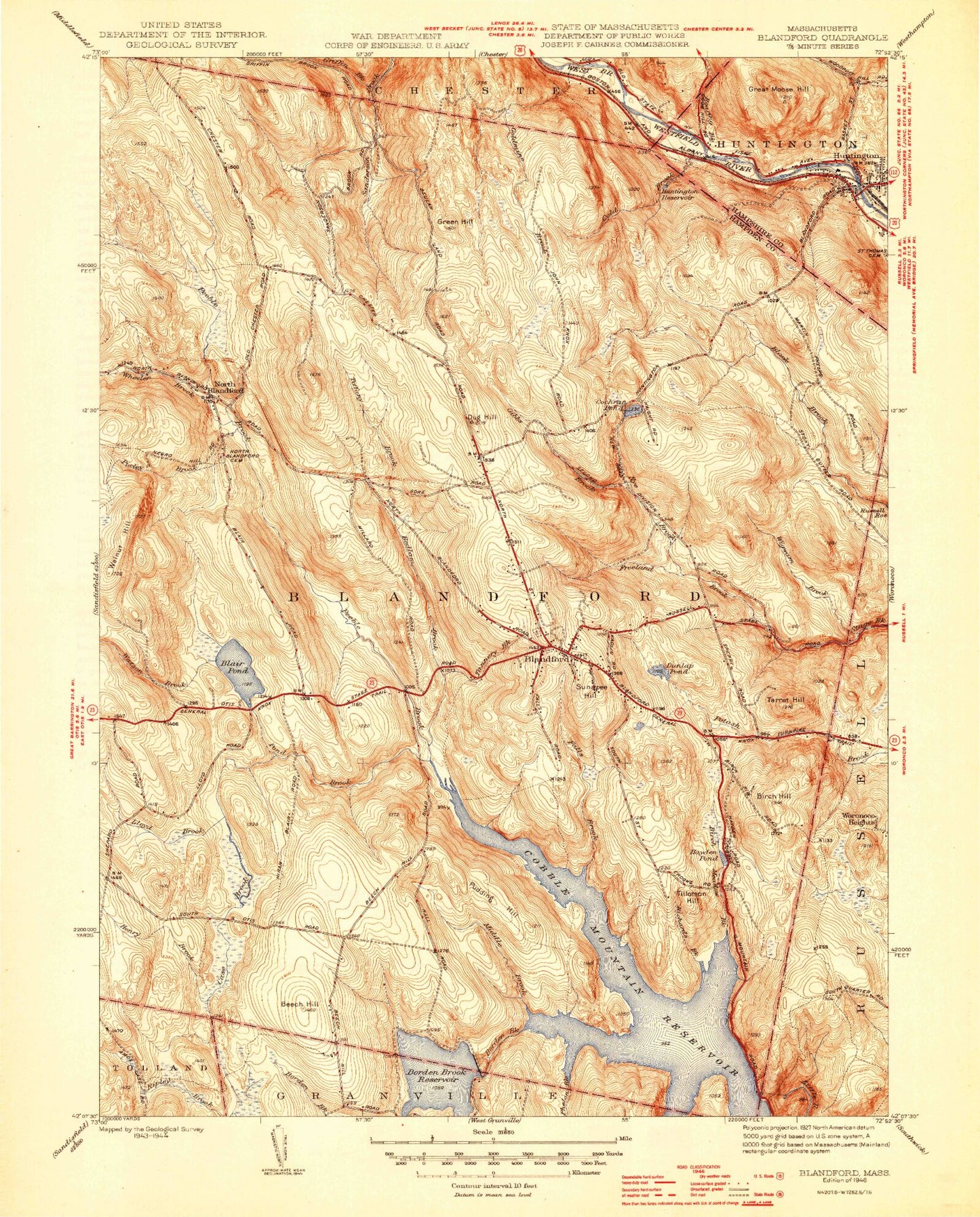
Historical USGS topographic quad map of Blandford in the state of Massachusetts. Map scale is 1:25000. Print size is approximately 24" x 27"
This quadrangle is in the following counties: Hampden, Hampshire.
The map contains contour lines, roads, rivers, towns, and lakes. Printed on high-quality waterproof paper with UV fade-resistant inks, and shipped rolled.
Contains the following named places: Beaver Pond, Beaver Pond, Beaver Pond, Beaver Pond Dam, Beaver Pond Dam, Beaver Pond Dam, Bedlam Brook, Bedlam Brook, Bedlam Brook, Beech Hill, Beech Hill, Beech Hill, Birch Hill, Birch Hill, Birch Hill, Birch Meadow Brook, Birch Meadow Brook, Birch Meadow Brook, Black Brook Dam, Black Brook Dam, Black Brook Dam, Black Brook Reservoir, Black Brook Reservoir, Black Brook Reservoir, Blair Pond, Blair Pond, Blair Pond, Blandford, Blandford, Blandford, Blandford Cemetery, Blandford Cemetery, Blandford Cemetery, Blandford Census Designated Place, Blandford Census Designated Place, Blandford Census Designated Place, Blandford Fire Department, Blandford Fire Department, Blandford Fire Department, Blandford Police Department, Blandford Police Department, Blandford Post Office, Blandford Post Office, Blandford Post Office, Blandford Ski Area, Blandford Ski Area, Blandford Ski Area, Blandford Town Hall, Blandford Town Hall, Blandford Town Hall, Blanford Elementary School, Blanford Elementary School, Blanford Elementary School, Borden Brook, Borden Brook, Borden Brook, Borden Brook Reservoir, Borden Brook Reservoir, Borden Brook Reservoir, Borden Brook Reservoir Dam, Borden Brook Reservoir Dam, Borden Brook Reservoir Dam, Case Brook, Case Brook, Case Brook, Chester-Blanford State Forest, Chester-Blanford State Forest, Chester-Blanford State Forest, Cobble Mountain Reservoir, Cobble Mountain Reservoir, Cobble Mountain Reservoir, Cobble Mountain Reservoir Dam, Cobble Mountain Reservoir Dam, Cobble Mountain Reservoir Dam, Cochran Pond, Cochran Pond, Cochran Pond, Cold Brook, Cold Brook, Cold Brook, Dug Hill, Dug Hill, Dug Hill, Dunlap Pond, Dunlap Pond, Dunlap Pond, Dunlap Pond Dam, Dunlap Pond Dam, Dunlap Pond Dam, Falls Brook, Falls Brook, Falls Brook, First Congregational Church of Blandford, First Congregational Church of Blandford, First Congregational Church of Blandford, Freeland Brook, Freeland Brook, Freeland Brook, Gibbs Brook, Gibbs Brook, Gibbs Brook, Goldmine Brook, Goldmine Brook, Goldmine Brook, Great Moose Hill, Great Moose Hill, Great Moose Hill, Green Hill, Green Hill, Green Hill, Griffin Brook, Griffin Brook, Griffin Brook, Hayden Pond, Hayden Pond, Hayden Pond, Henry Brook, Henry Brook, Henry Brook, Huntington, Huntington, Huntington, Huntington Census Designated Place, Huntington Census Designated Place, Huntington Census Designated Place, Huntington Evangelical Church, Huntington Evangelical Church, Huntington Evangelical Church, Huntington Fire Department Main Station, Huntington Fire Department Main Station, Huntington Fire Department Main Station, Huntington Police Department, Huntington Police Department, Huntington Police Department, Huntington Post Office, Huntington Post Office, Huntington Post Office, Huntington Reservoir, Huntington Reservoir, Huntington Reservoir, Huntington Town Hall, Huntington Town Hall, Huntington Town Hall, Lloyd Brook, Lloyd Brook, Lloyd Brook, Middle Brook, Middle Brook, Middle Brook, Murrayfield Elementary Schol, Murrayfield Elementary Schol, Murrayfield Elementary Schol, North Blandford, North Blandford, North Blandford, North Blandford Cemetery, North Blandford Cemetery, North Blandford Cemetery, Nye Brook, Nye Brook, Nye Brook, Pebble Hill, Pebble Hill, Pebble Hill, Peebles Brook, Peebles Brook, Peebles Brook, Peebles Hollow, Peebles Hollow, Peebles Hollow, Phelon Brook, Phelon Brook, Phelon Brook, Pioneer Valley Assembly Church, Pioneer Valley Assembly Church, Pioneer Valley Assembly Church, Pixley Brook, Pixley Brook, Pixley Brook, Pond Brook, Pond Brook, Pond Brook, Pudding Hill, Pudding Hill, Pudding Hill, Richards Brook, Richards Brook, Richards Brook, Roaring Brook, Roaring Brook, Roaring Brook, Sugar Creek, Sugar Creek, Sugar Creek, Sunset Hill, Sunset Hill, Sunset Hill, Sunset Rock, Sunset Rock, Sunset Rock, Tannery Brook, Tannery Brook, Tannery Brook, Tarrot Hill, Tarrot Hill, Tarrot Hill, The Volcanic Crater, The Volcanic Crater, The Volcanic Crater, Tiffany Brook, Tiffany Brook, Tiffany Brook, Tillotson Hill, Tillotson Hill, Tillotson Hill, Town of Blandford, Town of Blandford, Town of Blandford, Walnut Hill, Walnut Hill, Walnut Hill, Warfield Cemetery, Warfield Cemetery, Warfield Cemetery, Watson Brook, Watson Brook, Watson Brook, Watson Park, Watson Park, Watson Park, Wheeler Brook, Wheeler Brook, Wheeler Brook, Wigwam Brook, Wigwam Brook, Wigwam Brook