MyTopo
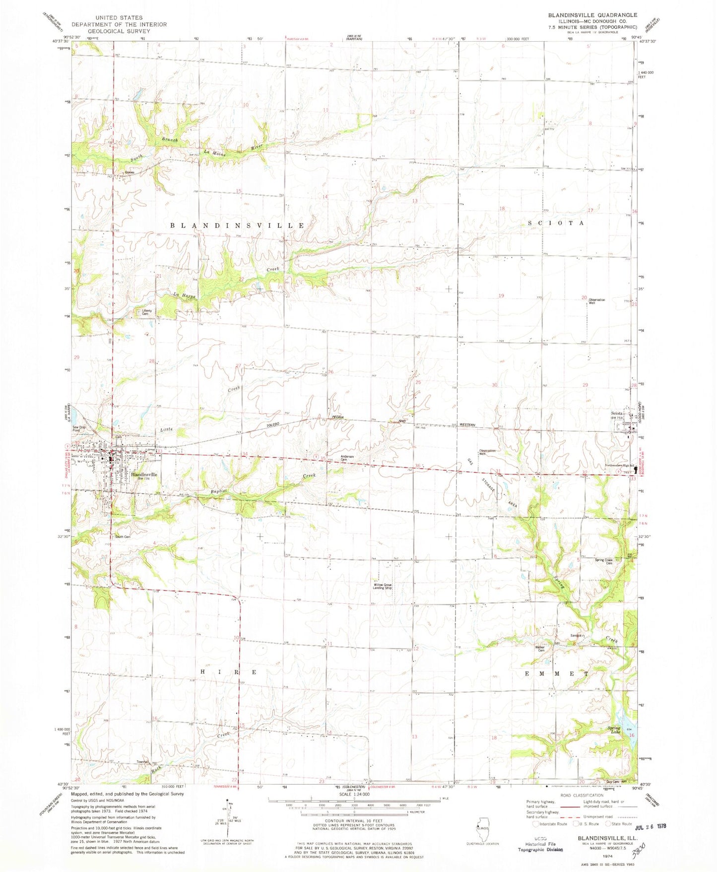
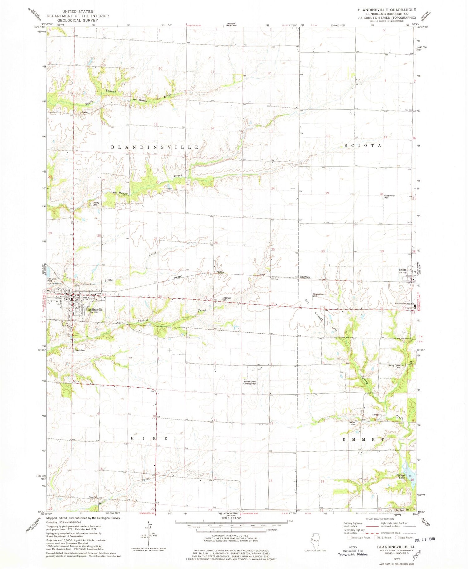
Classic USGS Blandinsville Illinois 7.5'x7.5' Topo Map
Couldn't load pickup availability
Historical USGS topographic quad map of Blandinsville in the state of Illinois. Map scale may vary for some years, but is generally around 1:24,000. Print size is approximately 24" x 27"
This quadrangle is in the following counties: McDonough.
The map contains contour lines, roads, rivers, towns, and lakes. Printed on high-quality waterproof paper with UV fade-resistant inks, and shipped rolled.
Contains the following named places: Anderson and Huff Cemetery, Blandinsville, Blandinsville - Hire Fire Protection District, Blandinsville City Lake Dam, Blandinsville City Reservoir, Blandinsville Post Office, Blandinsville School, Blandinsville United Methodist Church, Blandinsville-Hire Community Center, Cane Patch School, Center School, Elm Grove School, Elm Grove United Brethren Church, First Baptist Church of Blandinsville, First Christian Church, Foster School, Glade City Cemetery, Good Hope - Sciota Fire Protection District Station 2, Guy Cemetery, Guy School, Hainline School, Hardscrabble School, Hire Townhall, Huston Lawn School, Liberty Cemetery, Liberty Christian Church, Liberty Methodist Episcopal Church, Liberty School, Lombard School, Muddy Lane School, Mustain Cemetery, Northwestern High School, Northwestern Junior High School, Pennington Number 1 Cemetery, Pleasant Gale United Brethren Church, Pleasant View Methodist Episcopal Church, Rabbit Burrow School, Sciota, South Cemetery, Spring Creek Cemetery, Spring Creek Settlement, Thompson College School, Timber School, Township of Blandinsville, Township of Hire, Village of Blandinsville, Walker Cemetery, Willow Grove Evangelical United Brethren Church, Willow Grove Landing Strip, Willow Grove School, ZIP Codes: 61420, 61475