MyTopo
Classic USGS Blankenbaker Flats Montana 7.5'x7.5' Topo Map
Regular price
$16.95
Regular price
Sale price
$16.95
Unit price
per
Couldn't load pickup availability
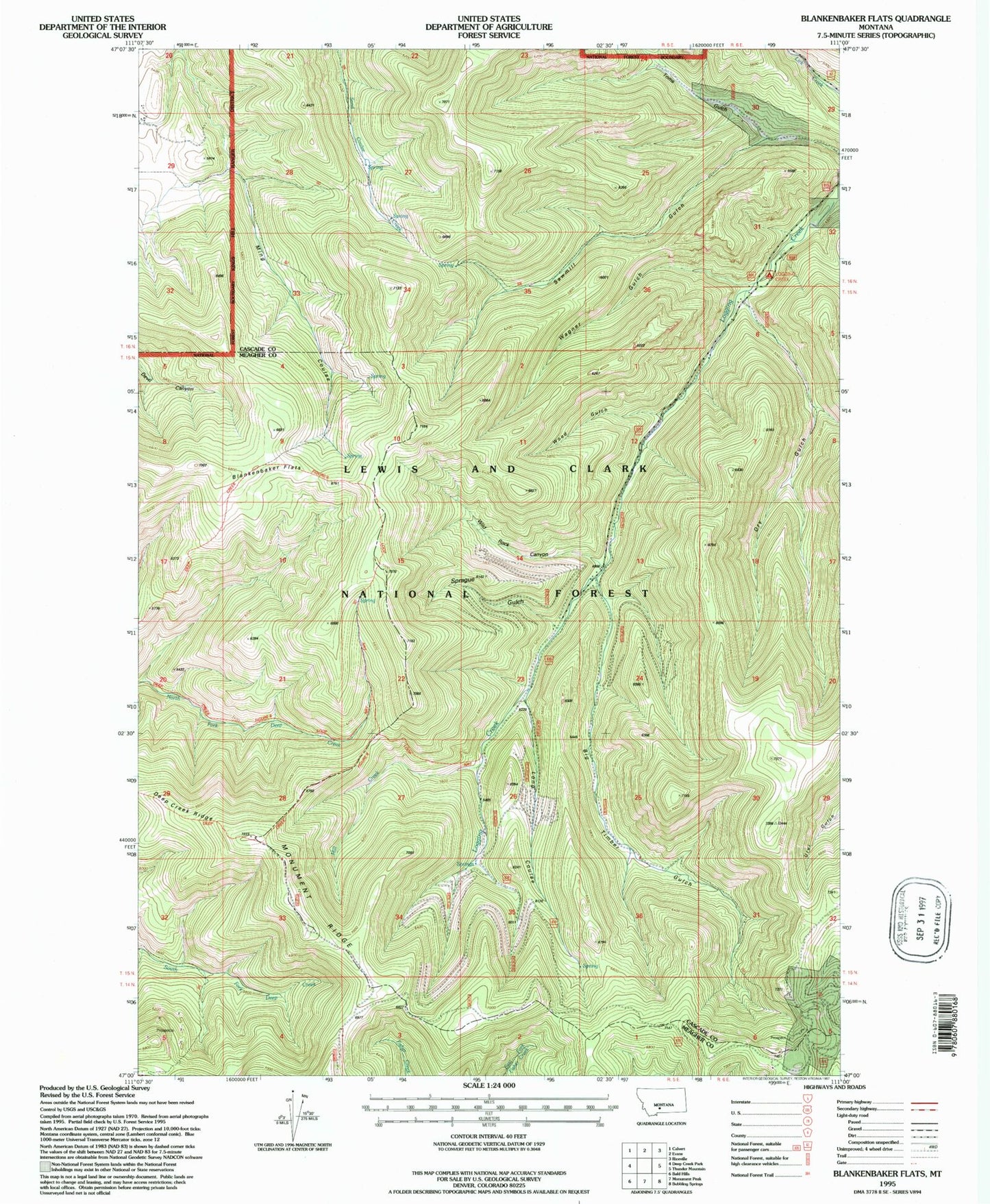
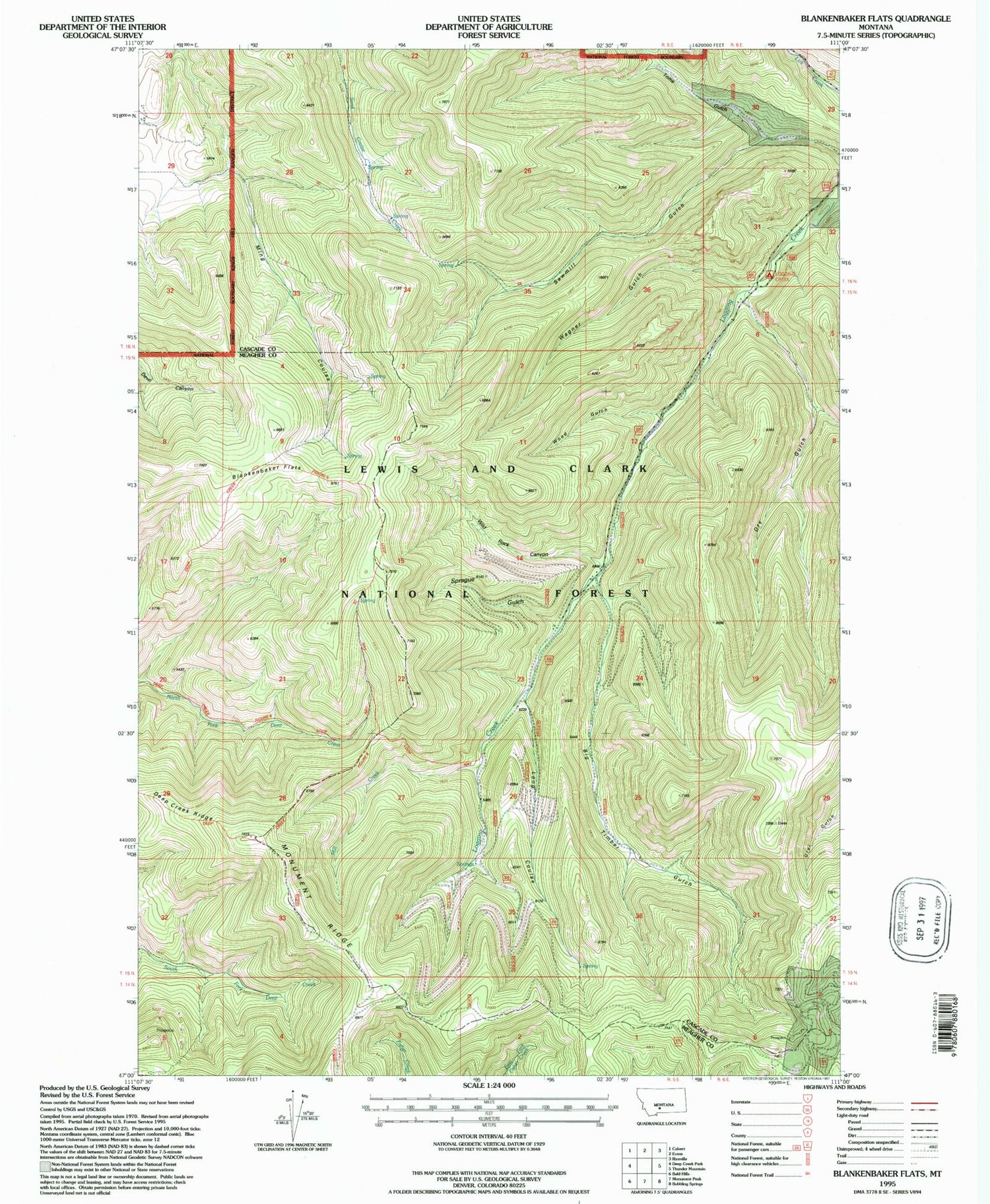
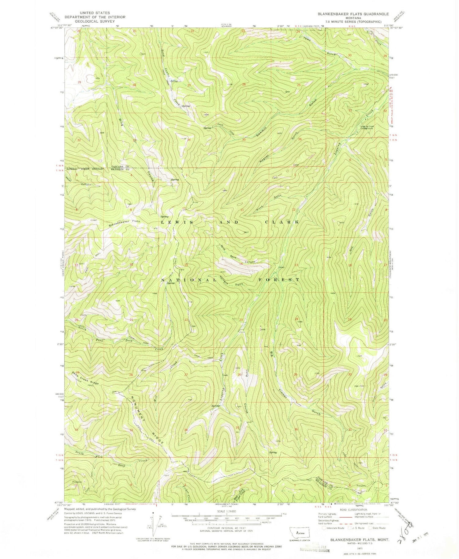
Historical USGS topographic quad map of Blankenbaker Flats in the state of Montana. Map scale may vary for some years, but is generally around 1:24,000. Print size is approximately 24" x 27"
This quadrangle is in the following counties: Cascade, Meagher.
The map contains contour lines, roads, rivers, towns, and lakes. Printed on high-quality waterproof paper with UV fade-resistant inks, and shipped rolled.
Contains the following named places: Big Timber Gulch, Blankenbaker Flats, Carbonate, Deep Creek Figure 8 Loop National Recreation Trail, Deep Creek Ridge, Dry Gulch, Logging Creek Campground, Long Coulee, Mill Creek, Monument Ridge, Sprague Gulch, Toms Gulch, Wagner Gulch, Wild Rock Canyon, Wood Gulch