MyTopo
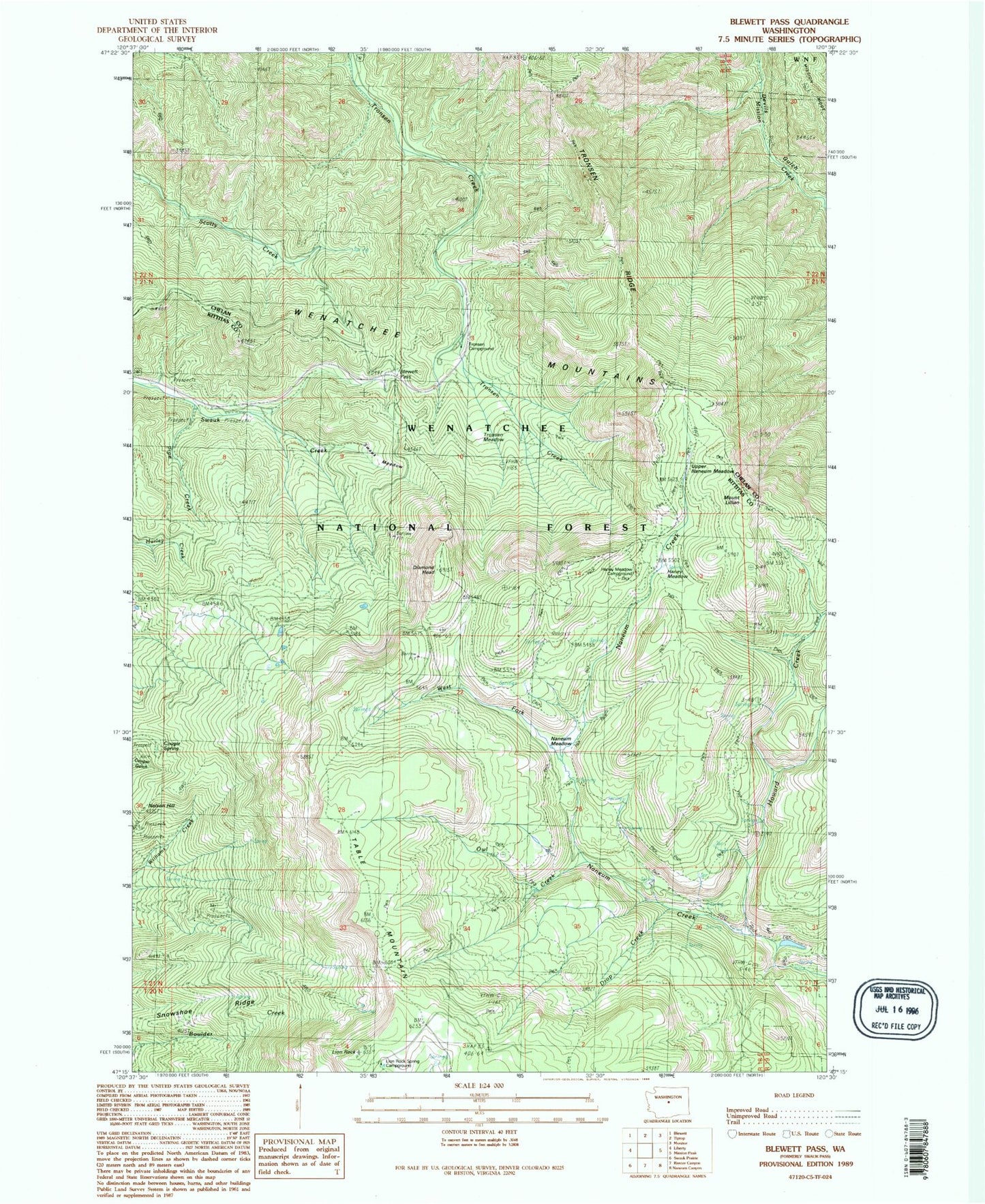
Classic USGS Blewett Pass Washington 7.5'x7.5' Topo Map
Couldn't load pickup availability
Historical USGS topographic quad map of Blewett Pass in the state of Washington. Map scale is 1:24000. Print size is approximately 24" x 27"
This quadrangle is in the following counties: Chelan, Kittitas.
The map contains contour lines, roads, rivers, towns, and lakes. Printed on high-quality waterproof paper with UV fade-resistant inks, and shipped rolled.
Contains the following named places: Blewett Pass, Diamond Head, Drop Creek, Drop Creek Spur Trail, Haney Meadow, Haney Meadow Campground, Howard Creek, Howard Creek Trail, Lion Rock, Lion Rock Lookout, Lion Rock Spring Campground, Mount Lillian, Naneum Meadow, Naneum Meadow Trail, Old Ellensburg Trail, Owl Creek, Owl Creek Spur Trail, Pine Campground, Pipe Creek, Snowshoe Ridge, Stump Campground, Swauk Meadow, Swauk Pass Sno-Park, Swauk Ridge, Table Mountain, Tronsen Campground, Tronsen Creek Trail, Tronsen Meadow, Tronsen Ridge, Upper Naneum Meadow, West Fork Naneum Creek