MyTopo
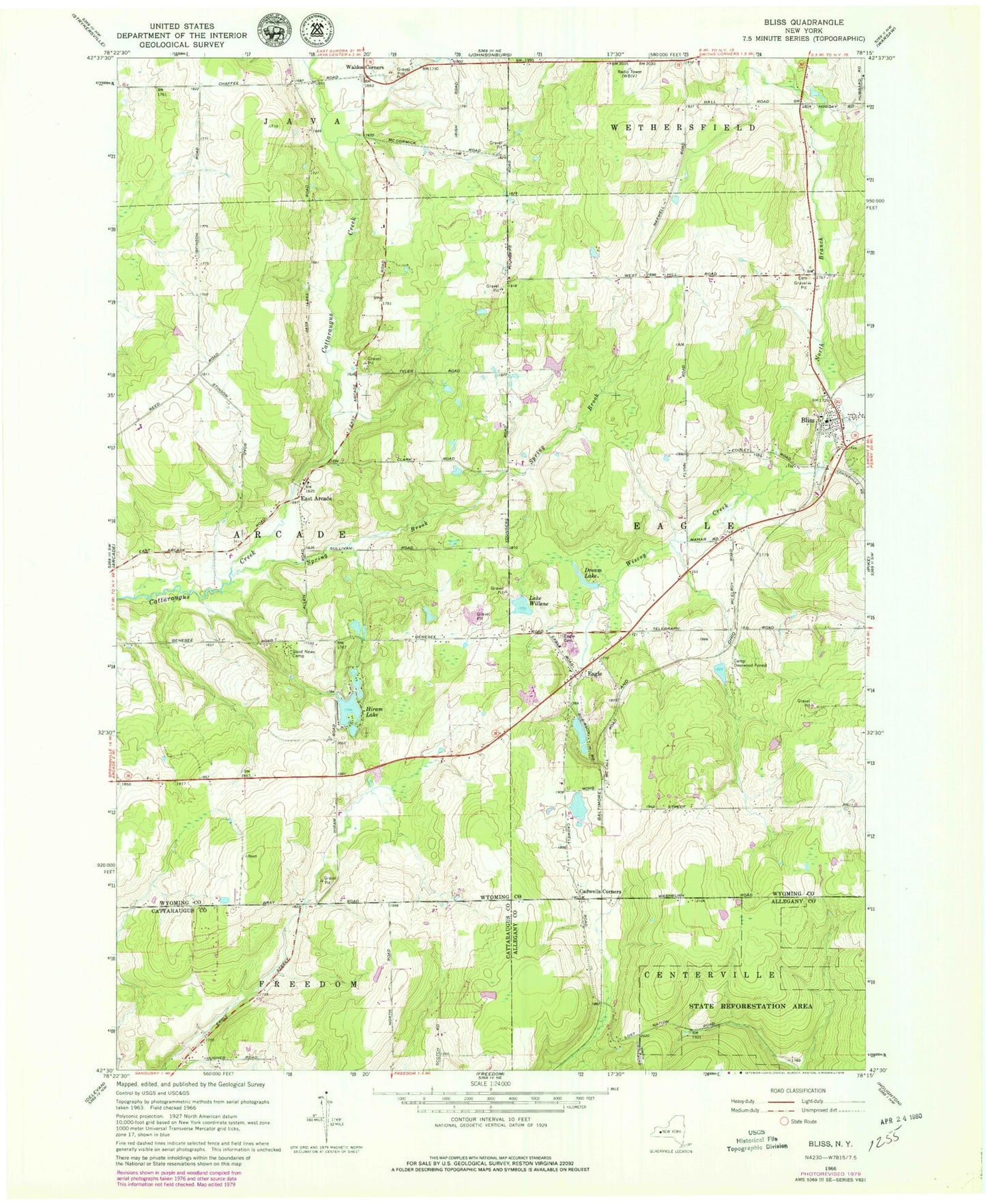
Classic USGS Bliss New York 7.5'x7.5' Topo Map
Couldn't load pickup availability
Historical USGS topographic quad map of Bliss in the state of New York. Typical map scale is 1:24,000, but may vary for certain years, if available. Print size: 24" x 27"
This quadrangle is in the following counties: Allegany, Cattaraugus, Wyoming.
The map contains contour lines, roads, rivers, towns, and lakes. Printed on high-quality waterproof paper with UV fade-resistant inks, and shipped rolled.
Contains the following named places: Bliss, Cadwells Corners, Camp Deerwood Forest, Dream Lake, Eagle, Eagle Village Cemetery, Good News Camp, Hiram Lake, North Branch Wiscoy Creek, Spring Brook, Waldos Corners, Lake Willene, East Arcade, East Arcade Airport (historical), Keysa Airport, WEZQ-FM (Town of Wethersfield), Saint Mary's Cemetery, Saint Mary's Catholic Church, Cadwell Corners Cemetery, Bliss Post Office, Bliss Census Designated Place, Bliss Fire Department Eagle Hose Company 1, Davis Valley Farm, Dziedzic Farms, Zielenieski Farms