MyTopo
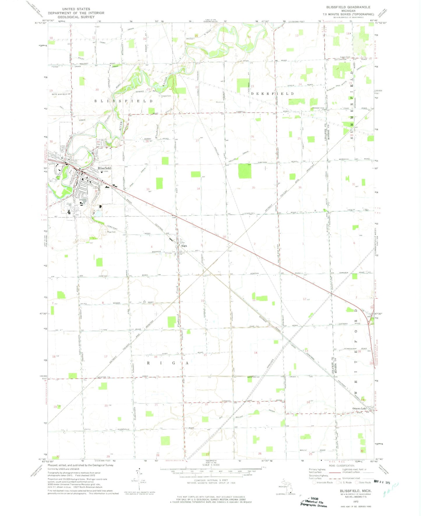
Classic USGS Blissfield Michigan 7.5'x7.5' Topo Map
Couldn't load pickup availability
Historical USGS topographic quad map of Blissfield in the state of Michigan. Map scale may vary for some years, but is generally around 1:24,000. Print size is approximately 24" x 27"
This quadrangle is in the following counties: Lenawee, Monroe.
The map contains contour lines, roads, rivers, towns, and lakes. Printed on high-quality waterproof paper with UV fade-resistant inks, and shipped rolled.
Contains the following named places: Bachmayer Little League Park, Bachmayer Park, Betz Airport, Blissfield, Blissfield Baptist Church, Blissfield Bible Holiness Church, Blissfield Elementary School, Blissfield Hotel Historical Marker, Blissfield Junior High, Blissfield Police Department, Blissfield Post Office, Blissfield Senior High School, Blissfield Station, Blissfield Township Fire Department, Carpenter House Historical Marker, Christian Union Church, Crane Cemetery, Eddy Extension Drain, Ellis Park, Erie and Kalamazoo Railroad Historical Marker, Farver Little League Park, First Presbyterian Church, First Presbyterian Church Historical Marker, First United Brethren Church, First United Methodist Church, Floodwood Creek, Hill Drain, Hiram D Ellis House Historical Marker, Kellar and Riga Drain, Kellar Drain, Logan Cemetery, Ottawa Lake Station, Pease Drain, Pleasant View Cemetery, Ravine Drain, Riga, Riga Cemetery, Riga Drain, Riga Post Office, Riga Station, Riga Township Fire Department, Saint Johns Evangelical Lutheran Church, Saint Paul Evangelical Lutheran Church, Saint Peter the Apostle Church, Schultz-Holmes Memorial Library, Township of Blissfield, Township of Riga, Trinity Lutheran Church, Village of Blissfield, Wiley Drain, ZIP Code: 49276