MyTopo
Classic USGS Blizzard Gap Oregon 7.5'x7.5' Topo Map
Regular price
$16.95
Regular price
Sale price
$16.95
Unit price
per
Couldn't load pickup availability
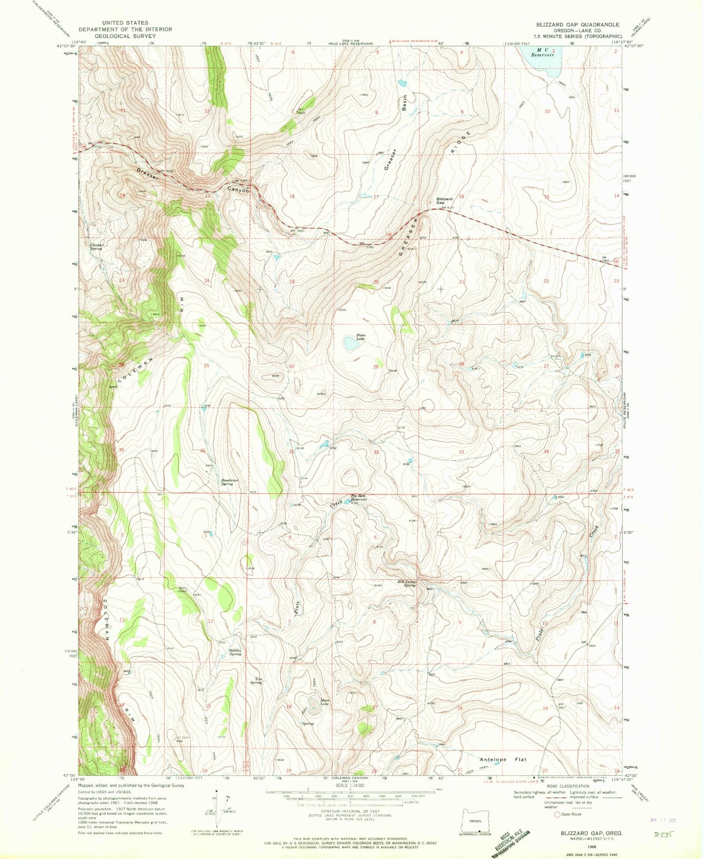
Historical USGS topographic quad map of Blizzard Gap in the state of Oregon. Map scale may vary for some years, but is generally around 1:24,000. Print size is approximately 24" x 27"
This quadrangle is in the following counties: Lake.
The map contains contour lines, roads, rivers, towns, and lakes. Printed on high-quality waterproof paper with UV fade-resistant inks, and shipped rolled.
Contains the following named places: Antelope Flat, Barry Cabin, Big Hole Reservoir, Blizzard Gap, Chukar Spring, Coleman Rim, East Barry Reservoir, Greaser Basin, Greaser Ridge, Hidden Spring, Hill Camp Spring, L J H Reservoir, Moon Lake, North Barry Reservoir, Ornoname 4 Dam, Pinto Lake, Rosebriar Spring, Tim Spring