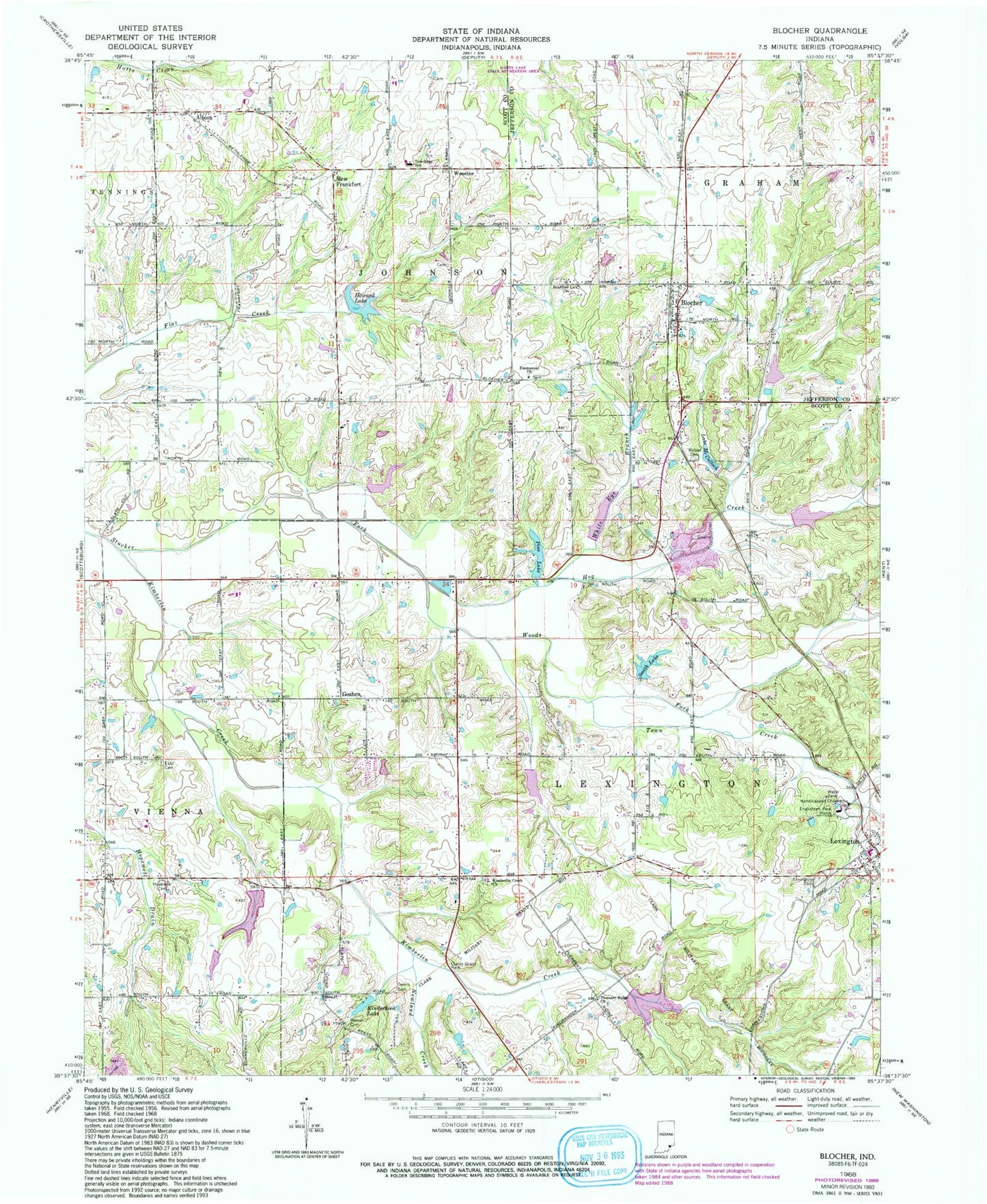
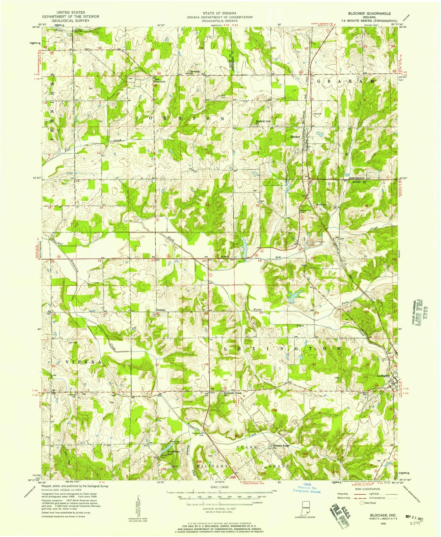
MyTopo
Classic USGS Blocher Indiana 7.5'x7.5' Topo Map
Couldn't load pickup availability
Historical USGS topographic quad map of Blocher in the state of Indiana. Map scale may vary for some years, but is generally around 1:24,000. Print size is approximately 24" x 27"
This quadrangle is in the following counties: Jefferson, Scott.
The map contains contour lines, roads, rivers, towns, and lakes. Printed on high-quality waterproof paper with UV fade-resistant inks, and shipped rolled.
Contains the following named places: Albion, Bethel Cemetery, Blocher, Bridgewater Cemetery, Clarks Grant Park, Emmanuel Church, Englishton Park Home, Estil Cemetery, Goshen, Hardy Quarry, Hog Creek, Hopewell Cemetery, Howard Lake, Johnson Township Volunteer Fire Department, Kimberlin Creek, Kimberlin Creek Church, Kinderhook Lake, Lake McCulloch, Leroy Smith Lake Dam, Lexington, Lexington Cemetery, Lexington Elementary School, Lexington Post Office, Morgan Trail Park, New Frankfort, Newland Creek, Pine Lake, Pine Lake Dam, Pleasant Ridge Church, Presbyterian National Missions Lake, Presbyterian National Missions Lake Dam, Reeves Cemetery, Scaffold Lick Church, Scott County, Scott County Quarry, Smith Lake, Stucker Fork Structure Number 4, Thomas J Miller Lake, Thomas J Miller Lake Dam, Town Creek, Township of Lexington, White Eye Branch, Woods Fork, Wooster