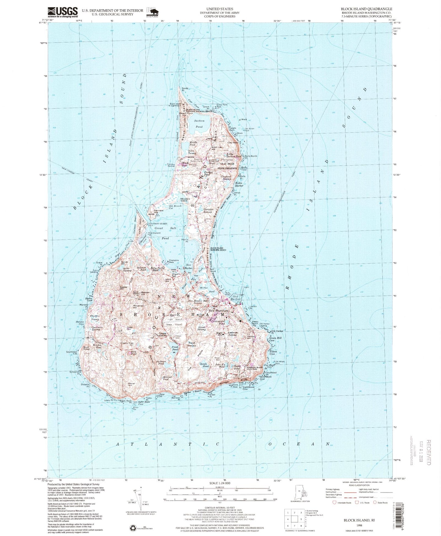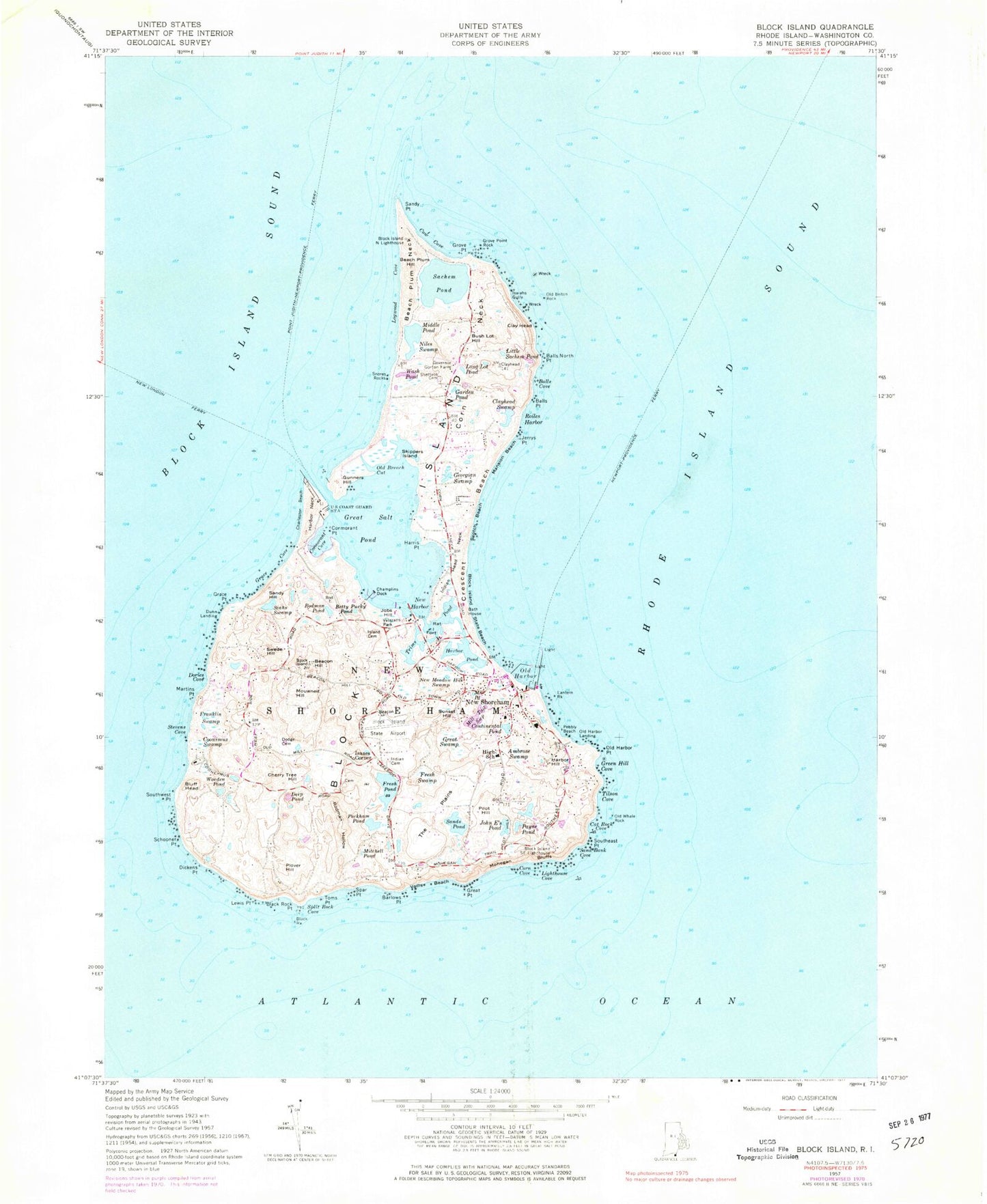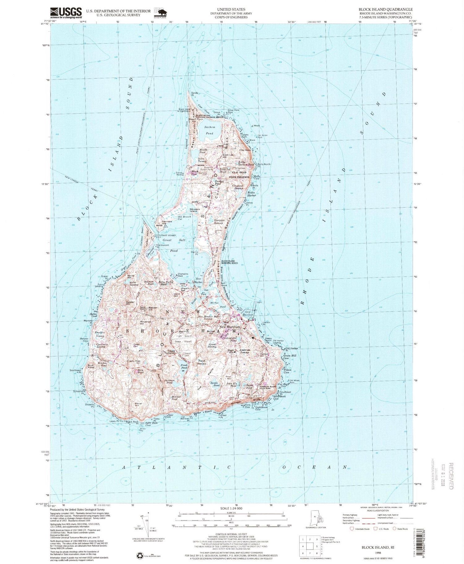
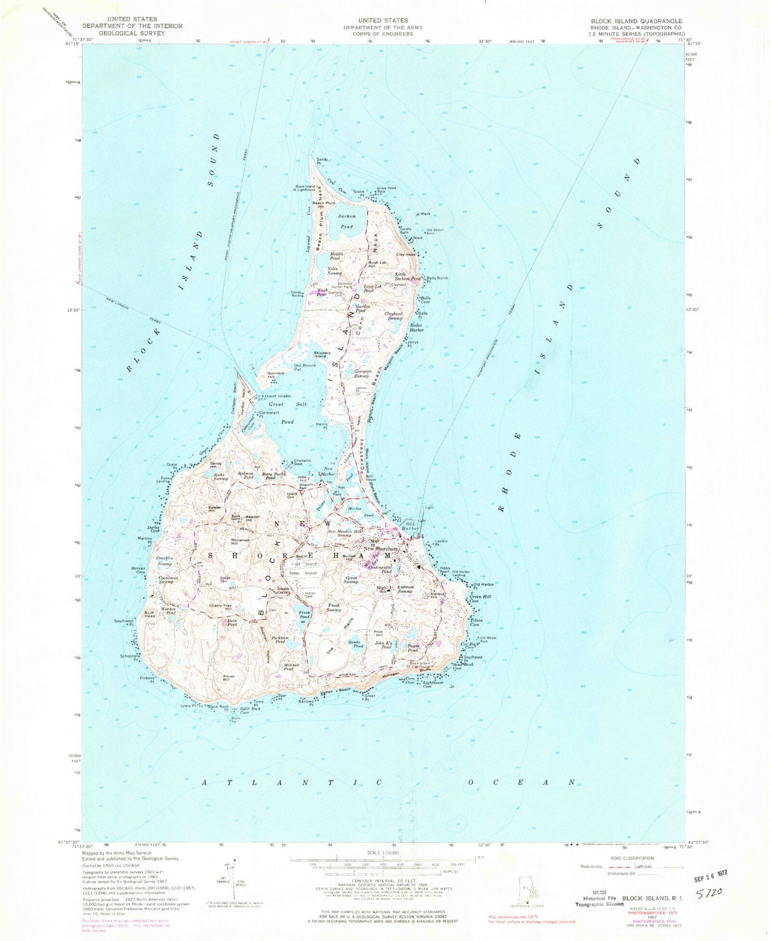
MyTopo
Classic USGS Block Island Rhode Island 7.5'x7.5' Topo Map
Couldn't load pickup availability
Historical USGS topographic quad map of Block Island in the state of Rhode Island. Typical map scale is 1:24,000, but may vary for certain years, if available. Print size: 24" x 27"
This quadrangle is in the following counties: Washington.
The map contains contour lines, roads, rivers, towns, and lakes. Printed on high-quality waterproof paper with UV fade-resistant inks, and shipped rolled.
Contains the following named places: Sandy Point, Block Island North Lighthouse, Cow Cove, Grove Point, Grove Point Rock, Sachem Pond, Logwood Cove, Beach Plum Neck, Beach Plum Hill, Niles Swamp, Snores Rocks, Wash Pond, Governor Gorton Farm, Corn Neck, Bush Lot Hill, Long Lot Pond, Garden Pond, Isaiahs Gully, Old Briton Rock, Clay Head, Little Sachem Pond, Balls North Point, Balls Cove, Clayhead Swamp, Roiles Harbor, Jerrys Point, Georgian Swamp, Mansion Beach, Scotch Beach, Indian Head Neck, Crescent Beach, Block Island State Beach, Skippers Island, Old Breach Cut, Gunners Hill, Great Salt Pond, Harris Point, Champlins Dock, Cormorant Point, Cormorant Cove, Harbor Neck, Charleston Beach, Grace Cove, Grace Point, Sandy Hill, New Harbor, Jobs Hill, Siahs Swamp, Betty Pucky Pond, Rodman Pond, Veterans Park, Trims Pond, Fort Island, Harbor Pond, Rat Island, Swede Hill, Beacon Hill, Dories Cove, Mouwneit Hill, Martins Point, Stevens Cove, Franklin Swamp, Coonimus Swamp, Southwest Point, Bluff Head, Cherry Tree Hill, Deep Pond, Schooner Point, Dickens Point, Lewis Point, Plover Hill, Black Rock Point, Black Rock, Split Rock Cove, Toms Point, Spar Point, Barlows Point, Vaills Beach, Great Point, Corn Cove, Lighthouse Cove, Sand Bank Cove, Southeast Point, Cat Rock Cove, Old Whale Rock, Tilson Cove, Green Hill Cove, Old Harbor Point, Lantern Rock, Old Harbor, Block Island, Rodman Hollow, Mitchell Pond, Peckham Pond, Fresh Pond, Block Island State Airport, Fresh Swamp, The Plains, Sands Pond, New Meadow Hill Swamp, Sunset Hill, Great Swamp, Mill Pond, Mill Tail Swamp, Continental Pond, Pilot Hill, John E's Pond, Ambrose Swamp, Payne Pond, Block Island Southeast Lighthouse, Mill Tail Swamp and Pond, Pebbly Beach, Boiling Spring, Worden Pond, Dunn Landing, Old Harbor Landing, Isaacs Corner, Block Island North Reef, Sheffield Cemetery, Balls Point, Island Cemetery, John R Dodge Cemetery, Harbor Hill, Mohegan Bluffs, New Shoreham Center, New Shoreham, Middle Pond, Town of New Shoreham, Ballards Beach, Beacon Hill Stone Tower, Black Rock Beach, Block Island Free Library, Block Island Historical Society Museum, Block Island National Wildlife Refuge, Block Island School, Clayhead Nature Trail, Dees Tug Hole, Harbor Church, Free Will Baptist Church, Middletown Square, Monhegan Bluffs Beach, Ball Pond, Neptune Lodge Number 21, New Shoreham Town Hall, Niles Spring, Old Center School House, Old Harbor (historical), Old Harbor Historic District, Palentine Graves Cemetery, Primitive Methodist Church, Rossis Swamp, Settlers Rock, Spring House Ice Pond, West Beach, West Side Life Saving Station, Woonsocket House, North Ligth Beach, North Light Interpretive Center, United States Weather Bureau Station, Block Island Health Services Building, Block Island Fire and Rescue Station, New Shoreham Police Department, Block Island Early Learning Center, Sugarloaf Cove, New Shoreham Census Designated Place, Catch Pond, Block Island Post Office, Sands - Thompson Cemetery, Indian Cemetery, Dickens Cemetery, Allen Cemetery