MyTopo
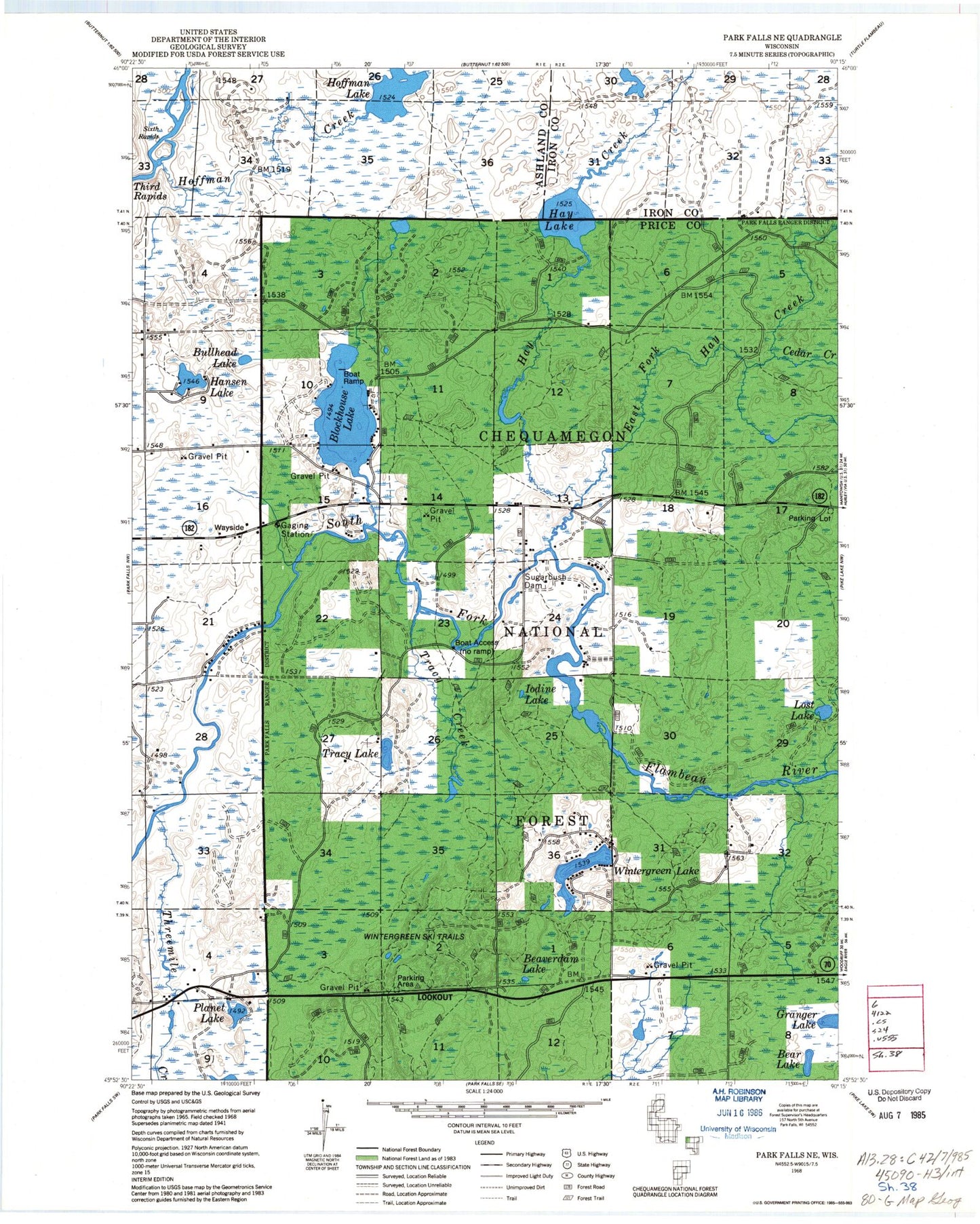
Classic USGS Blockhouse Lake Wisconsin 7.5'x7.5' Topo Map
Couldn't load pickup availability
Historical USGS topographic quad map of Blockhouse Lake in the state of Wisconsin. Typical map scale is 1:24,000, but may vary for certain years, if available. Print size: 24" x 27"
This quadrangle is in the following counties: Ashland, Iron, Price.
The map contains contour lines, roads, rivers, towns, and lakes. Printed on high-quality waterproof paper with UV fade-resistant inks, and shipped rolled.
Contains the following named places: Bear Lake, Beaverdam Lake, Blockhouse Lake, Bullhead Lake, Cedar Creek, East Fork Hay Creek, Granger Lake, Hansen Lake, Hay Creek, Hay Lake, Hoffman Creek, Hoffman Lake, Iodine Lake, Lost Lake, Planet Lake, Sixth Rapids, Sugarbush Dam, Third Rapids, Threemile Creek, Tracy Creek, Tracy Lake, Wintergreen Lake, Hay Creek Hoffman Lake State Wildlife Area, The Ledge Rapids, Fifth Rapids, Fourth Rapids, Forest Rapids, Fifield Lookout Tower, WHBM-FM (Park Falls), WLEF-TV (Park Falls), Town of Eisenstein, Pershing School (historical), Sugarbush School (historical), Creeds Flowage, Bear Lake, Beaverdam Lake, Blockhouse Lake, Bullhead Lake, Cedar Creek, East Fork Hay Creek, Granger Lake, Hansen Lake, Hay Creek, Hay Lake, Hoffman Creek, Hoffman Lake, Iodine Lake, Lost Lake, Planet Lake, Sixth Rapids, Sugarbush Dam, Third Rapids, Threemile Creek, Tracy Creek, Tracy Lake, Wintergreen Lake, Hay Creek Hoffman Lake State Wildlife Area, The Ledge Rapids, Fifth Rapids, Fourth Rapids, Forest Rapids, Fifield Lookout Tower, WHBM-FM (Park Falls), WLEF-TV (Park Falls), Town of Eisenstein, Pershing School (historical), Sugarbush School (historical), Creeds Flowage