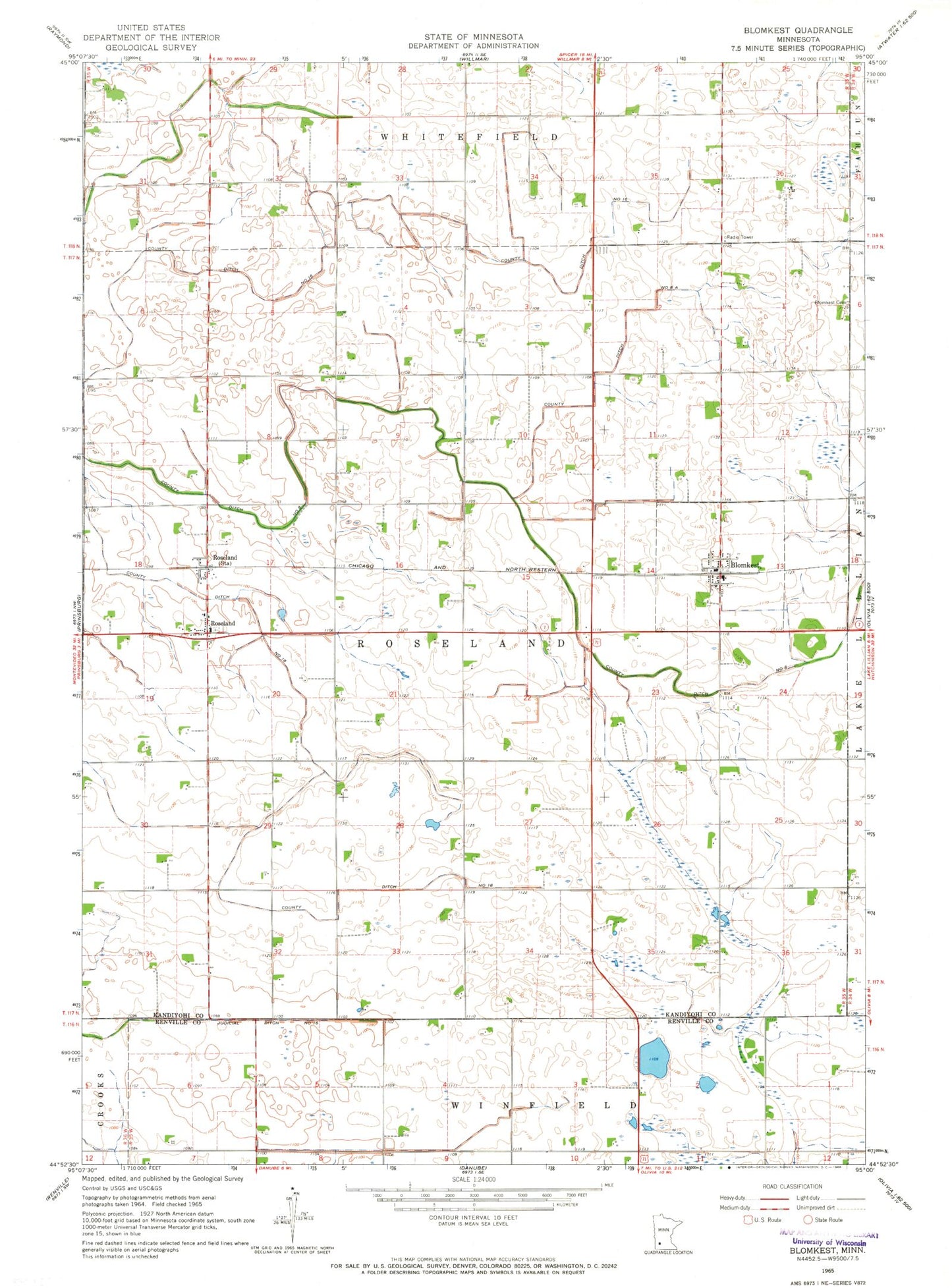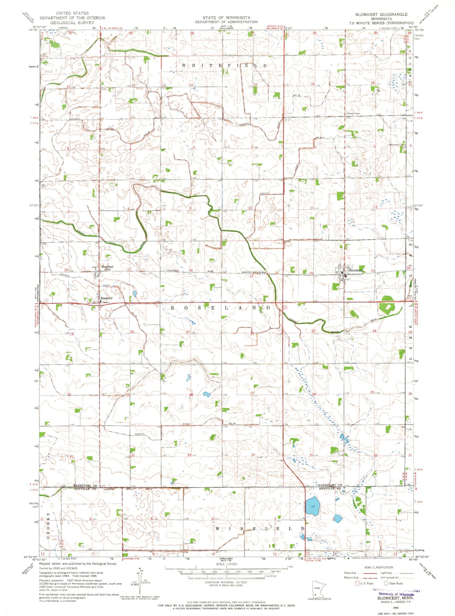
MyTopo
Classic USGS Blomkest Minnesota 7.5'x7.5' Topo Map
Couldn't load pickup availability
Historical USGS topographic quad map of Blomkest in the state of Minnesota. Map scale may vary for some years, but is generally around 1:24,000. Print size is approximately 24" x 27"
This quadrangle is in the following counties: Kandiyohi, Renville.
The map contains contour lines, roads, rivers, towns, and lakes. Printed on high-quality waterproof paper with UV fade-resistant inks, and shipped rolled.
Contains the following named places: Blomkest, Blomkest Baptist Church, Blomkest Cemetery, Blomkest Fire Department, Blomkest Post Office, Blomkest Rest Area, City of Blomkest, County Ditch Number Eight, County Ditch Number Eight A, County Ditch Number Eighteen, County Ditch Number Sixteen, Johnson Farms, Poortvliet Dairy, Roseland, Roseland Christian Reformed Cemetery, Roseland Post Office, Roseland Reformed Church, Township of Roseland, ZIP Code: 56216