MyTopo
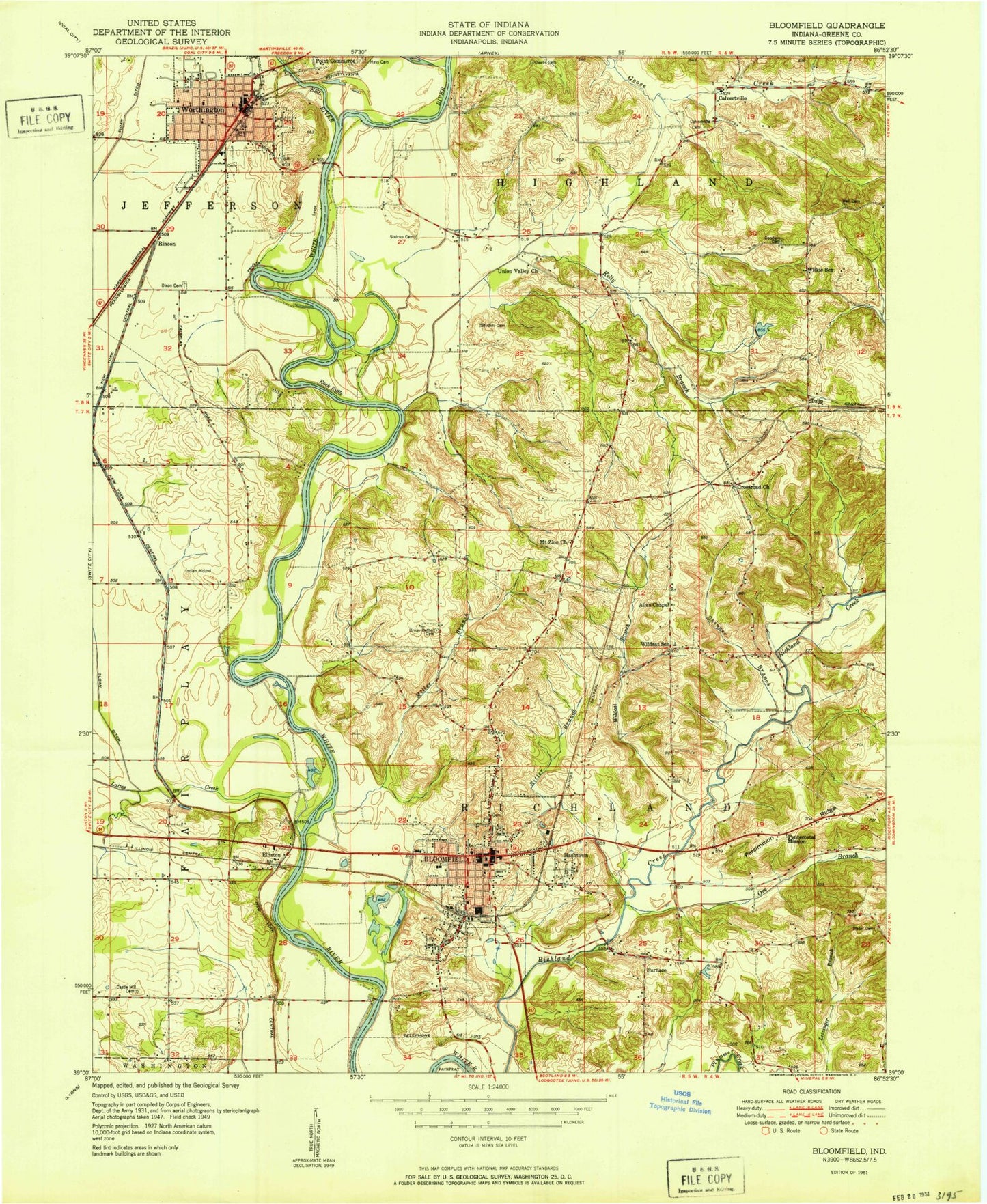
Classic USGS Bloomfield Indiana 7.5'x7.5' Topo Map
Couldn't load pickup availability
Historical USGS topographic quad map of Bloomfield in the state of Indiana. Map scale may vary for some years, but is generally around 1:24,000. Print size is approximately 24" x 27"
This quadrangle is in the following counties: Greene.
The map contains contour lines, roads, rivers, towns, and lakes. Printed on high-quality waterproof paper with UV fade-resistant inks, and shipped rolled.
Contains the following named places: Allen Chapel, Beechwood Lake, Bloom Volunteer Fire Department, Bloomfield, Bloomfield Elementary School, Bloomfield High School, Bloomfield Police Department, Bloomfield Post Office, Bloomfield Volunteer Fire Department, Bucher Cemetery, Bullock Ditch, Calvertville, Calvertville Cemetery, Castle Hill Cemetery, Clark Creek, Dayhoff Ditch, Dead Horse Branch, Dixon Cemetery, Eel River, Elliston, Fairplay Mound, Faulk Lake Dam, Flater Cemetery, Furnace, Goodwin Cemetery, Greene County, Greene County Ambulance Service, Greene County Sheriff Department, Hashtown, Hayes Cemetery, Highland Township Volunteer Fire Department, Jackson Lake, Jackson Lake Dam, Kelly Branch, Lattas Creek, Miller Branch, Moses Lake, Moses Lake Dam, Mount Zion Church, Ore Branch, Owens Cemetery, Persimmon Ridge, Richland Township Fire and Rescue, Rincon, Ritter Branch, Rock Riffle, Skinner Branch, Stalcup Cemetery, Town of Bloomfield, Town of Worthington, Township of Highland, Township of Richland, Tulip, Tulip Church, Union Bethel Cemetery, Union Valley Church, Wall Cemetery, Wildcat Branch, Worthington - Jefferson Volunteer Fire Department, Worthington City Police Department, Worthington Elementary School, Worthington Post Office, ZIP Code: 47424