MyTopo
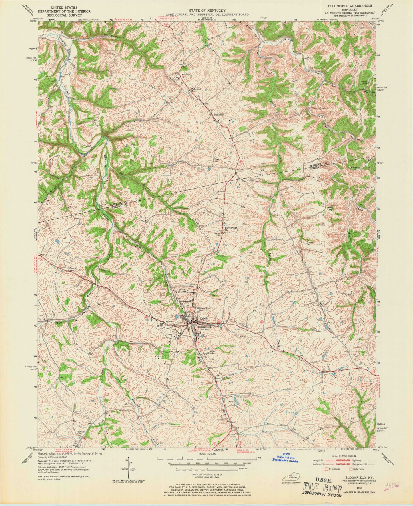
Classic USGS Bloomfield Kentucky 7.5'x7.5' Topo Map
Couldn't load pickup availability
Historical USGS topographic quad map of Bloomfield in the state of Kentucky. Map scale may vary for some years, but is generally around 1:24,000. Print size is approximately 24" x 27"
This quadrangle is in the following counties: Nelson, Spencer.
The map contains contour lines, roads, rivers, towns, and lakes. Printed on high-quality waterproof paper with UV fade-resistant inks, and shipped rolled.
Contains the following named places: Ashes Creek Church, Ashes Creek Union Church, Beauchamp Tragedy Historical Marker, Big Springs Branch, Big Springs Church, Bloomfield, Bloomfield Division, Bloomfield Police Department, Bloomfield Post Office, Bowman Creek, Brown Junior High School, Camp Branch, Camp Charity Creek, City of Bloomfield, Doe Run, East Fork Simpson Creek, Fairfield Cemetery, Fairfield Hill, Grays Run, Hahntown, Ham Brown Log Cabin Historical Marker, Hinkle Creek, Hunters Cemetery, Hunters Creek, Ingram Cemetery, Jacks Creek, James Guthrie Historical Marker, Lick Run, Maple Grove Cemetery, Millers Run, Mount Zion Church, Moxley Run, Northeast Nelson Volunteer Fire Department, Oberlies Railroad Station, Plum Run, Raymond Greer Run, Rogers Cemetery, School Number Seven, School Number Seventeen, Smileytown Post Office, Wakefield, Wakefield Pond, Wakefield Post Office, Wakefield Railroad Station, Wakefield School, Walnut Groves Farm Historical Marker, West Fork Simpson Creek, Wilkinson Cemetery, Zion, ZIP Code: 40008