MyTopo
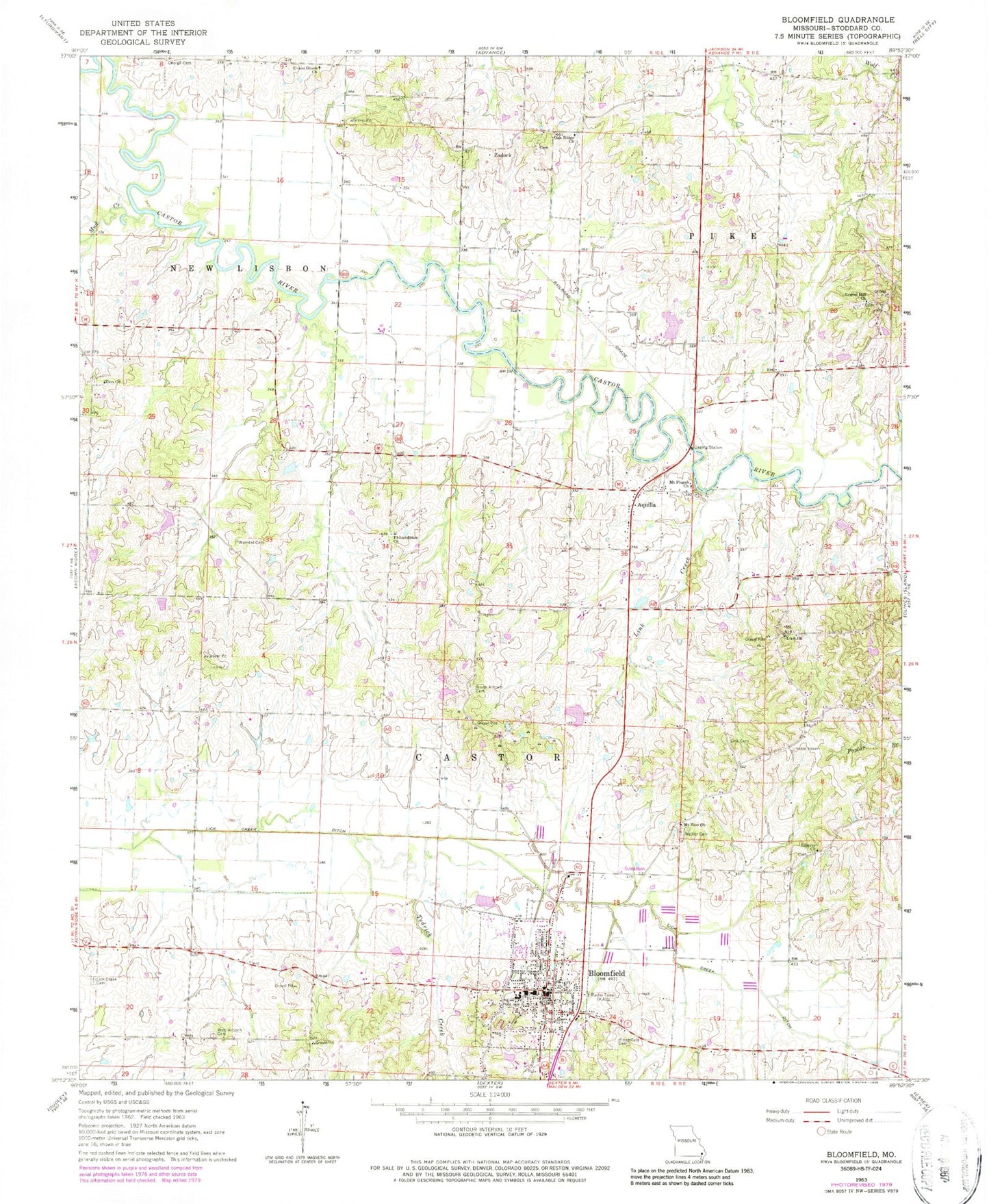
Classic USGS Bloomfield Missouri 7.5'x7.5' Topo Map
Couldn't load pickup availability
Historical USGS topographic quad map of Bloomfield in the state of Missouri. Map scale may vary for some years, but is generally around 1:24,000. Print size is approximately 24" x 27"
This quadrangle is in the following counties: Stoddard.
The map contains contour lines, roads, rivers, towns, and lakes. Printed on high-quality waterproof paper with UV fade-resistant inks, and shipped rolled.
Contains the following named places: Aquilla, Bloomfield, Bloomfield Cemetery, Bloomfield Fire Department Station 1, Bloomfield Fire Department Station 2, Bloomfield Police Department, Bloomfield Post Office, Buckhorn School, City of Bloomfield, Ezell, George Cemetery, Gravel Hill Church, Gum Point School, Hendley Lake Dam, Joe Hendley Lake, Liberty Church, Liberty School, Lick Creek Cemetery, Lick Creek Chapel, Link Cemetery, Link Church, Link Creek, Link School, Mount Pisgah Church, Mount Zion Church, Mud Creek, North Antioch Cemetery, North Antioch School, Oak Ridge Church, Old Shawnee Village, Philadelphia Church, Philadelphia School, Pleasant Valley School, Proffers, Stoddard County Sheriff's Office, Tedrick Creek, Township of Castor, Union Grove Church, Walker Cemetery, Wambel Cemetery, West Antioch Cemetery, West Antioch School, Whites Lake, Whites Lake Dam, Zadock, Zion Church, Zion School, ZIP Code: 63825