
MyTopo
Classic USGS Bloomfield Montana 7.5'x7.5' Topo Map
Couldn't load pickup availability
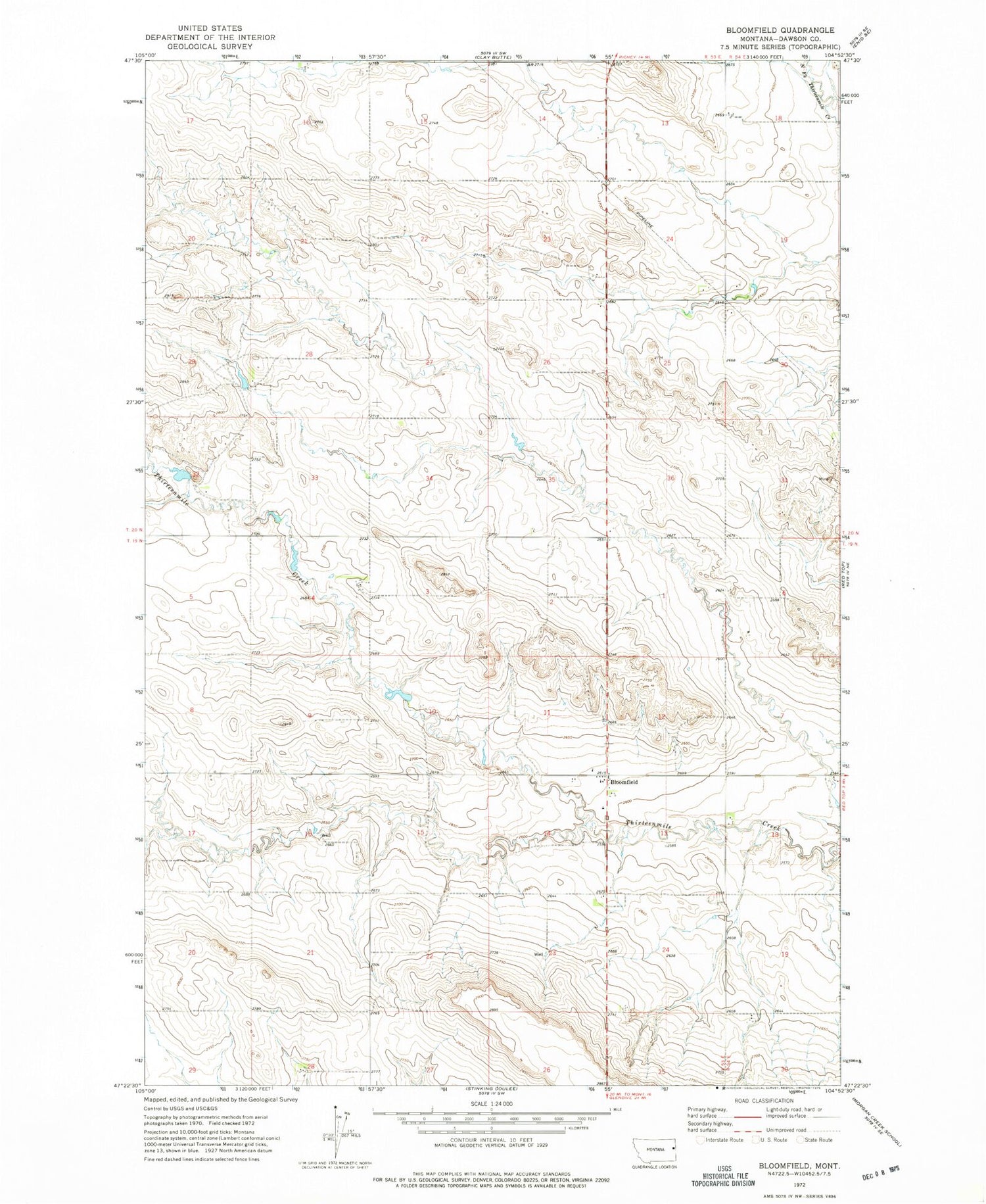
Historical USGS topographic quad map of Bloomfield in the state of Montana. Map scale may vary for some years, but is generally around 1:24,000. Print size is approximately 24" x 27"
This quadrangle is in the following counties: Dawson.
The map contains contour lines, roads, rivers, towns, and lakes. Printed on high-quality waterproof paper with UV fade-resistant inks, and shipped rolled.
Contains the following named places: 19N53E12DCBB01 Well, 19N53E24BBBB01 Well, 19N53E24CCDC01 Well, 19N54E30BABC01 Well, 20N53E14BBCC01 Well, 20N53E16AADB01 Well, 20N53E22BCCC01 Well, 20N53E26AAAD01 Well, 20N53E26BCCB01 Well, 20N53E32DBBD01 Well, 20N54E18BCCA01 Well, 20N54E19DC__01 Well, Bloomfield, Bloomfield Census Designated Place, Bloomfield Christian Missionary Alliance Church, Bloomfield Post Office, Bloomfield School, Everett Hill School, Oh No Dam, Pleasant Valley School, Raise Number 1 Dam, Steffen School


