MyTopo
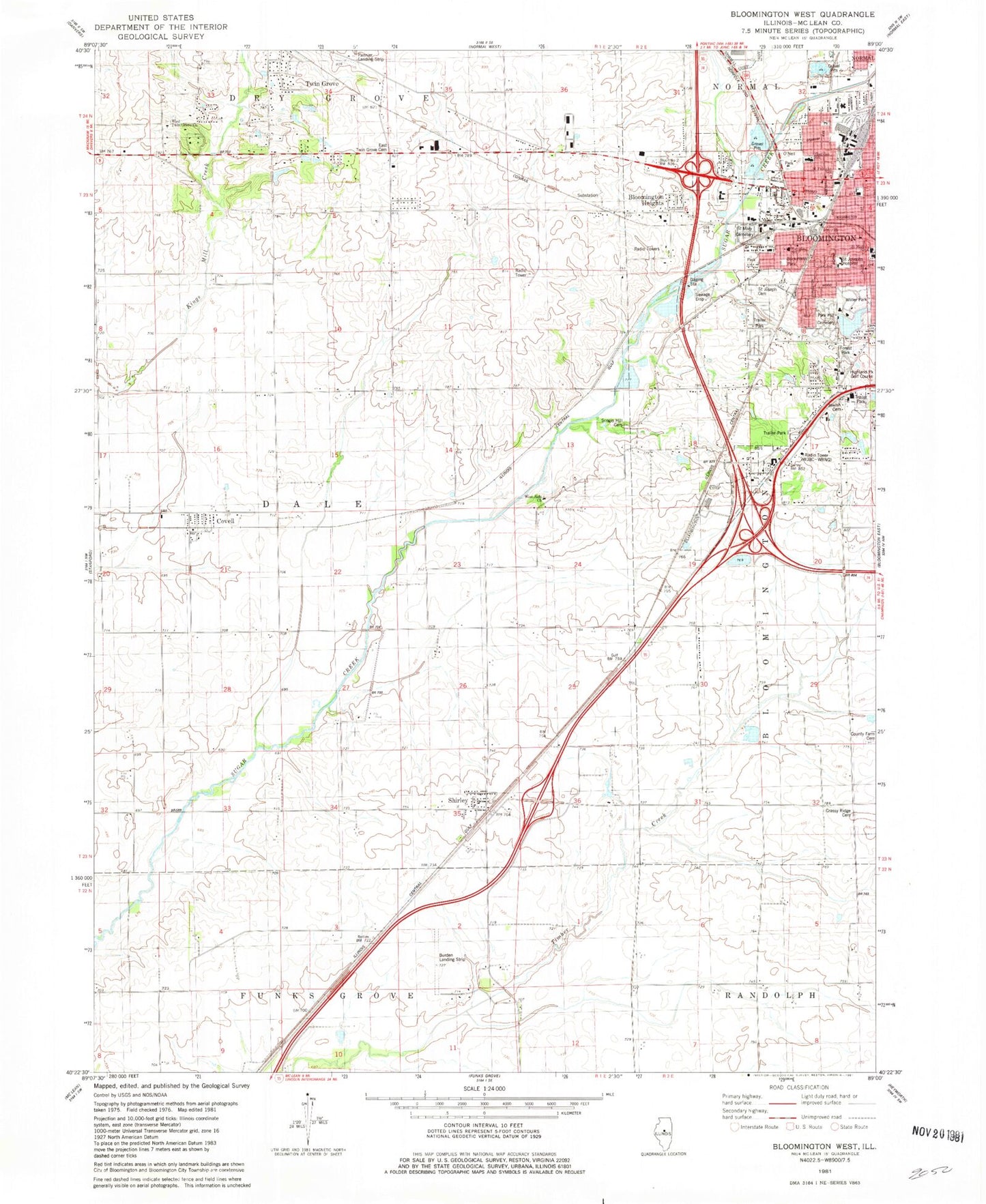
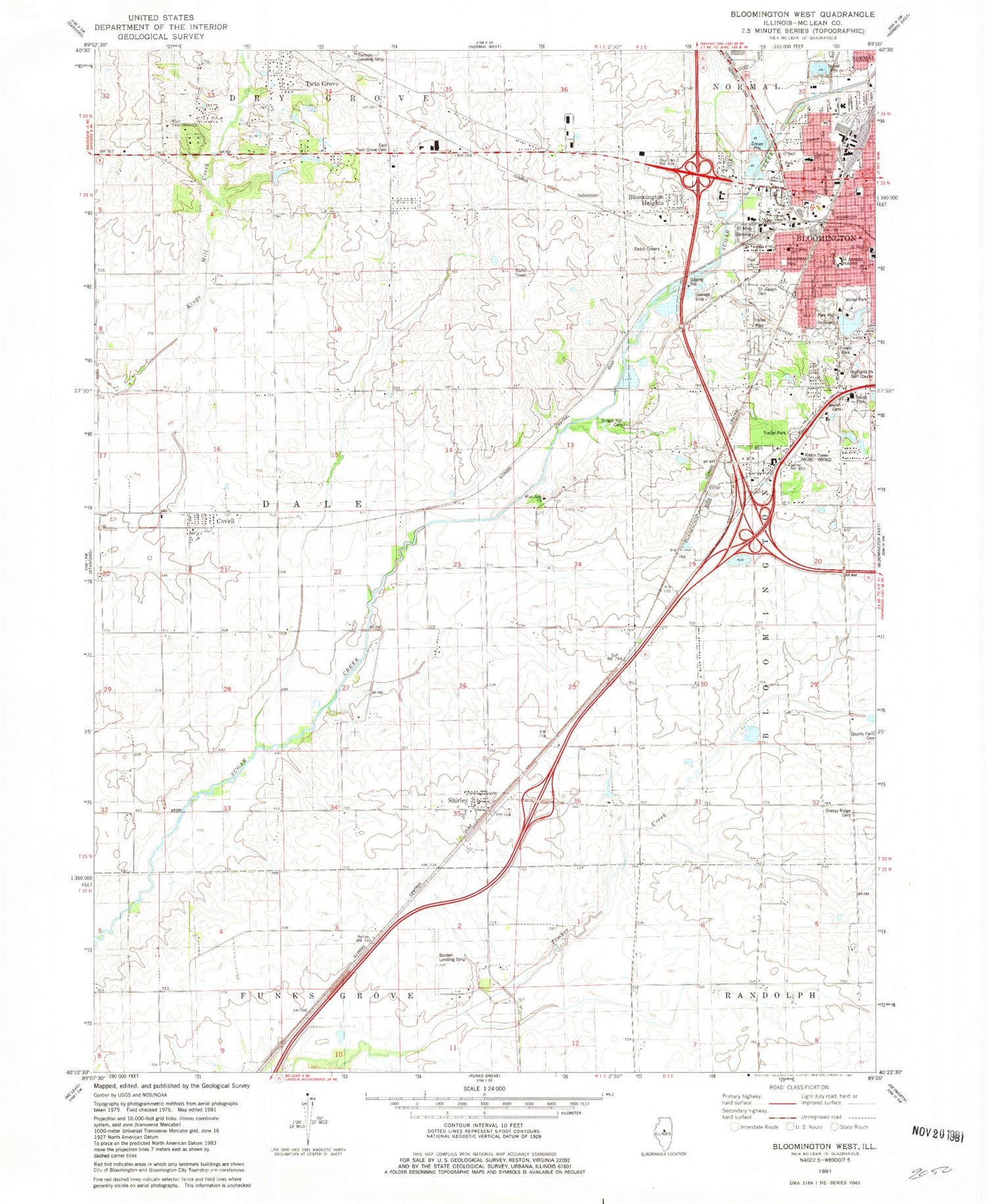
Classic USGS Bloomington West Illinois 7.5'x7.5' Topo Map
Couldn't load pickup availability
Historical USGS topographic quad map of Bloomington West in the state of Illinois. Map scale may vary for some years, but is generally around 1:24,000. Print size is approximately 24" x 27"
This quadrangle is in the following counties: McLean.
The map contains contour lines, roads, rivers, towns, and lakes. Printed on high-quality waterproof paper with UV fade-resistant inks, and shipped rolled.
Contains the following named places: Alexander School, Bloomington Fire Department Station 4, Bloomington Heights, Bloomington Township Fire Protection District Station 2, Bloomington West Church of God, Buckmann Park, California School, Cottonwood Airport, County Farm Cemetery, Covell, Dale Fire Protection District Shirley Station, Dale School, Dale Township Fire Protection District Covell Station, East Twin Grove Cemetery, Evergreen Park, First Church of God, Forest Park, Goose Creek, Grassy Ridge Cemetery, Grassy Ridge School, Highland Park Golf Course, Jewish Cemetery, Miller Park, Miller Park Lake, Miller Park Lake Dam, Mobil-Land Trailer Park, O'Neil Park, Pannier Flying Club Airport, Park Hill Cemetery, Park United Methodist Church, Rosewood Cemetery, Roy Burden RLA Airport, Saint Josephs Cemetery, Saint Josephs Hospital, Saint Mary's Cemetery, Saint Marys School, Saint Patricks School, Sarah E Raymond School of Early Education, Scogin Hill Cemetery, Sheridan Elementary School, Shirley, Shirley Cemetery, Shirley Census Designated Place, Shirley Post Office, Sugar Creek School, Sunny Point School, Township of Dale, Twin Grove, Twin Grove Census Designated Place, WBNQ-FM (Bloomington), West Side Church, West Twin Grove Church, WGLT-FM (Normal), WIHN-FM (Normal), Willow Creek Trailer Park, WJBC-AM (Bloomington), ZIP Code: 61772