MyTopo
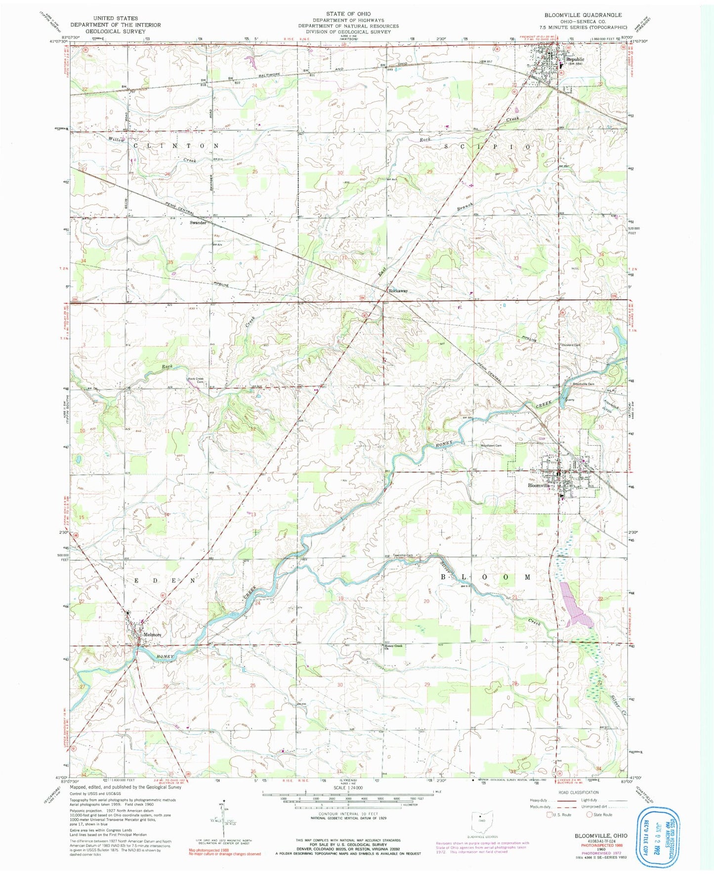
Classic USGS Bloomville Ohio 7.5'x7.5' Topo Map
Couldn't load pickup availability
Historical USGS topographic quad map of Bloomville in the state of Ohio. Map scale may vary for some years, but is generally around 1:24,000. Print size is approximately 24" x 27"
This quadrangle is in the following counties: Seneca.
The map contains contour lines, roads, rivers, towns, and lakes. Printed on high-quality waterproof paper with UV fade-resistant inks, and shipped rolled.
Contains the following named places: Bliss Memorial Public Library, Bloom Township Cemetery, Bloom Township Elementary School, Bloom Township Fire and Emergency Medical Services Department, Bloomville, Bloomville Cemetery, Bloomville Post Office, Bloomville United Methodist Church, Dunkard Cemetery, East Branch Rock Creek, Elizabethtown, Farewell Retreat Cemetery, Honey Creek Church, Melmore, Melmore Census Designated Place, Melmore Elementary School, Melmore Post Office, Melmore United Methodist Church, Pleasant View Cemetery, Reformed Cemetery, Republic, Republic Elementary School, Republic Police Department, Republic Post Office, Rock Creek Cemetery, Rockaway, Rockaway Post Office, Scipio - Republic Fire Department, Scipio Township Cemetery, Silver Creek, Slee Ditch, Swander, Township of Bloom, Village of Bloomville, Woodlawn Cemetery