MyTopo
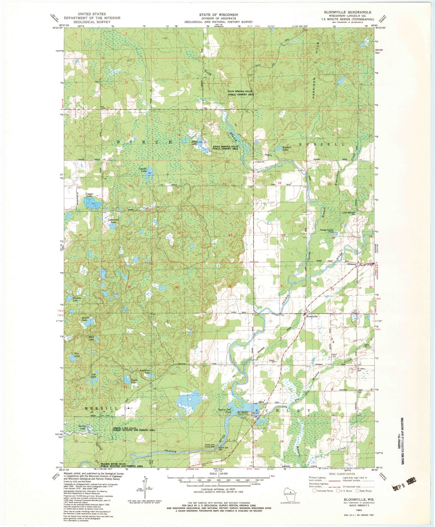
Classic USGS Bloomville Wisconsin 7.5'x7.5' Topo Map
Couldn't load pickup availability
Historical USGS topographic quad map of Bloomville in the state of Wisconsin. Typical map scale is 1:24,000, but may vary for certain years, if available. Print size: 24" x 27"
This quadrangle is in the following counties: Lincoln.
The map contains contour lines, roads, rivers, towns, and lakes. Printed on high-quality waterproof paper with UV fade-resistant inks, and shipped rolled.
Contains the following named places: Allen Lake, Anderson Lake, Anient Lake, Big Hay Meadow Creek, Bloomville, Bloomville Church, Copper Lake, Fox Lake, Hart Lake, Henson Lake, Kippenberg Creek, Lokemoen Lake, Luecks Lake, Manacke Creek, North Branch Prairie River, Oak Lake, Prairie Dell Dam, Prairie Dell Pond, Saint John Baptist Catholic Cemetery, Spring Lake, Swiss Lake, Wedlers Pond, Town of Birch, Town of Schley, Prairie Dells Dam (historical), Prairie Dells Pond 179, Doering E12.129 Dam, 0.9 Reservoir, Hay Meadow County Park, Kings Springs State Public Fishery Area, Luther Memorial Cemetery, Pays Springs State Public Fishery Area, Prairie Dell County Park, Spring Lake State Public Hunting and Fishing Area, Axen Lake School (historical), Drew School (historical), Maple Grove School (historical), Lincoln County Landfill