MyTopo
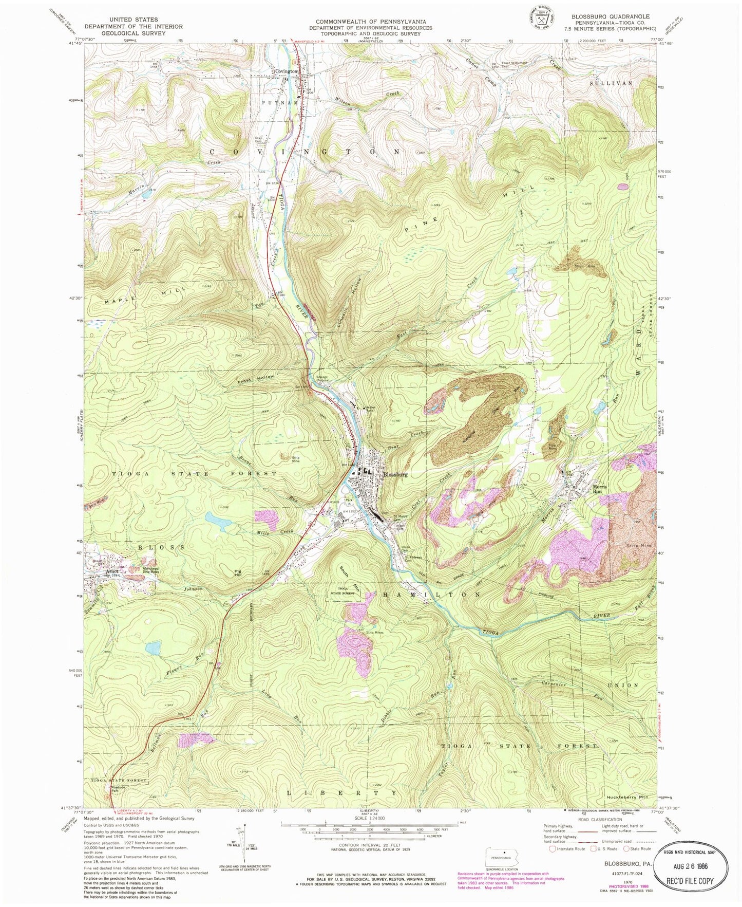
Classic USGS Blossburg Pennsylvania 7.5'x7.5' Topo Map
Couldn't load pickup availability
Historical USGS topographic quad map of Blossburg in the state of Pennsylvania. Typical map scale is 1:24,000, but may vary for certain years, if available. Print size: 24" x 27"
This quadrangle is in the following counties: Tioga.
The map contains contour lines, roads, rivers, towns, and lakes. Printed on high-quality waterproof paper with UV fade-resistant inks, and shipped rolled.
Contains the following named places: Arbon Cemetery, Arnot, Bear Creek, Bellman Run, Boone Run, Carpenter Run, Coal Creek, Copp Hollow, Covington, Dibble Run, East Creek Tioga River, Fall Brook, Flower Run, Frost Hollow, Frost Settlement Cemetery, Gray Cemetery, Huckleberry Mountain, Johnson Creek, Limekiln Hollow, Long Run, Marvin Creek, Mills Creek, Morris Run, Morris Run, Pig Hill, Pine Hill, Saint Andrews Cemetery, Saint Mary's Cemetery, Sawmill Creek, South Mountain, Tan Creek, Taylor Run, Union Cemetery, Wilson Creek, Morris Run Mine Dam Number Three, Morris Run Reservoir, Baity School (historical), Blakes, Barneys Hill, Pig Hill Trail, Blossburg, Borough of Blossburg, Township of Putnam, Township of Covington, Township of Hamilton, Helen Lutes Softball Field, President's House - Mansfield University, Arnot Census Designated Place, Blossburg Volunteer Fire Department, Blossburg Firemens Ambulance Association, Arnot Post Office, Blossburg Post Office, Covington Post Office, Morris Run Post Office, Old Settlers Cemetery, Morris Run Cemetery, Saint Josephs Cemetery, Swedish Lutheran Cemetery, Blossburg City Police Department