
MyTopo
Classic USGS Blountville Tennessee 7.5'x7.5' Topo Map
Couldn't load pickup availability
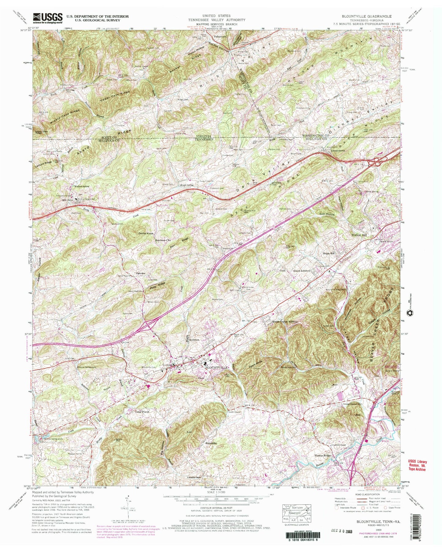
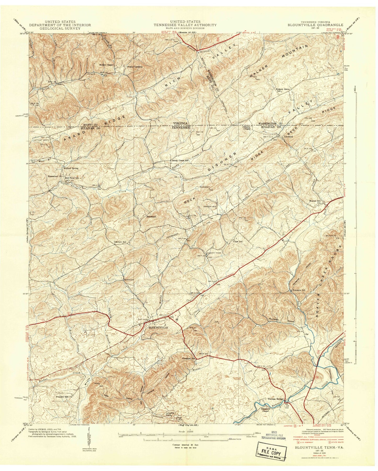
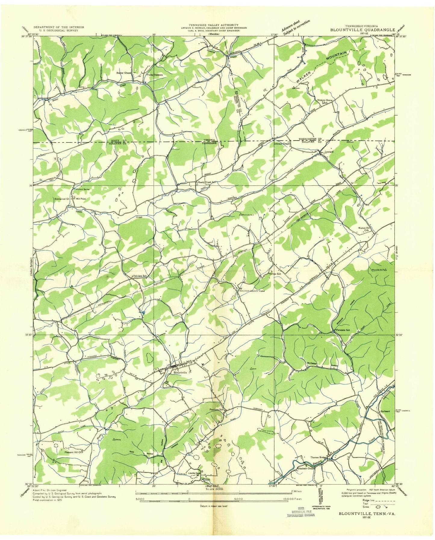
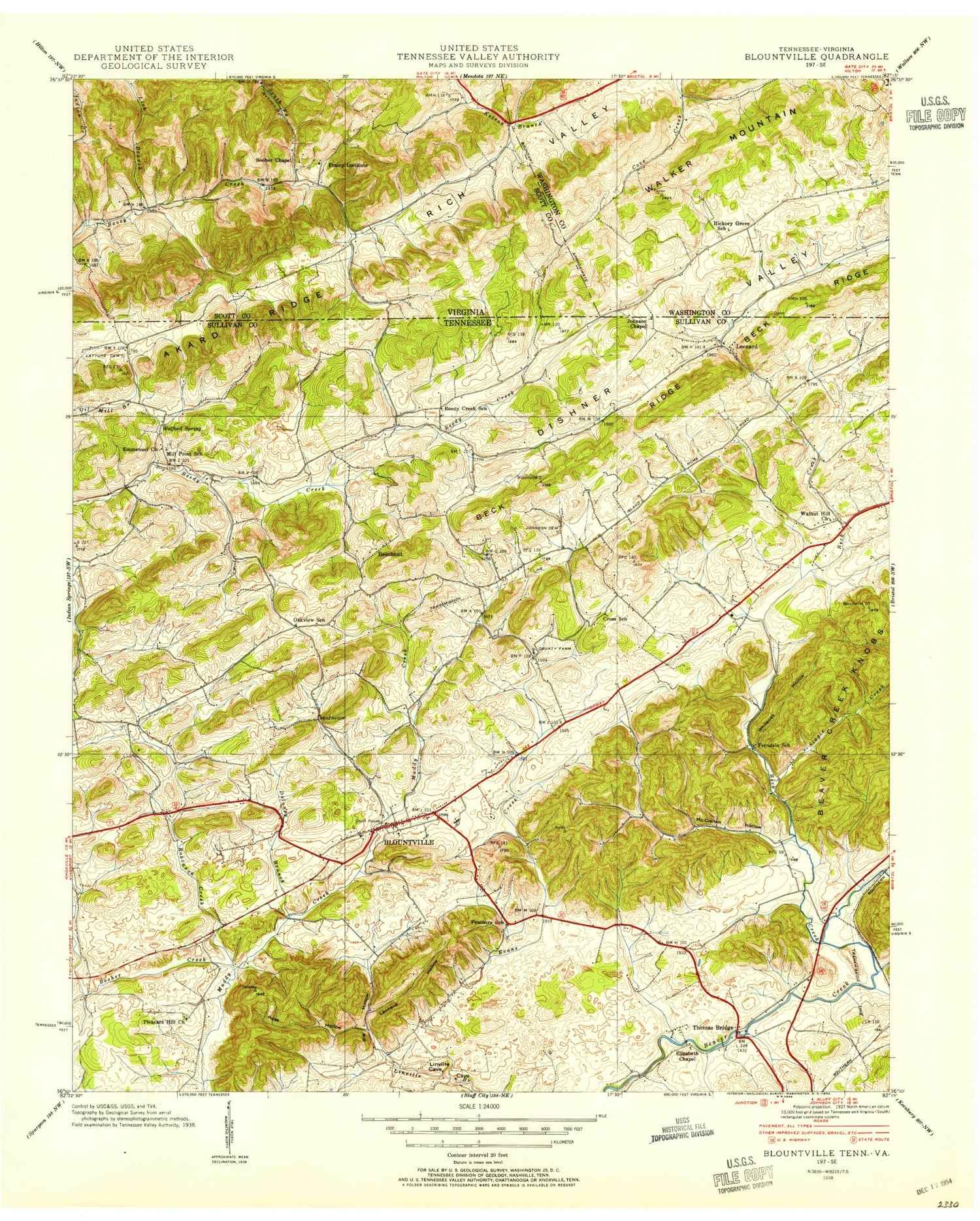
Historical USGS topographic quad map of Blountville in the states of Tennessee, Virginia. Map scale may vary for some years, but is generally around 1:24,000. Print size is approximately 24" x 27"
This quadrangle is in the following counties: Scott, Sullivan, Washington.
The map contains contour lines, roads, rivers, towns, and lakes. Printed on high-quality waterproof paper with UV fade-resistant inks, and shipped rolled.
Contains the following named places: Acuff Cemetery, Acuff Chapel, Akard Addition, Akard Memorial Elementary School, Akard Ridge, Anderson, Anderson Cemetery, Anderson-Hughes Cemetery, Avoca Volunteer Fire Department, Ayers Knob, Back Creek, Bailey Cemetery, Baker Hollow, Barger Hollow, Barr Cemetery, Barr Ridge, Beechnut City, Belmont Bible Church, Bethany Church, Bethel View Baptist Church, Big Hollow, Blountville, Blountville Cemetery, Blountville Census Designated Place, Blountville Division, Blountville Elementary School, Blountville Emergency Response, Blountville Historic District, Blountville Middle School, Blountville Post Office, Blountville United Methodist Church, Blountville Water Works, Booher Cemetery, Booher Chapel, Booher Creek, Booher Ridge, Booher's Chapel Cemetery, Bright Spring, Bristol International Speedway, Bristol Motor Speedway Fire Department, Bristol Regional Medical Center, Bristol Tennessee Fire Department Station 4, Buncombe, Burr Branch, Camp Placid, Cantrell, Carden Cemetery, Carden Hollow, Central Heights Elementary School, Clark Cemetery, Combs Cemetery, Commissioner District 4, County Home Cemetery, Cox Cemetery, Cross, Cross School, Deck Cemetery, Deck Ridge, Deck Valley, Denton Cemetery, Dishner Cemetery, Dishner Valley, Drake Cemetery, Dry Ridge, Dulaney Branch, Earheart, Elizabeth Chapel, Evans Creek, Faulkner Cemetery, Fauver Cemetery, Feathers School, Ferndale School, First Baptist Church, First Presbyterian Church, Fraley Institute, Fulkerson Cemetery, Goodman Cemetery, Gott Hollow, Graham Bible College, Graveyard Hill, Grindstone Hollow, Hanchers Mill, Harr Cemetery, Harr Hollow, Hickory Grove School, Hill Country, Hines Cemetery, Hobbs Hollow, Holt Cemetery, Immanuel Church, Interchange 74, Island Road Church, Johnson Cemetery, Johnson Chapel, Lane Cemetery, Latture Cemetery, Latture Ridge, Leonard Cemetery, Leonard Hollow, Leonardtown, Lick Branch, Mackey Cemetery, Maple Hill, Maplehurst, McClellan Hollow, Middle Cave Ridge, Mill Point, Mount Area Estates, Mount Tucker Addition, Necessary Cemetery, Norris Cemetery, Oakleigh Estates, Oakview, Oakview School, Pippin Cemetery, Pleasant Hill Church, Polly Ridge, Pullen Cemetery, Pullon Hollow, Pullontown, Raccon Branch, Reedy Creek Church, Reedy Creek School, Rich Valley, Ridgeway Cemetery, Robinson Creek, Rodefer Hollow, Ross Hollow, Sac, Seneker Cemetery, Shaffer Cemetery, Shankle Cemetery, Slagle Creek, Slagle Hollow, Smith Cemetery, Smith Chapel, Snapp Cemetery, Snodgrass Cemetery, Staubus Cemetery, Steele Cemetery, Steele Spring, Stine Cemetery, Sullivan County, Sullivan County Courthouse, Sullivan County EMS, Sullivan County Farm, Sullivan County Library, Sullivan County Sheriff's Office, Sullivan County Volunteer Fire Department, Sunny Hills, Taylor Cemetery, Thomas Bridge, Thomas Mill, Upper Cave Ridge, Walker Mountain, Walnut Hill, Walnut Hill Census Designated Place, Walnut Hill Church, WBCV-AM (Bristol), Webb Cemetery, Whiteoak Hollow, Whitetop Creek, Wilcox Cemetery, Wilson Cemetery, Windy Hill, Wolford Cemetery, Wolford Spring, Worley Cemetery, Young Cemetery, Zachs Knob, Zion Cemetery, Zion Lutheran Church, ZIP Code: 37617