MyTopo
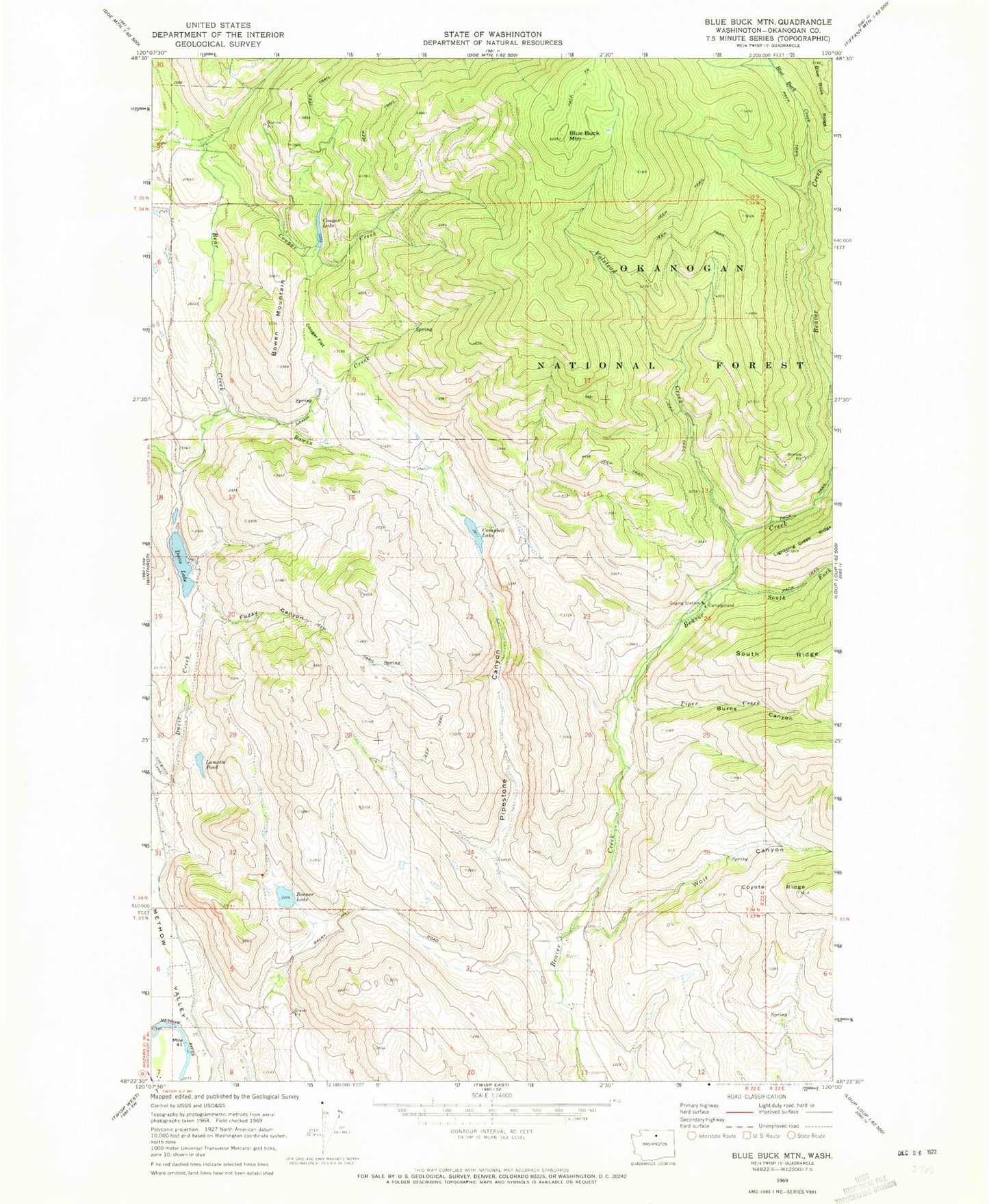
Classic USGS Blue Buck Mountain Washington 7.5'x7.5' Topo Map
Couldn't load pickup availability
Historical USGS topographic quad map of Blue Buck Mountain in the state of Washington. Typical map scale is 1:24,000, but may vary for certain years, if available. Print size: 24" x 27"
This quadrangle is in the following counties: Okanogan.
The map contains contour lines, roads, rivers, towns, and lakes. Printed on high-quality waterproof paper with UV fade-resistant inks, and shipped rolled.
Contains the following named places: Blue Buck Creek, Blue Buck Mountain, Bonner Lake, Bowen Creek, Bowen Mountain, Burns Canyon, Campbell Lake, Cougar Creek, Cougar Flat, Cougar Lake, Davis Creek, Fuzzy Canyon, Johnson Creek, Lamotte Pond, Piper Creek, Pipestone Canyon, South Fork Beaver Creek, Volstead Creek, Wolf Canyon, Methow Wildlife Recreation Area, Storer Creek, Beaver Campground, Storer Creek, Davis Lake Dam, Davis Lake, North Fork Beaver Creek