MyTopo
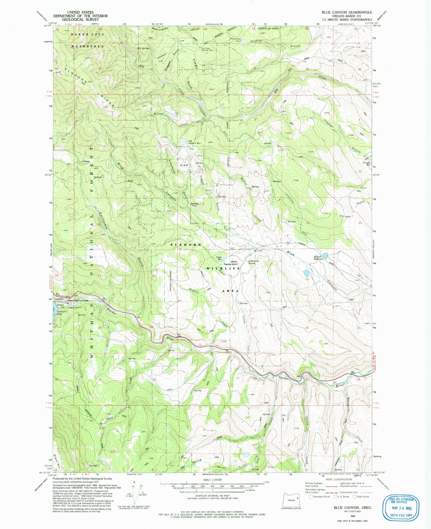
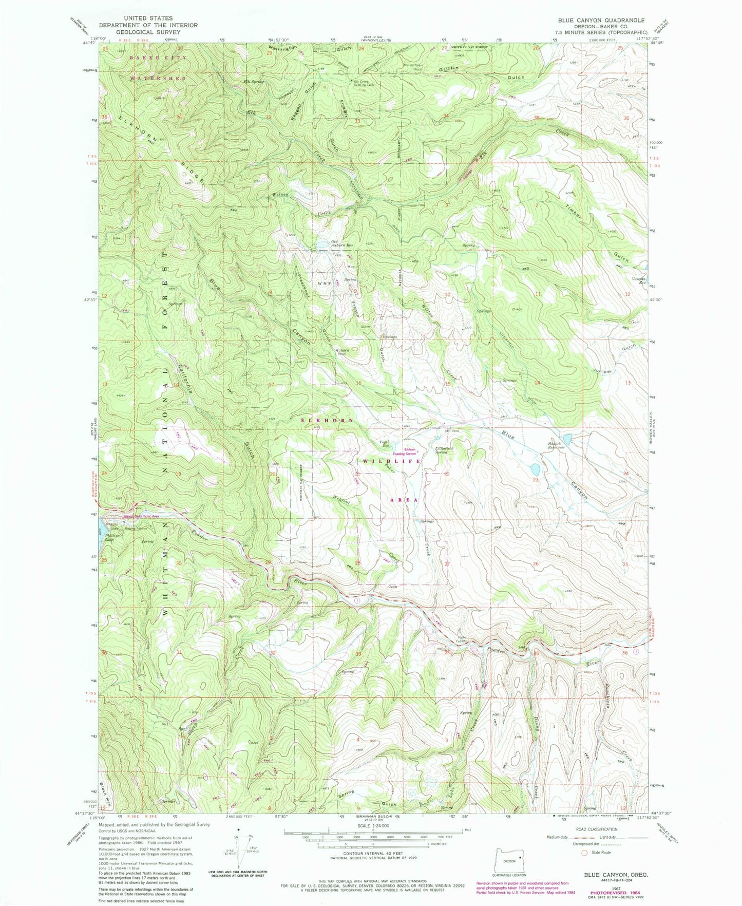
Classic USGS Blue Canyon Oregon 7.5'x7.5' Topo Map
Couldn't load pickup availability
Historical USGS topographic quad map of Blue Canyon in the state of Oregon. Map scale may vary for some years, but is generally around 1:24,000. Print size is approximately 24" x 27"
This quadrangle is in the following counties: Baker.
The map contains contour lines, roads, rivers, towns, and lakes. Printed on high-quality waterproof paper with UV fade-resistant inks, and shipped rolled.
Contains the following named places: Auburn, Auburn Cemetery, Auburn Post Office, Auburn Sno-Park, Boulder Gorge, California Gulch, Denny, Denny Creek, Elk Creek Settling Tank, Elk Spring, Fivebit Gulch, Freezeout Gulch, French Gulch, Haskell Reservoir, Lake Creek, Littlefield Ditch, Littlefield Spring, Lockhart, Malloy Cabin, Mason, Mason Dam, Mason Dam Recreation Site, Miles Pond, Old Auburn Reservoir, Poker Creek, Powder River Recreation Site, Ragged Gulch, Rancheria Creek, Salisbury Marsh, Sheep Creek, Spring Gulch, Thompson, Vaughn Reservoir, Vogel Reservoir, Webfoot Creek, Willow Creek, Wilson Creek