
MyTopo
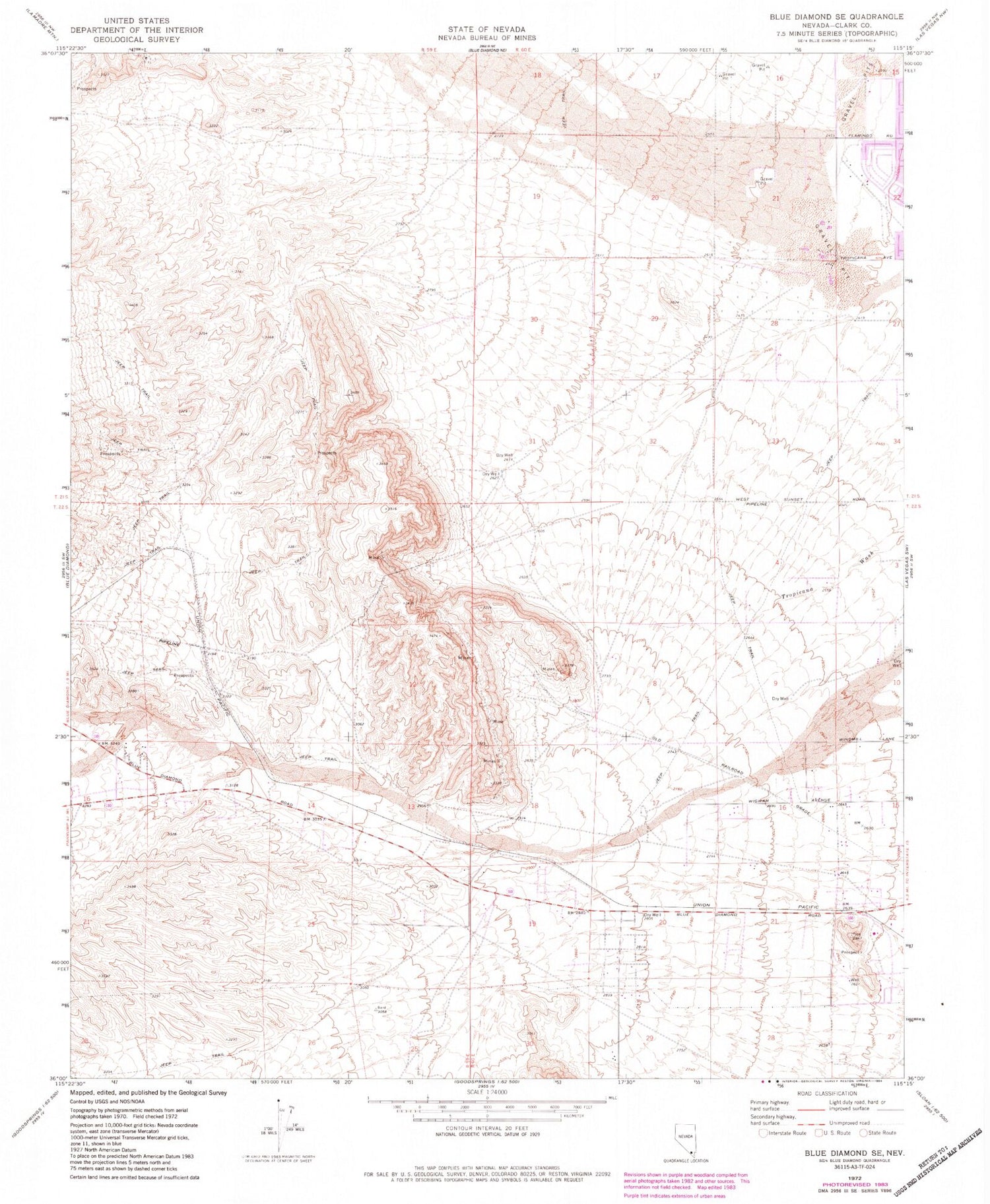
Classic USGS Blue Diamond SE Nevada 7.5'x7.5' Topo Map
Couldn't load pickup availability
Historical USGS topographic quad map of Blue Diamond SE in the state of Nevada. Map scale is 1:24000. Print size is approximately 24" x 27"
This quadrangle is in the following counties: Clark.
The map contains contour lines, roads, rivers, towns, and lakes. Printed on high-quality waterproof paper with UV fade-resistant inks, and shipped rolled.
Contains the following named places: Arden Beacon, Arden Gypsum Mine, Arden Mining District, Bishop Gorman High School, Calvary Chapel of Spring Valley, Clark County Fire Department Station 26, Clark County Fire Department Station 34, Clark County Fire Department Station 66, Clifford J Lawrence Junior High School, Department of Veterans Affairs Southern Nevada Healthcare System - Southwest Primary Care Clinic, Desert Breeze Park, Dignity Health Saint Rose Dominican Hospitals San Martin Campus, Exploration Peak, Exploration Peak Park, Faith Baptist Church, Frank Kim Elementary School, Helen Meyer Community Center, Kathy L Batterman Elementary School, Keith C and Karen W Hayes Elementary School, Kids Campus Learning Center, Kids Turf Academy, KNUU-AM (Paradise), Lucille S Rogers Elementary School, Merryhill Elementary School, Paul Meyer Park, Poe Flamingo Post Office, Roger M Bryan Elementary School, Sierra Vista High School, Southern Hills Hospital and Medical Center, Southwest Baptist Church, Spring Valley Assembly of God Church, Spring Valley Census Designated Place, Spring Valley Christian Academy, Spring Valley High School, Summerlin South Census Designated Place, Sunday Mine, The Crossing Church, Valley Bible Fellowship Church, Victoria Fertitta Middle School, Wayne N Tanaka Elementary School, Westridge Post Office


