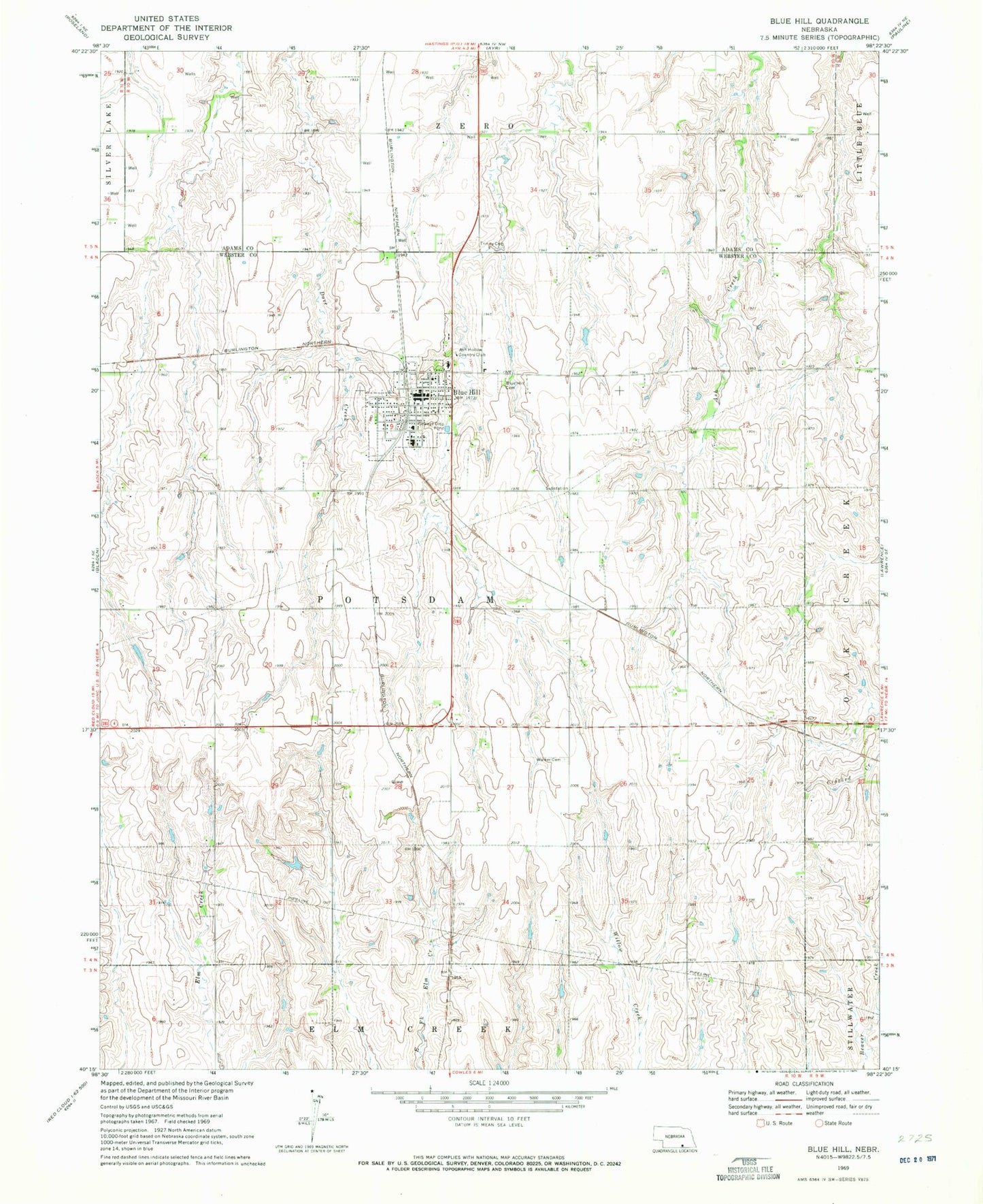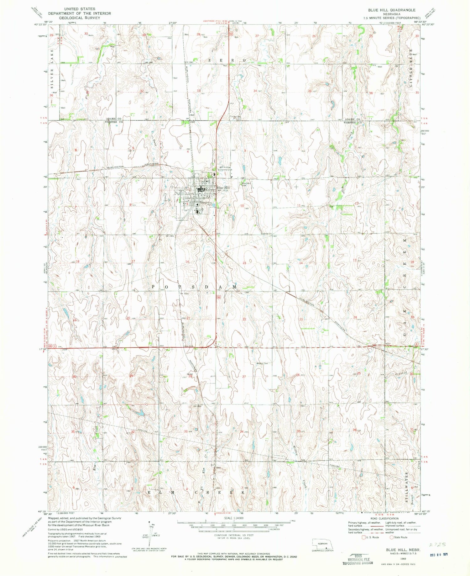
MyTopo
Classic USGS Blue Hill Nebraska 7.5'x7.5' Topo Map
Couldn't load pickup availability
Historical USGS topographic quad map of Blue Hill in the state of Nebraska. Map scale may vary for some years, but is generally around 1:24,000. Print size is approximately 24" x 27"
This quadrangle is in the following counties: Adams, Webster.
The map contains contour lines, roads, rivers, towns, and lakes. Printed on high-quality waterproof paper with UV fade-resistant inks, and shipped rolled.
Contains the following named places: Agri Co-op Elevator, Armstrong Dam, Armstrong Reservoir, Ash Hollow Country Club, Belle Amis, Blue Hill, Blue Hill Cemetery, Blue Hill Clinic, Blue Hill Dental Center, Blue Hill Election Precinct, Blue Hill Elementary School, Blue Hill High School, Blue Hill Police Station, Blue Hill Post Office, Blue Hill Public Library, Blue Hill Volunteer Fire and Rescue, Calvary Lutheran Church, City of Blue Hill, Community Care, Election District 2, Election District 4, Holy Trinity Catholic Church, Saint Paul Lutheran Church, Schmidt Dam, Schmidt Reservoir, Seeman Dam, Seeman Reservoir, Siebrass Dam, Siebrass Reservoir, Township of Elm Creek, Township of Potsdam, Trinity Lutheran Cemetery, Trinity Lutheran Church, United Methodist Church, Walker Cemetery, ZIP Code: 68930