MyTopo
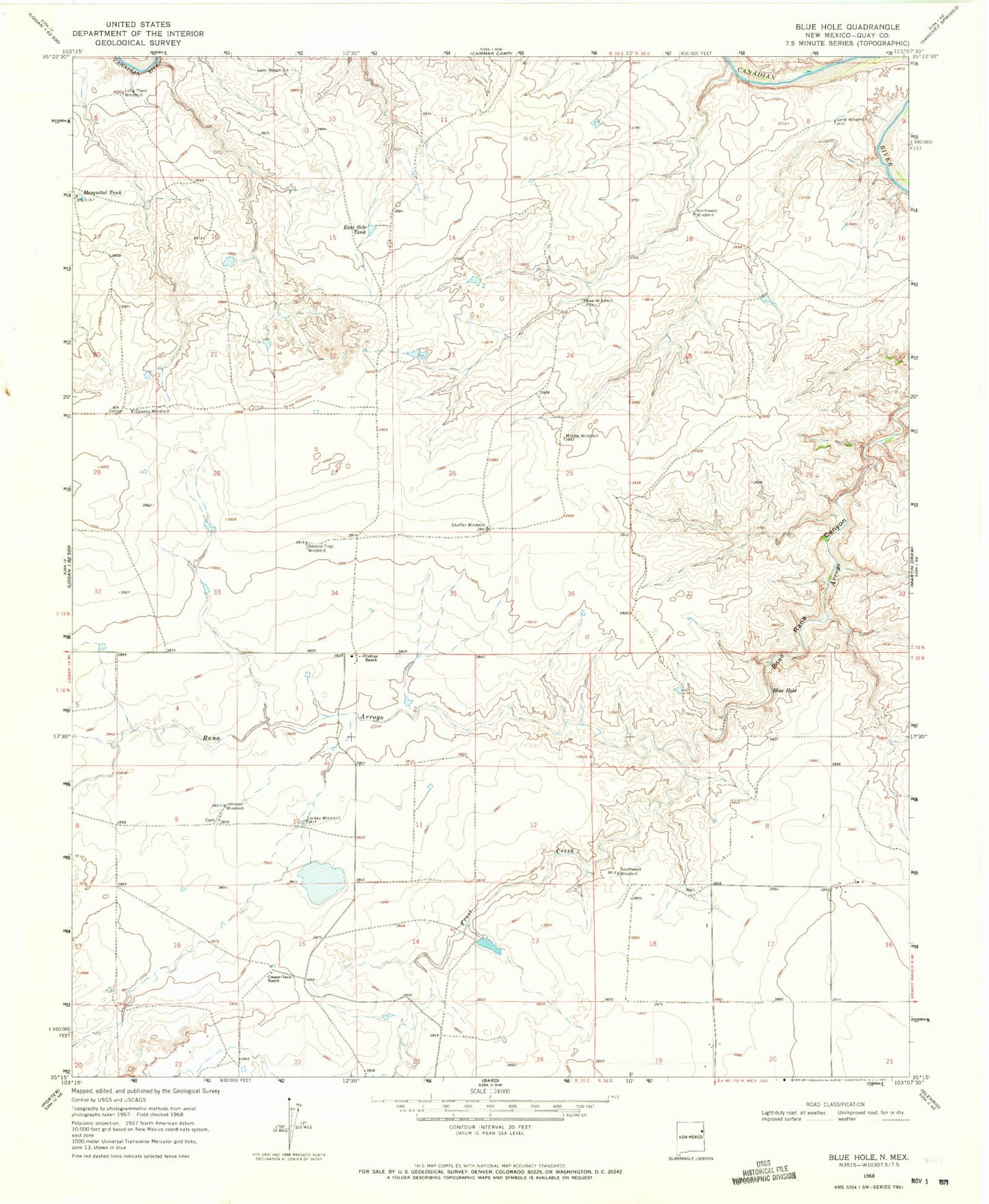
Classic USGS Blue Hole New Mexico 7.5'x7.5' Topo Map
Couldn't load pickup availability
Historical USGS topographic quad map of Blue Hole in the state of New Mexico. Map scale may vary for some years, but is generally around 1:24,000. Print size is approximately 24" x 27"
This quadrangle is in the following counties: Quay.
The map contains contour lines, roads, rivers, towns, and lakes. Printed on high-quality waterproof paper with UV fade-resistant inks, and shipped rolled.
Contains the following named places: 05407 Water Well, 05411 Water Well, 05412 Water Well, 05413 Water Well, 05426 Water Well, 05427 Water Well, 05428 Water Well, 05433 Water Well, 05516 Water Well, 05517 Water Well, 05519 Water Well, 05520 Water Well, 05523 Water Well, 05525 Water Well, 05527 Water Well, 05528 Water Well, 05529 Water Well, Blue Hole, Collins Ranch, Cooper-Trew Ranch, Dourgherty, East Side Tank, Frost Creek, Granny Windmill, Ivory Windmill, Johnson Windmill, Lackey Windmill, Long Place Windmill, Mesquital Tank, Middle Windmill, New Windmill, Northwest Windmill, Pharis, Sand Windmill, Second Trap Windmill, Shaffer Windmill, Southwest Windmill