MyTopo
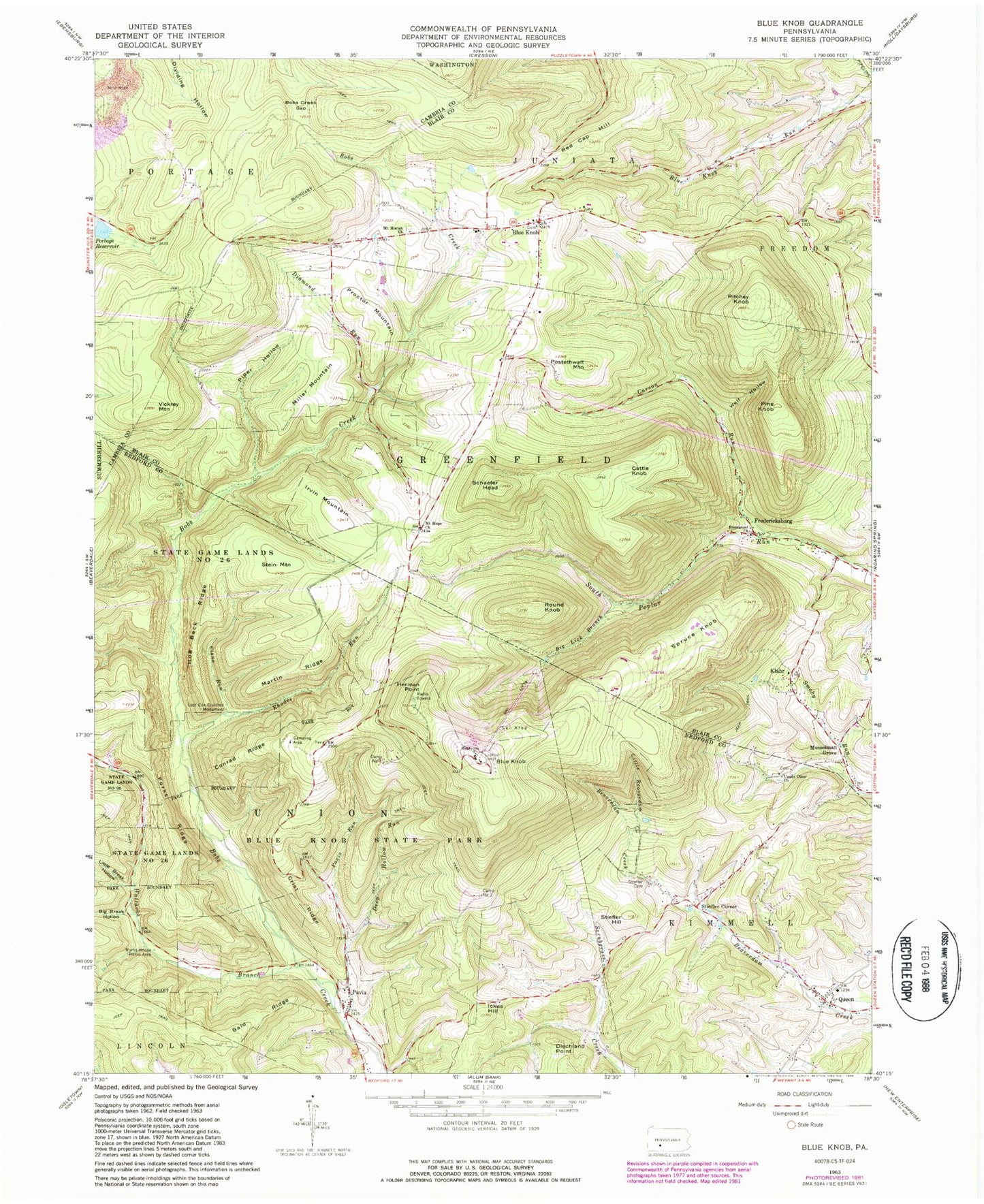
Classic USGS Blue Knob Pennsylvania 7.5'x7.5' Topo Map
Couldn't load pickup availability
Historical USGS topographic quad map of Blue Knob in the state of Pennsylvania. Typical map scale is 1:24,000, but may vary for certain years, if available. Print size: 24" x 27"
This quadrangle is in the following counties: Bedford, Blair, Cambria.
The map contains contour lines, roads, rivers, towns, and lakes. Printed on high-quality waterproof paper with UV fade-resistant inks, and shipped rolled.
Contains the following named places: Bald Ridge, Big Break Hollow, Big Lick Branch, Blue Knob, Blue Knob, Blue Knob State Park, Bobs Creek Gap, Burnt House Picnic Area, Carson Run, Cattle Knob, Ciana Run, Conrad Ridge, Crist Ridge, Deep Hollow Run, Diamond Run, Diechland Point, Emmanuel Church, Forks Ridge, Fredericksburg, Herman Point, Hog Back Ridge, Ickes Hill, Irvin Mountain, Klahr, Little Beaverdam Creek, Little Break Hollow, Lost Cox Children Monument, Martin Ridge, Miller Mountain, Mount Hope Church, Mount Moriah Church, Musselman Grove, Pavia, Pavia Run, Pine Knob, Piper Hollow, Portage Reservoir, Postethwait Mountain, Proctor Mountain, Queen, Red Cap Hill, Rhodes Run, Ritchey Knob, Round Knob, Schaefer Head, Spruce Knob, Stein Mountain, Stiefler Cemetery, Stiefler Hill, Upper Claar Church, Vickrey Mountain, Wallacks Branch, Wolf Hollow, Martindale Dam, Stiefler Corner, Blue Knob Recreation Area, Camp Number 1, Camp Number 2, Blue Knob Fire Tower, Township of Kimmel, Township of Pavia, Township of Greenfield, Claysburg Air Force Station (historical), Blue Knob Volunteer Fire Company Station 86, Burk Cemetery, Mount Zion Cemetery, Upper Claar Cemetery, Blue Knob Cemetery, Mount Hope Cemetery, Mount Moriah Cemetery, Blue Knob Census Designated Place, Klahr Census Designated Place, Ski Gap Census Designated Place