MyTopo
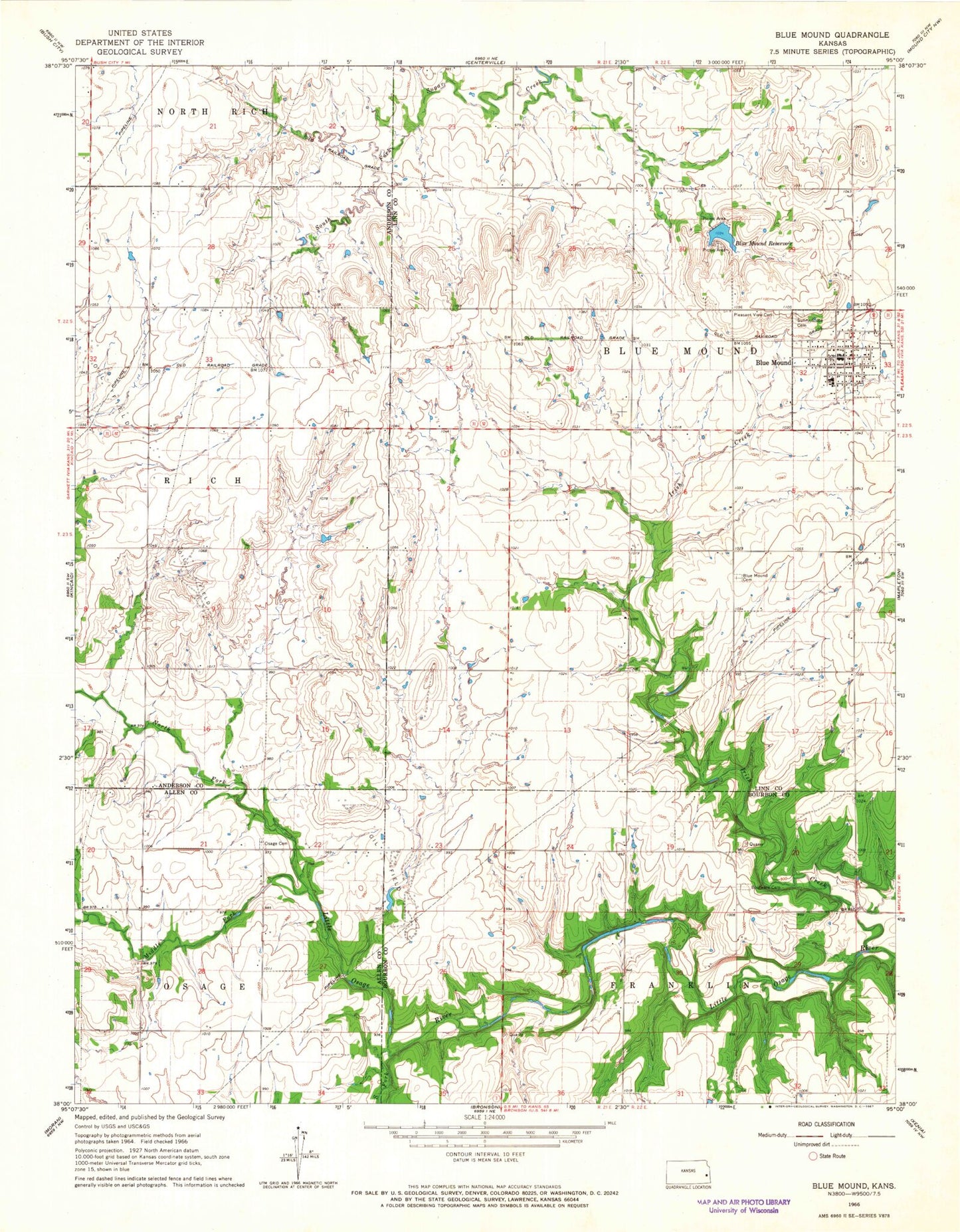
Classic USGS Blue Mound Kansas 7.5'x7.5' Topo Map
Couldn't load pickup availability
Historical USGS topographic quad map of Blue Mound in the state of Kansas. Map scale may vary for some years, but is generally around 1:24,000. Print size is approximately 24" x 27"
This quadrangle is in the following counties: Allen, Anderson, Bourbon, Linn.
The map contains contour lines, roads, rivers, towns, and lakes. Printed on high-quality waterproof paper with UV fade-resistant inks, and shipped rolled.
Contains the following named places: Blue Mound, Blue Mound Elementary School, Blue Mound Municipal Water Treatment Facility, Blue Mound Post Office, Blue Mound Reservoir, Blue Mound United Methodist Church, Boulware Cemetery, City of Blue Mound, Glendale School, Irish Creek, Laura, Linn County Library District Number 3, Linn County Rural Fire District 1 Station 970, Middle Fork Little Osage River, Mount Sterling School, North Fork Little Osage River, Old Blue Mound Cemetery, Osage Valley Cemetery, Pleasant View Cemetery, Rocky Point School, Ross Branch, South Fork Little Osage River, Sunny Slope Cemetery, Township of Blue Mound