MyTopo
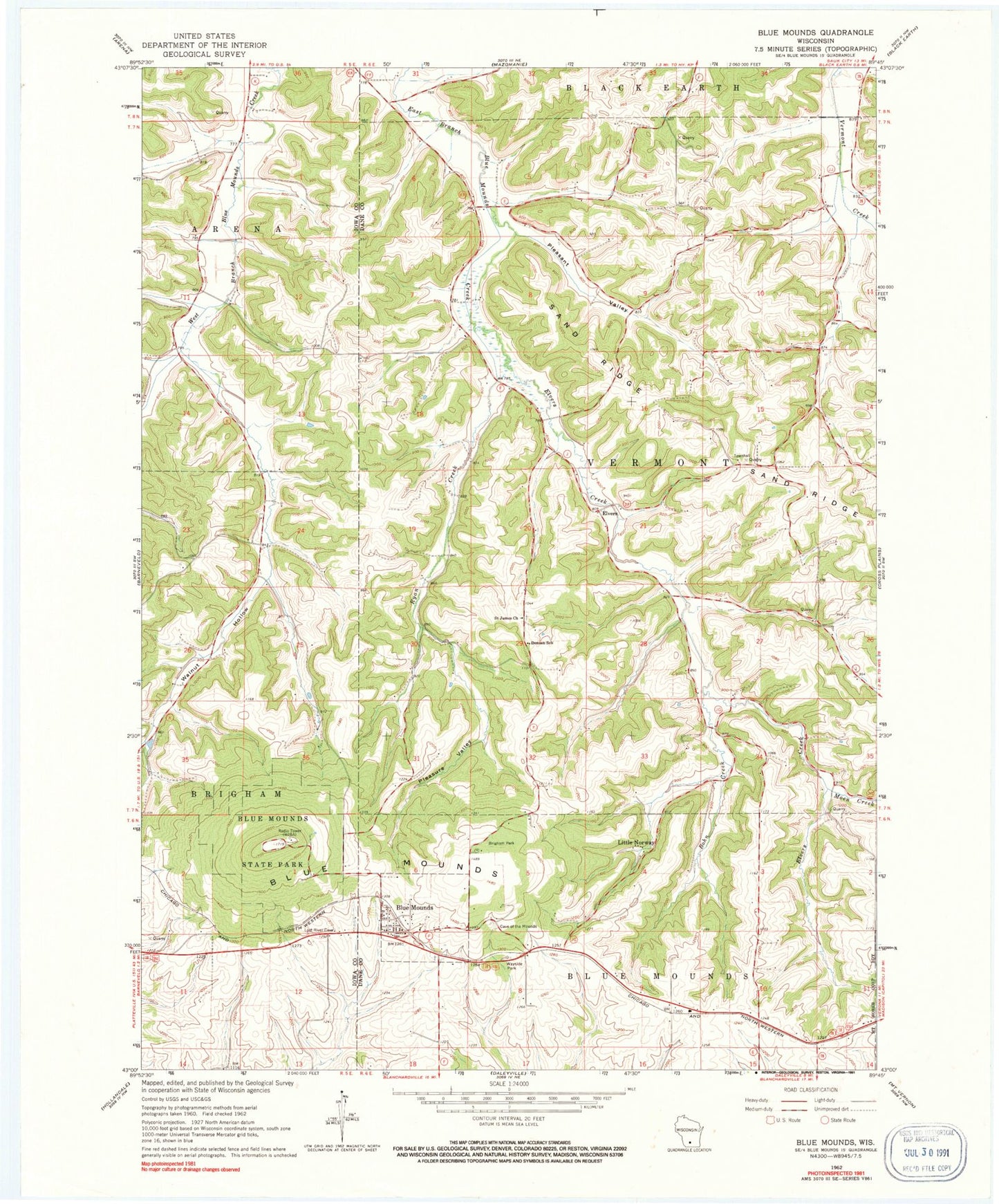
Classic USGS Blue Mounds Wisconsin 7.5'x7.5' Topo Map
Couldn't load pickup availability
Historical USGS topographic quad map of Blue Mounds in the state of Wisconsin. Map scale may vary for some years, but is generally around 1:24,000. Print size is approximately 24" x 27"
This quadrangle is in the following counties: Dane, Iowa.
The map contains contour lines, roads, rivers, towns, and lakes. Printed on high-quality waterproof paper with UV fade-resistant inks, and shipped rolled.
Contains the following named places: Bitsedalen, Blue Mound State Park, Blue Mounds, Blue Mounds Police Department, Blue Mounds Post Office, Blue Mounds Wastewater Treatment Plant, Bohn Creek, Brigham Park, Deneen School, Elvers, Elvers Creek, Hallick Farm Airport, Hylee Farm, Little Norway, Moen Creek, Pleasant Valley, Pleasant Valley Creek, Pleasure Valley, Ryan Creek, Saint James Catholic Cemetery, Saint James Church, Sand Ridge, Town of Vermont, Village of Blue Mounds, Walnut Hollow, West Blue Mounds Lutheran Cemetery, ZIP Code: 53517