MyTopo
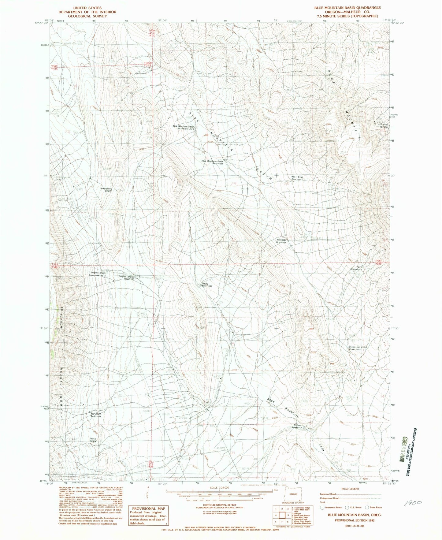
Classic USGS Blue Mountain Basin Oregon 7.5'x7.5' Topo Map
Couldn't load pickup availability
Historical USGS topographic quad map of Blue Mountain Basin in the state of Oregon. Map scale may vary for some years, but is generally around 1:24,000. Print size is approximately 24" x 27"
This quadrangle is in the following counties: Malheur.
The map contains contour lines, roads, rivers, towns, and lakes. Printed on high-quality waterproof paper with UV fade-resistant inks, and shipped rolled.
Contains the following named places: Achabal Spring, Backside Reservoir, Big Brush Reservoir, Blue Mountain, Blue Mountain Basin, Blue Mountain Basin Reservoir, Blue Mountain Basin Reservoir Number Two, Dinky Reservoir, Ditch Spring, Diversion Ditch Reservoir, Echave Reservoir, Oregon Canyon Reservoir, Oregon Canyon Reservoir Number Two, Twelvemile Summit, Twin Reservoirs, West Blue Reservoir