MyTopo
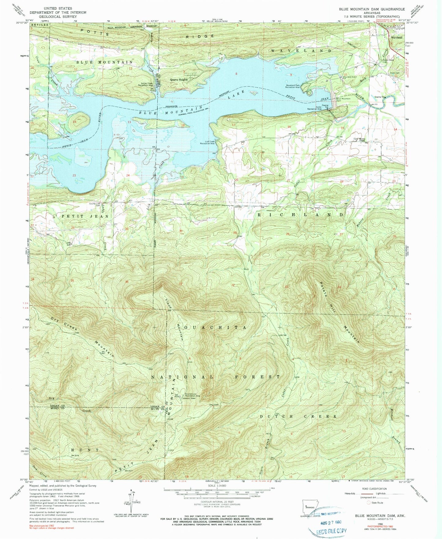
Classic USGS Blue Mountain Dam Arkansas 7.5'x7.5' Topo Map
Couldn't load pickup availability
Historical USGS topographic quad map of Blue Mountain Dam in the state of Arkansas. Map scale is 1:24000. Print size is approximately 24" x 27"
This quadrangle is in the following counties: Logan, Scott, Yell.
The map contains contour lines, roads, rivers, towns, and lakes. Printed on high-quality waterproof paper with UV fade-resistant inks, and shipped rolled.
Contains the following named places: Alexander A Scott Cemetery, Ashley Creek, Ashley Creek Recreation Area, Bakers Creek, Blue Mountain Dam, Blue Mountain Lake, Cedar Creek, Cedar Creek Church (historical), County Line Cemetery, Crow Creek, Dry Creek Mountain, Dry Creek Wilderness, Flood Mountain, Havana Fire Department Morris Chapel Station, Ladds Creek, Lick Creek, Lick Creek Recreation Area, Moores Chapel Cemetery, Moores Chapel United Methodist Church, Moores School (historical), North Petit Jean Mountain, Outlet Recreation Area, Petit Jean Mountain, Potato Hill Mountain, Potts Ridge, Quarry Heights, Rock Creek, Rock Creek Cemetery, Small Smith Cemetery, Smiths School (historical), Southern Home (historical), Stonehouse Recreation Area, Township of Richland, Township of Waveland, Waveland, Waveland Park Recreation Area, Waveland Post Office