MyTopo
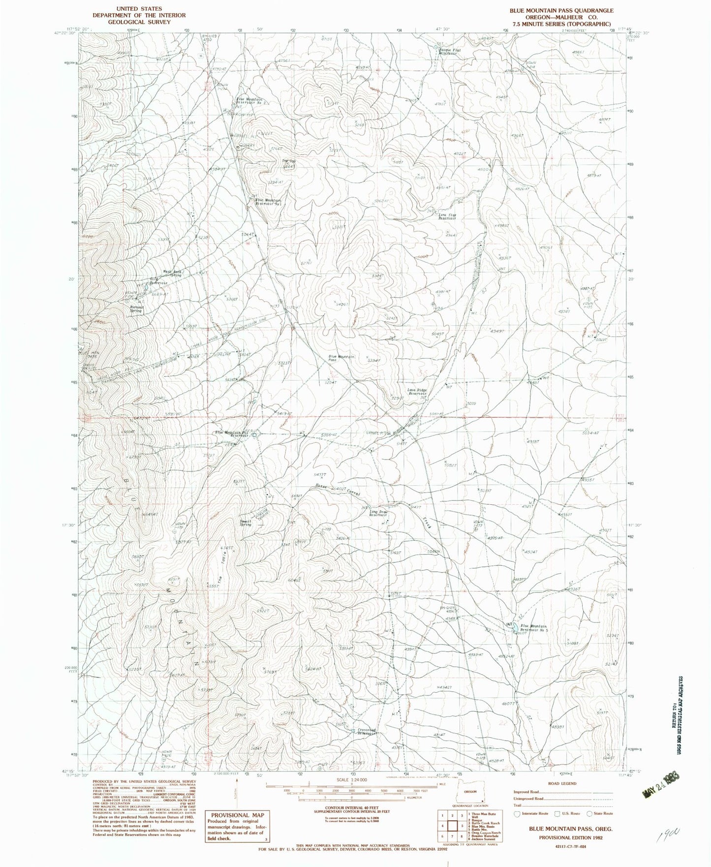
Classic USGS Blue Mountain Pass Oregon 7.5'x7.5' Topo Map
Couldn't load pickup availability
Historical USGS topographic quad map of Blue Mountain Pass in the state of Oregon. Map scale may vary for some years, but is generally around 1:24,000. Print size is approximately 24" x 27"
This quadrangle is in the following counties: Malheur.
The map contains contour lines, roads, rivers, towns, and lakes. Printed on high-quality waterproof paper with UV fade-resistant inks, and shipped rolled.
Contains the following named places: Basque Flat Reservoir, Blue Mountain Pass, Blue Mountain Pit Reservoir, Blue Mountain Reservoir Number Five, Blue Mountain Reservoir Number One, Blue Mountain Reservoir Number Two, Burnout Spring, Crossroad Reservoir, Gild Reservoir, Horse Corral Creek, Lava Ridge Reservoir, Lone Star Reservoir, Long Draw Reservoir, Summit Spring, The Cap, The Table, Wash Rock Spring