
MyTopo
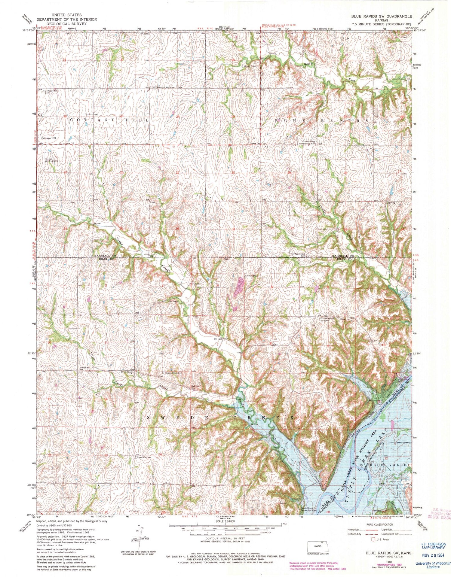
Classic USGS Blue Rapids SW Kansas 7.5'x7.5' Topo Map
Couldn't load pickup availability
Historical USGS topographic quad map of Blue Rapids SW in the state of Kansas. Map scale may vary for some years, but is generally around 1:24,000. Print size is approximately 24" x 27"
This quadrangle is in the following counties: Marshall, Pottawatomie, Riley.
The map contains contour lines, roads, rivers, towns, and lakes. Printed on high-quality waterproof paper with UV fade-resistant inks, and shipped rolled.
Contains the following named places: Bellegarde Cemetery, Center Hill School, Cleburne, Cottage Hill, Czeeh Church, Little Swede Creek, Pleasant Hill Cemetery, Prairie Ridge Community Hall, Riley County Fire District 1 Station 8, Roepke Landing Strip, Rose Hill Cemetery, Saint Wenceslaus Cemetery, Shannon Creek, Swede Creek, Swede Creek Cemetery, Swede Creek Recreation Area, Swede Creek United Methodist Church, Township of Blue Rapids, Township of Swede Creek


