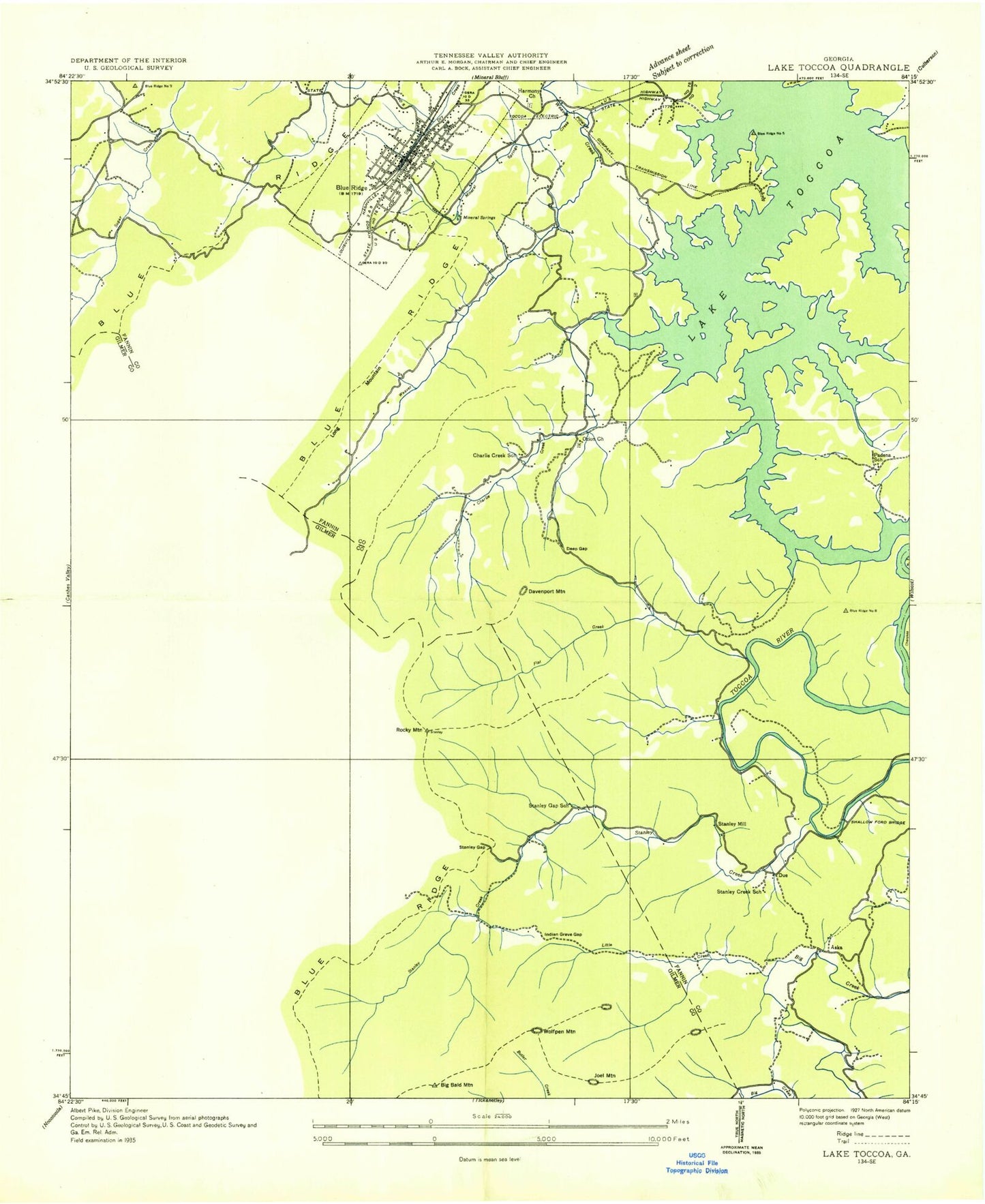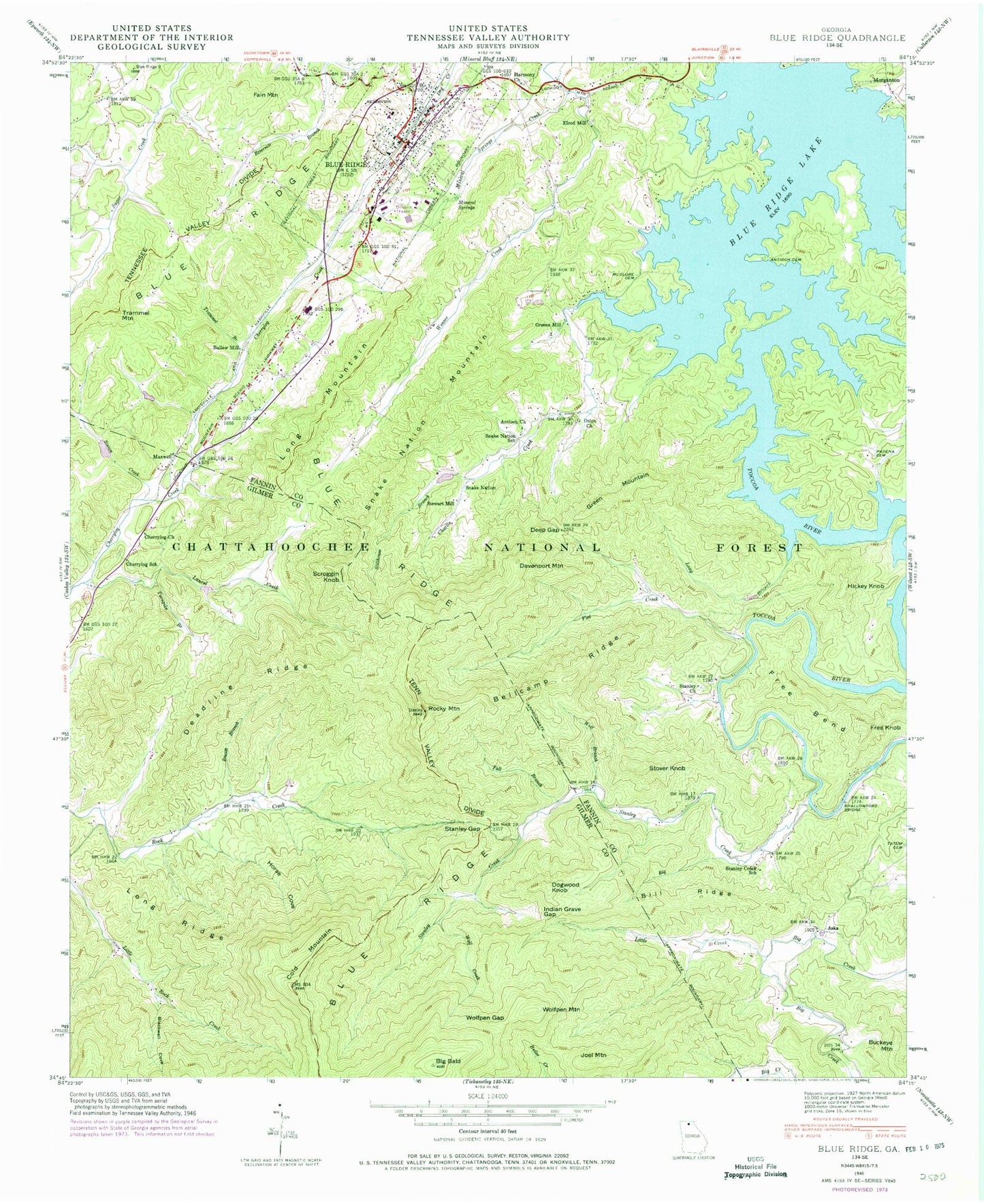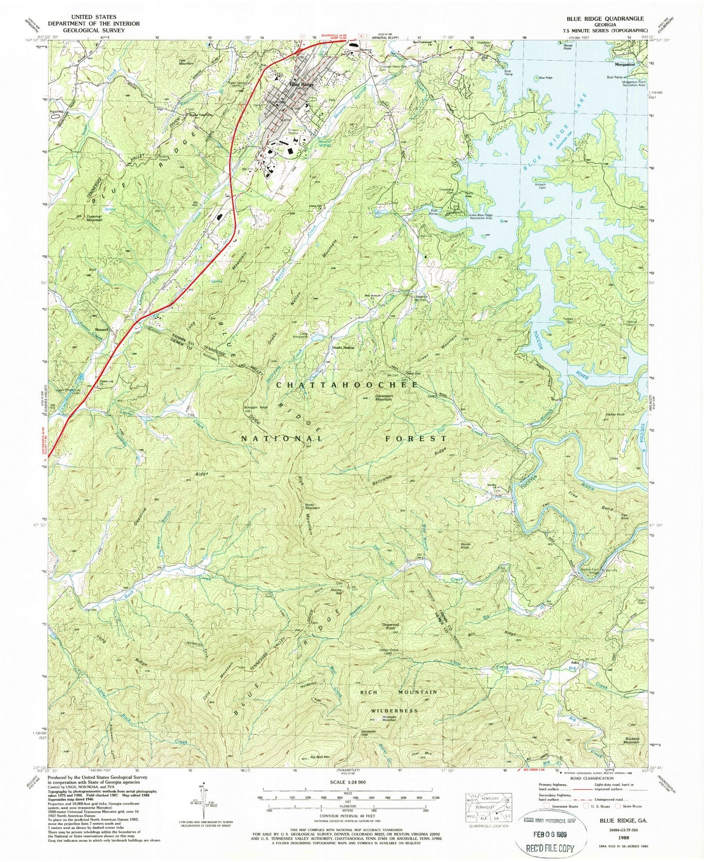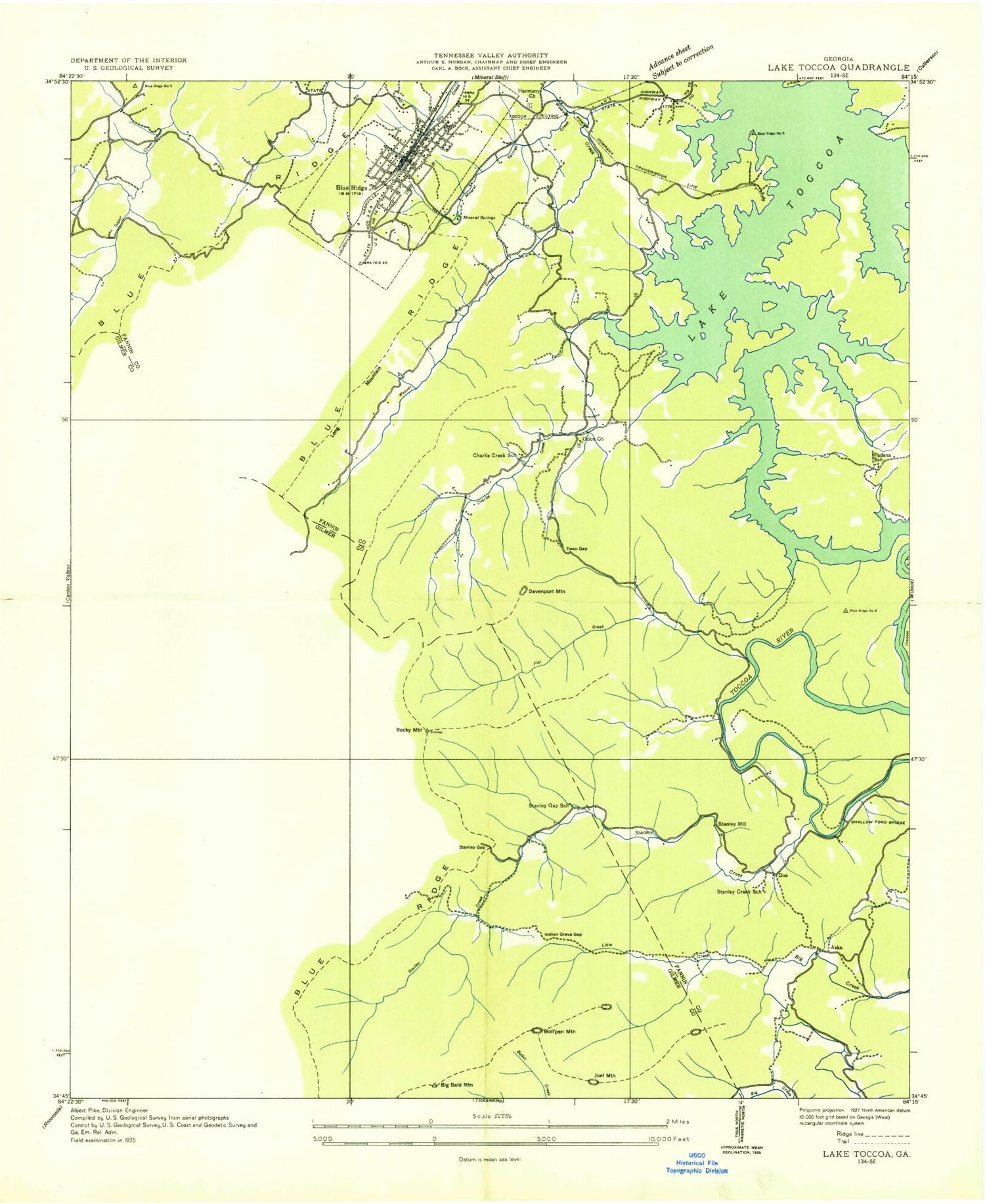
MyTopo
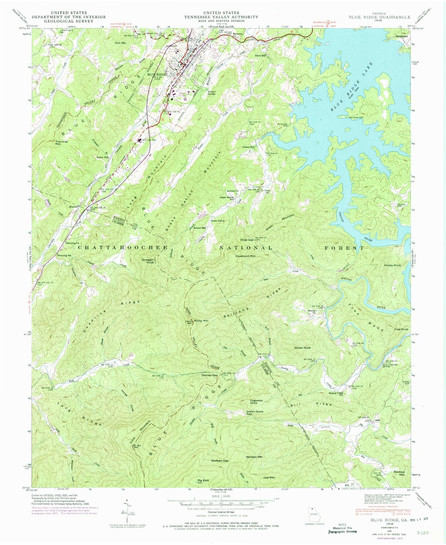
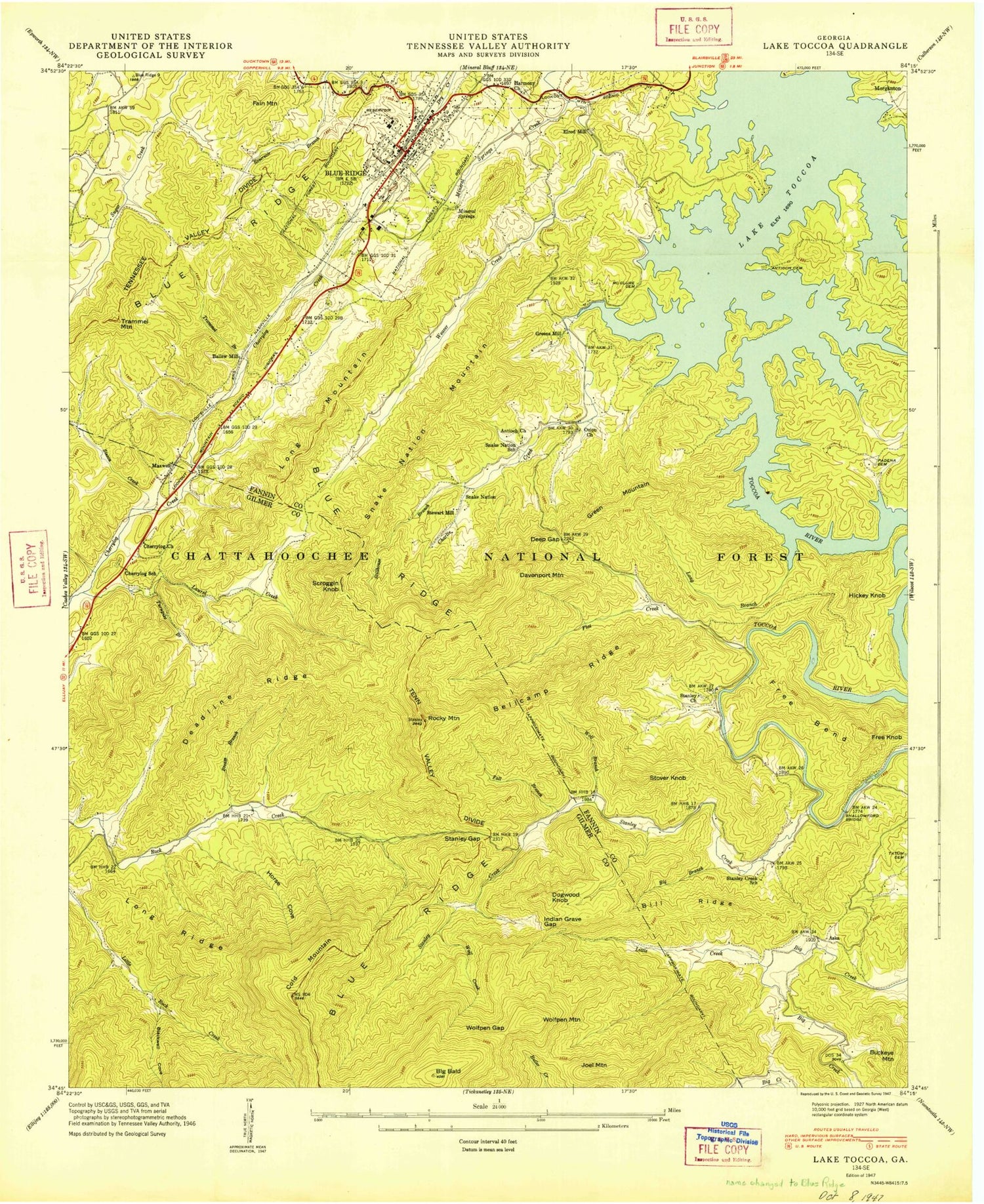
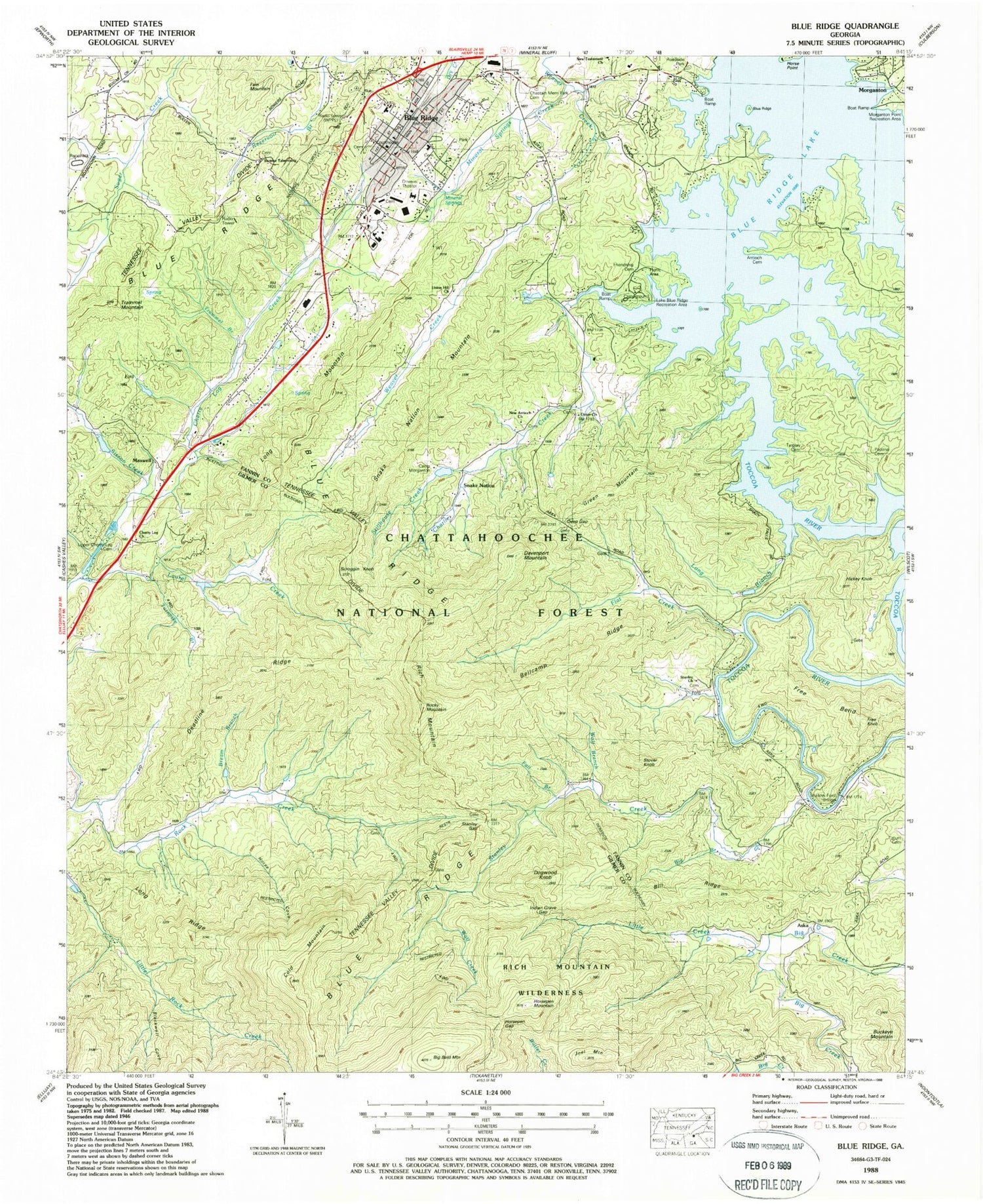
USGS Classic Blue Ridge Georgia 7.5'x7.5' Topo Map
Couldn't load pickup availability
Historical USGS topographic quad map of Blue Ridge in the state of Georgia. Scale: 1:24000. Print size: 24" x 27"
This quadrangle is in the following counties: Fannin, Gilmer.
The map contains contour lines, roads, rivers, towns, lakes, and grids including latitude / longitude and UTM / MGRS. Printed on high-quality waterproof paper with UV fade-resistant inks.
Contains the following named places: Antioch Cemetery, New Antioch Church, Bellcamp Ridge, Big Bald Mountain, Bill Ridge, Blackwell Cove, Bream Branch, Charlie Creek, Cherrying School, Cold Mountain, Deadline Ridge, Deep Gap, Fall Branch, Flat Creek, Free Bend, Harmony Church, Horse Cove, Indian Grave Gap, Laurel Creek, Little Creek, Long Branch, Long Ridge, Friendship Cemetery, Mineral Springs, Mineral Springs Creek, Ozion Church, Padena Cemetery, Rocky Mountain, Shallow Ford Bridge, Sisson Creek, Snake Nation, Snake Nation School, Stanley Church, Stanley Creek, Stanley Creek School, Stanley Gap, Stillhouse Creek, Trammel Branch, Turnpike Branch, Wolf Branch, Wolf Creek, Horsepen Gap, Bullen Gap, Chastain Memorial Park Cemetery, Blue Ridge Lake Recreation Area, Morganton Point Recreation Area, Camp Morganton, Union Hill Church, Upper Cherry Log Cemetery, WPPL Radio Tower, New Testament Church, Toccoa Work Center, Blue Ridge Campground, Rich Mountain, Tocca Ranger Station, Sunrise Tabernacle, Big Branch, Tarpley Cemetery, Aska, Ballew Mill, Blue Ridge, Buckeye Mountain, Davenport Mountain, Dogwood Knob, Elrod Mill, Fain Mountain, Free Knob, Green Mountain, Greens Mill, Hickey Knob, Joel Mountain, Long Mountain, Maxwell, Scroggin Knob, Snake Nation Mountain, Stewart Mill, Stover Knob, Trammel Mountain, Horsepen Mountain, Ellijay River Watershed Dam Number 12, Laurel Creek Lake, Gaeta Lake Dam, Gaeta Lake, Ellijay River Watershed Dam Number 11, Sisson Lake, Alsobrook School (historical), Blue Ridge City Hall, Blue Ridge Post Office, Due (historical), Fannin County, Fannin County High School, Fannin County Courthouse, First Baptist Church of Blue Ridge, Friendship Church (historical), Glen Hope Baptist Church, Padena Baptist Church (historical), Padena School (historical), Ray School (historical), Padgets Chapel African Methodist Episcopal Zion Church (historical), Robinson School (historical), Shallow Ford, WPPL-FM (Blue Ridge), Camp Patoka, Blue Ridge Lake, Cherry Log Church, Blue Ridge Division, City of Blue Ridge, Blue Ridge Elementary School, Fannin County Middle School, Fannin County Career and Technology Center, New Testament Christian Academy, Fannin County Fire Department Station 1, Cherry Log Baptist Church Old Cemetery, Cherry Log Baptist Church Cemetery, Fannin County Sheriff's Office, Blue Ridge Police Department, Georgia State Patrol Troop B Post 27, Fannin County Jail