MyTopo
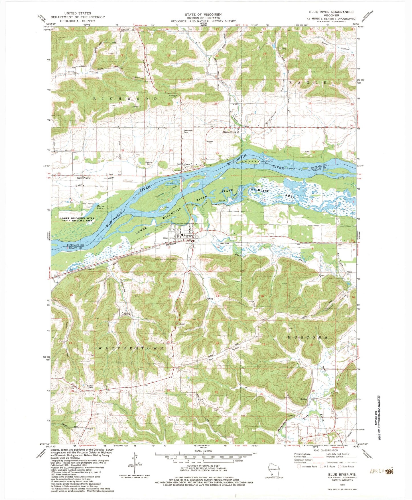
Classic USGS Blue River Wisconsin 7.5'x7.5' Topo Map
Couldn't load pickup availability
Historical USGS topographic quad map of Blue River in the state of Wisconsin. Typical map scale is 1:24,000, but may vary for certain years, if available. Print size: 24" x 27"
This quadrangle is in the following counties: Grant, Richland.
The map contains contour lines, roads, rivers, towns, and lakes. Printed on high-quality waterproof paper with UV fade-resistant inks, and shipped rolled.
Contains the following named places: Beulah Cemetery, Blue River, Blue River, Blue River Cemetery, Brimstone Hollow, Byrds Creek, Byrds Creek, Coumbe Cemetery, Coumbe Island, Cross Slough, Fennimore Fork, Garner Lake, Greenwood Cemetery, Jones Slough, Oak Ridge, Pleasant Valley, Port Andrew, Sand Prairie, Steamboat Island, Strawberry Ridge, Studenberg Hollow, Cooper Hill, Sand Prairie, Village of Blue River, Town of Richwood, Town of Watterstown, Brimstone Group H855 Dam, 0.4 Reservoir, Peterson G9917 Dam, 1.28 Reservoir, Sand Prairie Cemetery, Black School (historical), Heberlin School (historical), Tyler School (historical), Haskins School (historical), Kite School (historical), Upper Byrds Creek School (historical), Byrds Creek Stock Farm, Tisdale Homestead, Valley Farm, School Number 2 (historical), School Number 4 (historical), Eagle Valley Farm, Glen Eagle Farm, Pine Grove Stock and Dairy Farm, Pleasant Lawn Stock Farm, South Lawn Stock Farm, Blue River Bluffs State Natural Area, Blue River Sand Barrens State Natural Area, Blue River Fire and Rescue, Blue Mountain Orchard, Top T Farms, Blue River Wastewater Treatment Facility, Blue River Post Office