
MyTopo
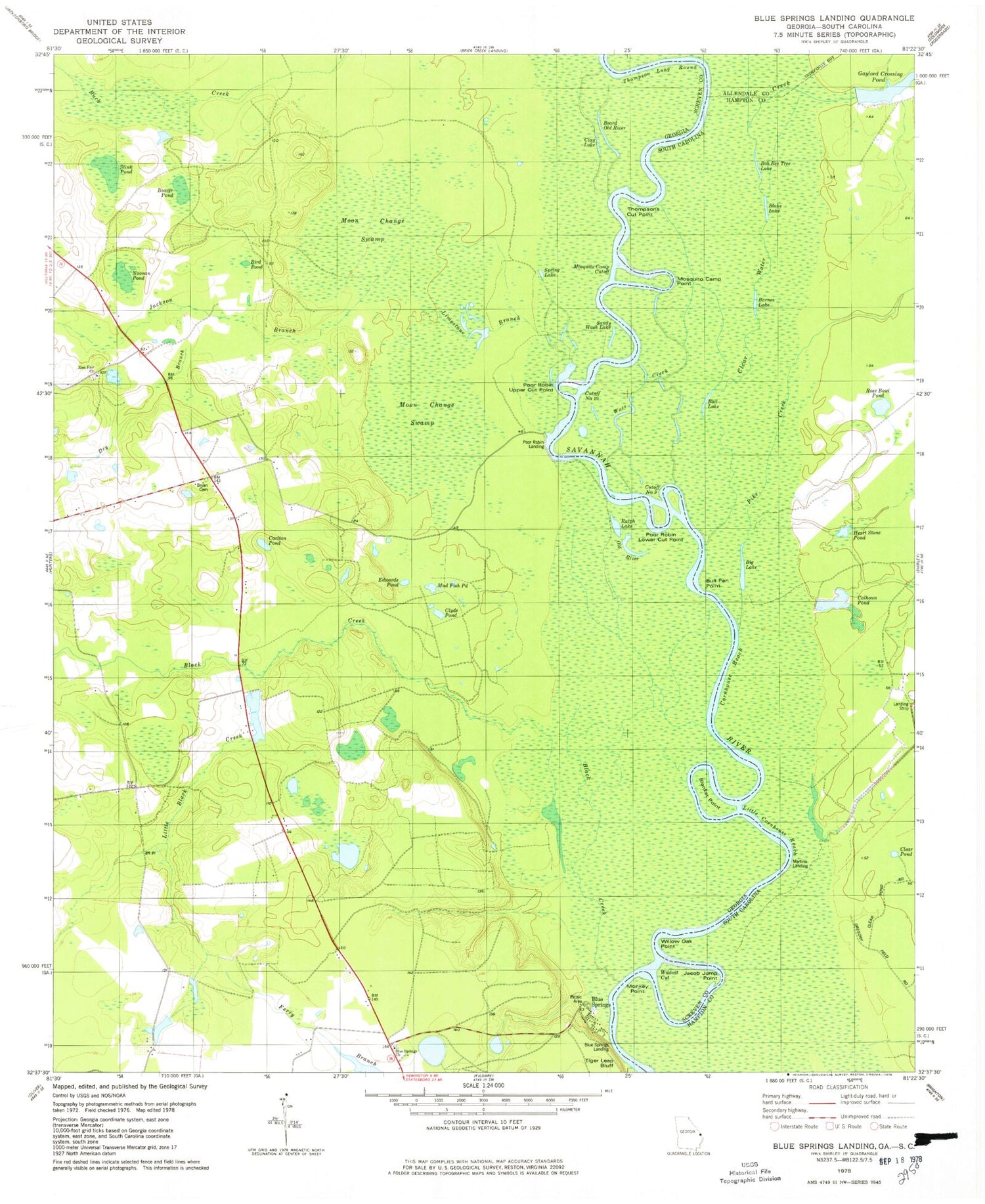
Classic USGS Blue Springs Landing Georgia 7.5'x7.5' Topo Map
Couldn't load pickup availability
Historical USGS topographic quad map of Blue Springs Landing in the states of Georgia, South Carolina. Map scale may vary for some years, but is generally around 1:24,000. Print size is approximately 24" x 27"
This quadrangle is in the following counties: Allendale, Hampton, Screven.
The map contains contour lines, roads, rivers, towns, and lakes. Printed on high-quality waterproof paper with UV fade-resistant inks, and shipped rolled.
Contains the following named places: Ball Lake, Barnes Lake, Beard Old River, Beaver Pond, Big Lake, Bird Pond, Black Creek, Blake Lake, Blake Plantation Pond Number Two D-2608 Dam, Blanket Point, Blue Springs, Blue Springs Church, Blue Springs Landing, Blue Springs School, Bob Bee Tree Lake, Borken Pond, Borken Pond Dam, Boyds School, Bryan Family Cemetery, Bull Pen Point, Calhoun Pond, Carlton Pond, Clay Lake, Clear Pond, Clear Water Creek, Clyde Pond, Cornhouse Reach, Cutoff Number Nine, Cutoff Number Ten, Dry Branch, Edwards Pond, Gaylord Crossing Pond, Heart Stone Pond, Jackson Branch, Jacob Jump Point, Limestone Branch, Little Black Creek, Little Cornhouse Reach, Long Branch, Martins Landing, Monkey Point, Moon Change Swamp, Mosquito Camp Cutoff, Mosquito Camp Point, Mud Fish Pond, Noonan Pond, Old River, Pike Creek, Poor Robin Landing, Poor Robin Lower Cut Point, Poor Robin Upper Cut Point, Ralph Lake, Rose Bowl Pond, Sandy Wash Lake, Spring Lake, Stink Pond, Thompson Long Round, Thompsons Cut Point, Three Bridges Branch, Ware Creek, Wildcat Cut, Willow Oak Point, Zion Fair Church, Zion School


