
MyTopo
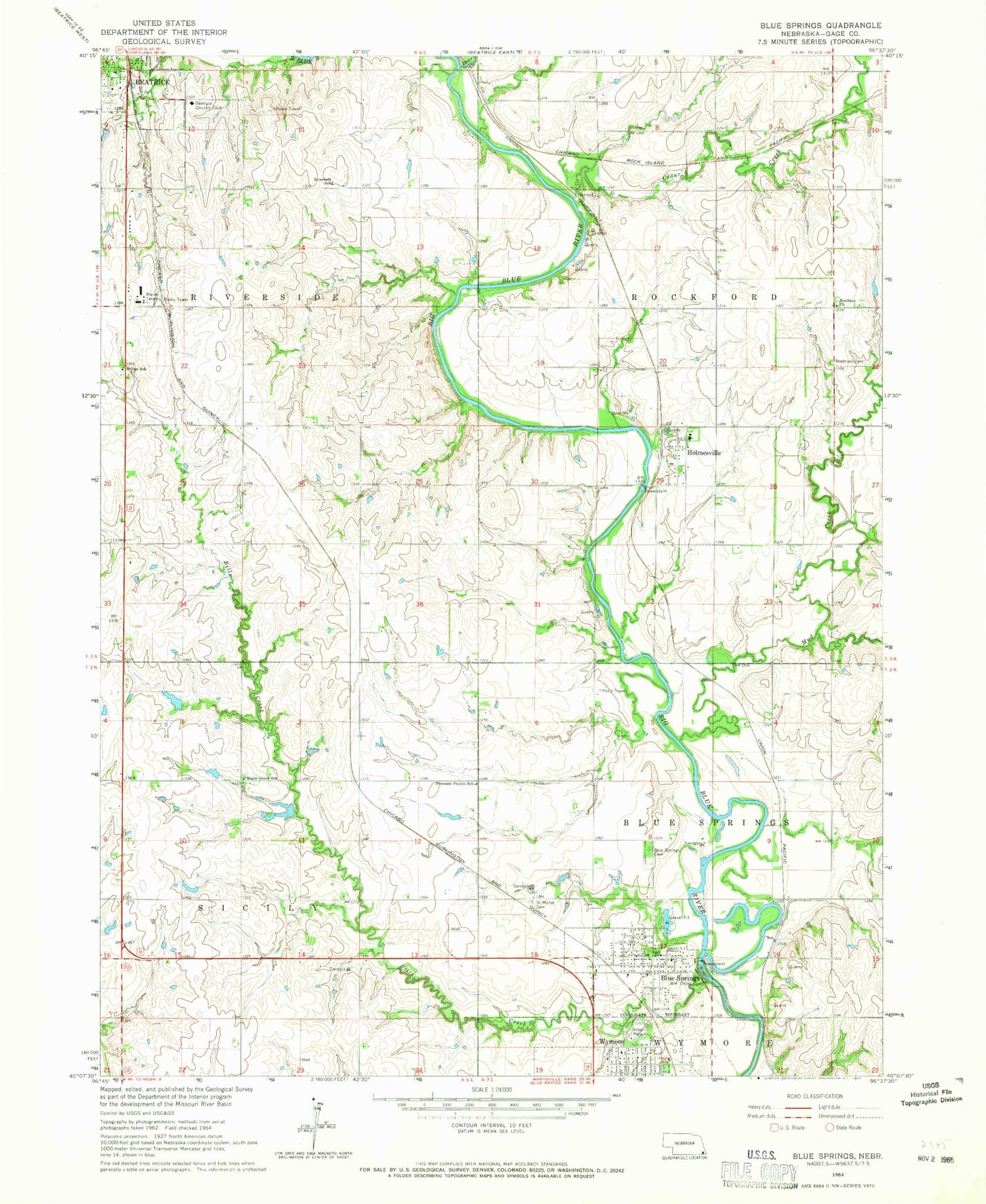
Classic USGS Blue Springs Nebraska 7.5'x7.5' Topo Map
Couldn't load pickup availability
Historical USGS topographic quad map of Blue Springs in the state of Nebraska. Typical map scale is 1:24,000, but may vary for certain years, if available. Print size: 24" x 27"
This quadrangle is in the following counties: Gage.
The map contains contour lines, roads, rivers, towns, and lakes. Printed on high-quality waterproof paper with UV fade-resistant inks, and shipped rolled.
Contains the following named places: Arbor Park, Bear Creek, Bills Creek, Bloody Run, Blue Springs, Blue Springs Cemetery, Brethren Cemetery, Brethren Church, Bridge School (historical), Cedar Creek, Holmesville, Maple Grove School (historical), Mud Creek, Pleasant Prairie School (historical), Riverside School (historical), Saint Marys Cemetery, Beatrice Country Club, Township of Blue Springs-Wymore, Township of Riverside, Township of Rockford, Township of Sicily, Holmesville Power Plant Dam, Holmesville Power Plant Reservoir, Blue Springs Power Plant Dam, Blue Springs Power Plant Reservoir, Southern Elementary School, Sicily Post Office (historical), Sicily (historical), Putnam (historical), Putnam Post Office (historical), Church of the Promise, Our Saviours Lutheran Church, United Presbyterian Church, Church of Christ, Holmesville School (historical), Holmesville, Holmesville Post Office, Searcey Grain Company Elevator, Blue Springs, Blue Springs Volunteer Fire Department, Farmers Union Co-operative Elevator, Blue Springs Post Office, Feit Memorial Park Campground, Feit Memorial Park, City of Blue Springs, Holmesville Census Designated Place


