MyTopo
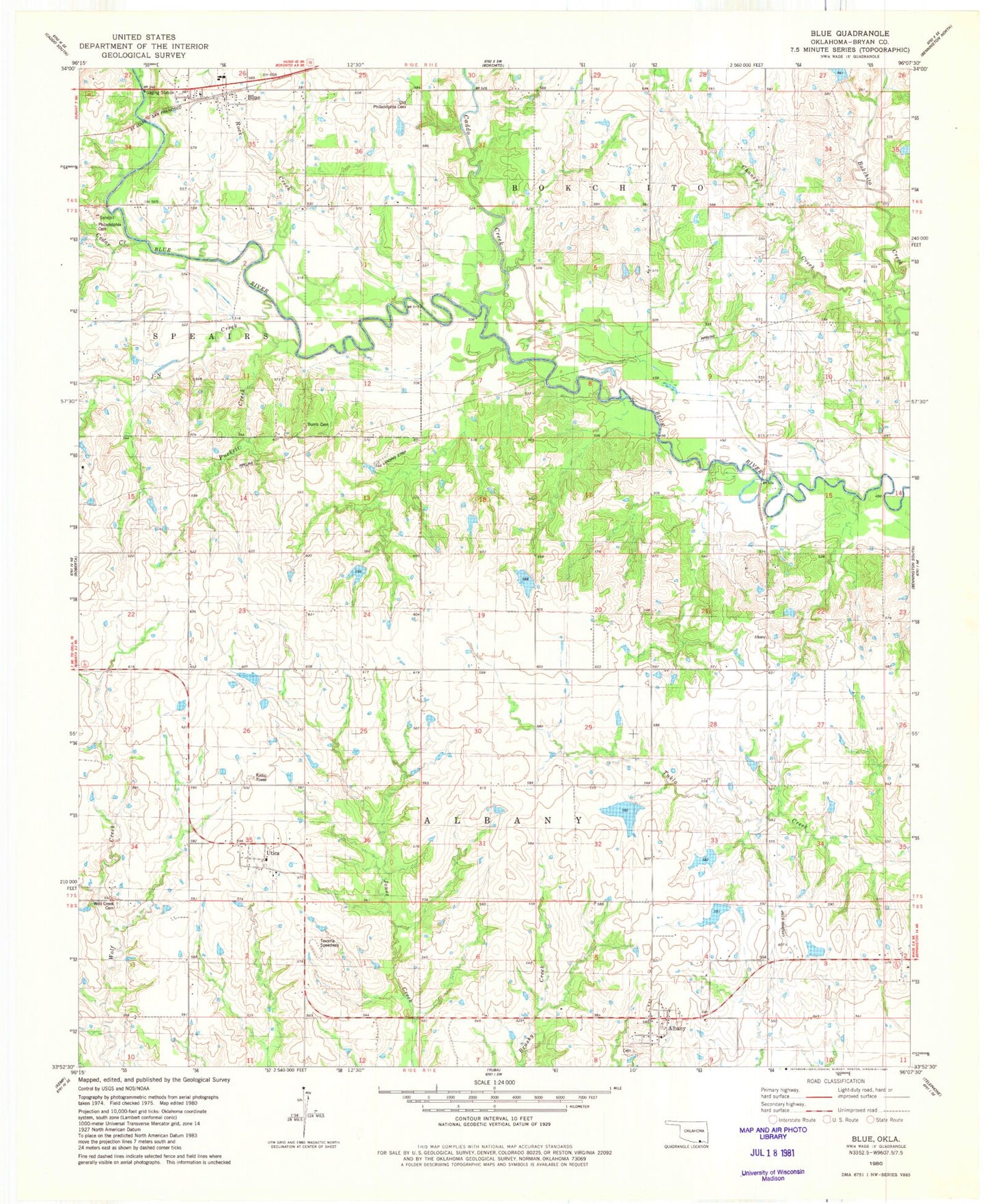
Classic USGS Blue Oklahoma 7.5'x7.5' Topo Map
Couldn't load pickup availability
Historical USGS topographic quad map of Blue in the state of Oklahoma. Map scale may vary for some years, but is generally around 1:24,000. Print size is approximately 24" x 27"
This quadrangle is in the following counties: Bryan.
The map contains contour lines, roads, rivers, towns, and lakes. Printed on high-quality waterproof paper with UV fade-resistant inks, and shipped rolled.
Contains the following named places: Albany, Albany Census Designated Place, Albany Fire Department, Albany Post Office, Blue, Blue Census Designated Place, Bray-Maxwell School, Burris Cemetery, Caddo Creek, Cedar Creek, Chaney Creek, County District 9, Dunegan Lake, Dunegan Lake Dam, Edwards Lake, Edwards Lake Dam, Fowler Lake, Fowler Lake Dam, J-N Creek, McGee Lake Number 1, McGee Lake Number 1 Dam, McGee Lake Number 2, McGee Lake Number 2 Dam, Musgrove Lake, Musgrove Lake Dam, Old Philadelphia Cemetery, Philadelphia Cemetery, Puckett Creek, Rock Branch, Rock Creek, Rock Creek Elementary School, Texoma Speedway, Utica, Utica Census Designated Place, Wolf Creek Cemetery, ZIP Code: 74726