MyTopo
Classic USGS Bluefield West Virginia 7.5'x7.5' Topo Map
Couldn't load pickup availability
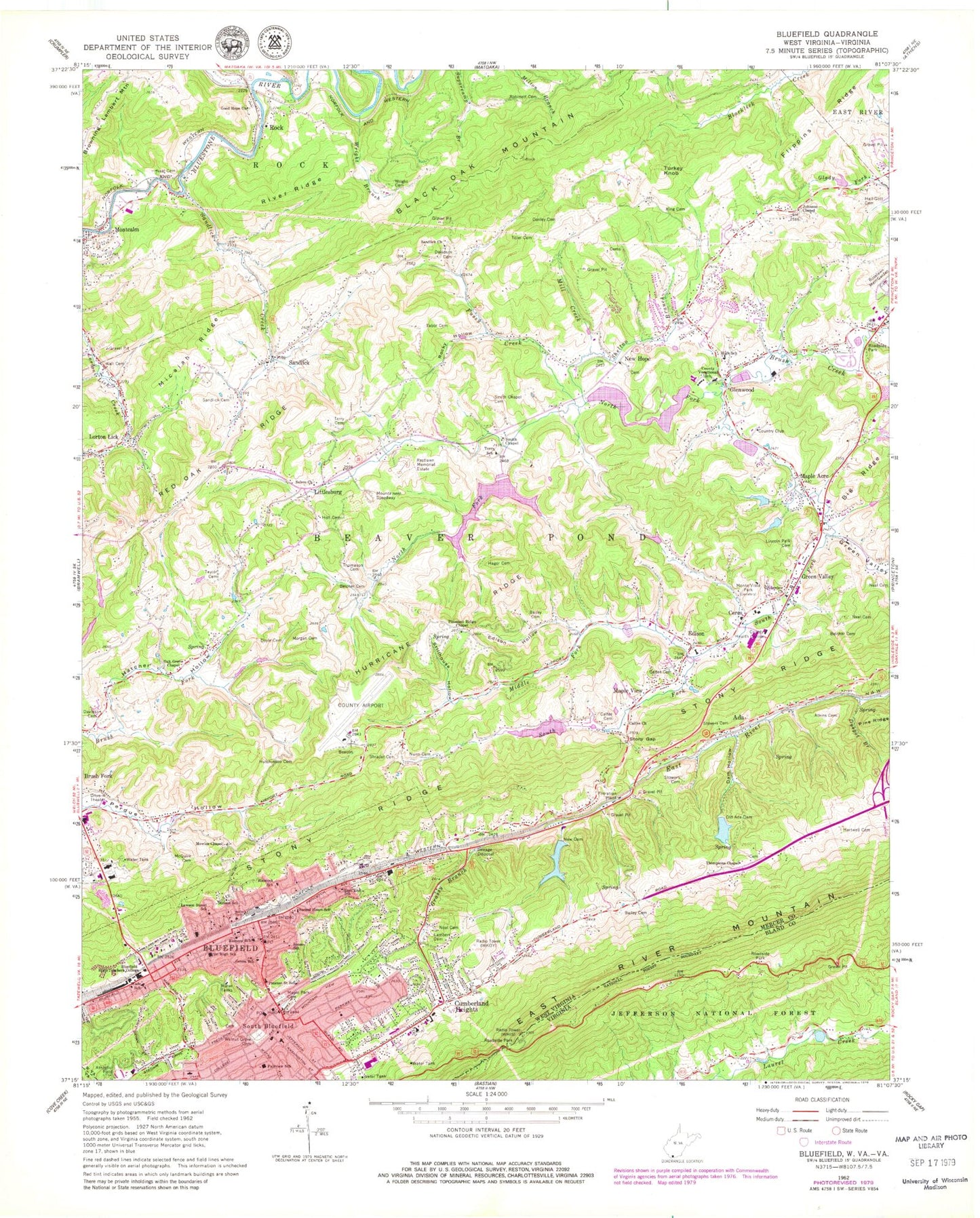
Historical USGS topographic quad map of Bluefield in the states of West Virginia, Virginia. Map scale may vary for some years, but is generally around 1:24,000. Print size is approximately 24" x 27"
This quadrangle is in the following counties: Bland, Mercer, Tazewell.
The map contains contour lines, roads, rivers, towns, and lakes. Printed on high-quality waterproof paper with UV fade-resistant inks, and shipped rolled.
Contains the following named places: Ada, Ada Dam, Ada Lake, Ada Reservoir Spring, Airport Square Shopping Center, Atkins Cemetery, Bailey Cemetery, Bailey School, Baptist Chapel, Belcher Cemetery, Bethel, Bethel African Methodist Episcopal Church, Black Oak Mountain, Bland Street Methodist Church, Blue Prince Shopping Center, Bluefield, Bluefield City Hall, Bluefield Downtown Commercial Historic District, Bluefield Fire Department Station 1, Bluefield Fire Department Station 3, Bluefield Middle School, Bluefield Plaza Shopping Center, Bluefield Police Department, Bluefield Post Office, Bluefield Regional Medical Center, Bluefield Regional Medical Center Heliport, Bluefield Sanitarium, Bluefield Spring, Bluefield State College, Bluefield State College Office of Public Safety, Bluefield West Virginia Rescue Squad, Bluewell Dam Number Two, Bluewell Water Supply Dam Number One, Bluewell Water Supply Dam Number Two, Bratton School, Bridge School, Browning Lambert Mountain, Brush Creek Structure Number 14 Dam, Brush Creek Structure Number 15 Dam, Brush Creek Structure Number 19a Dam, Brush Creek Structure Number 7a Dam, Brush Creek Structure Number Five Dam, Brush Creek Structure Number Four Dam, Brush Creek Structure Number Nine Dam, Brush Creek Structure Number Six Dam, Brush Fork Census Designated Place, Calfee Cemetery, Calfee Church, Calvary Baptist Church, Carmike Cinema 8, Carr School, Central Junior High School, Ceres, Ceres Elementary School, Christ Episcopal Church, Church of Christ, Church of God, Church of the Nazarene, City of Bluefield, College Baptist Church, Congregation Ahayan Sholom, Craft Memorial Library, Crusher, Cumberland Heights, Cumberland Heights Elementary School, Dam Hollow, Davidson Cemetery, Dawson School, District I, District II, Doctor Daniel Hale Lake, Donley Cemetery, Doyle Cemetery, Dyepot Branch, East End Baptist Church, East End School, Edison, Edison Hollow, Edwards Memorial Presbyterian Church, El Centro, Emmanuel Baptist Church, Fairview School, Federal Post Office, First African Methodist Episcopal Zion Church, First Baptist Church, First Christian Church, First Presbyterian Church, Flippins Ridge, Frank S Easley Bridge, Frye Cemetery, Fussy Creek, Genoa School, Glenwood, Glenwood Elementary School, Glenwood Junior High School, Glenwood School, Good Hope Church, Gott School, Grace United Methodist Church, Grant Street Bridge, Grassy Branch, Grassy Branch School, Green Valley, Green Valley - Glenwood Volunteer Fire Department, Greenview United Methodist Church, Hager Cemetery, Hall - Gott Cemetery, Hancock School, Harmon School, Hartwell Cemetery, Hatcher Hollow, Hillsville Police Department, Holt Cemetery, Horton Dam, Horton Lake, Hunt School, Hurricane Ridge, Hurricane School, Hutchinson Cemetery, Immanuel Lutheran Church, John Stewart Memorial Methodist Church, Johnson Chapel, Johnston Town, Jones School, Kendell Plaza Shoping Center, King Cemetery, Lambert Cemetery, Lawson Street School, Lincoln Park Cemetery, Littlesburg, Lorton Lick, Maple Acre, Maple Park Cemetery, Maple View, McQuire Cemetery, Memorial Elementary School, Mercer County Airport, Mercer County Convention and Visitors Bureau, Mercer County Fellowship Home, Mercer County Health Center, Mercer County Vocational School, Mercer Mall Shopping Center, Micajah Ridge, Middle Fork Brush Creek, Mill Creek, Mitchell Stadium, Montcalm Elementary School, Monte Vista Park, Montvale Park, Morgan Cemetery, Mount Olive Baptist Church, Mount Zion Baptist Church, Mountaineer Speedway, Mowles Chapel, Mowles School, Neal Cemetery, New Hope, New Hope Church, New Salem United Methodist Church, Norfolk Southern Railroad Police Department, North Fork Brush Creek, North Side United Holiness Church, Norton Hollow Spring, Nunn Cemetery, Oak Grove Chapel, Old Ada Dam, Park Central High School, Pleasant Ridge Chapel, Preston Street School, Princeton Elks Country Club Golf Course, Princeton Rescue Squad Station 4, Raleigh Street Methodist Church, Ramsey Elementary School, Red Oak Ridge, Refuge Church of Christ, Restlawn Memorial Estate, River Ridge, Robinett Cemetery, Rock, Rock Elementary School, Rock Post Office, Rocky Hollow, Roselawn Memorial Garden, Sacred Heart School, Saint Marys Hospital, Sam Perdue Juvenile Center, Sam Purdue Juvenile Center, Sandlick, Sandlick Cemetery, Sandlick Church, Sandlick Creek, Sandlick School, Shelton Branch, Shrader Cemetery, Smith Chapel, Smith Chapel Cemetery, South Bluefield, South Fork Brush Creek, Spruce Branch, Stillhouse Hollow, Stinson School, Stony Gap, Stony Point School, Stowers Cemetery, Tabor Cemetery, Taylor Cemetery, Terry Cemetery, Terry School, Thomason Cemetery, Thompson Chapel United Methodist Church, Thompson School, Tiller Cemetery, Turkey Knob, Union Mission Home, Valley View Seventh Day Adventist School, Wade Athletic field, Wade Elementary School, Wall Cemetery, Walnut Grove Cemetery, WBDY-FM (Bluefield), Wendell G Hardway Library, WHAJ-FM (Bluefield), WHIS Radio Tower (Sturgeon Bay), WHIS Radio Tower (Tazewell), Widemouth Creek, Windy Mountain Learning Center, WKOY Radio Tower (Sturgeon Bay), WKOY-AM (Bluefield), WPIR-FM (Bluefield), Wright Branch, Wright Cemetery, WVVA-TV (Bluefield), Young Street School, ZIP Codes: 24701, 24737


