MyTopo
Classic USGS Bluewater New Mexico 7.5'x7.5' Topo Map
Couldn't load pickup availability
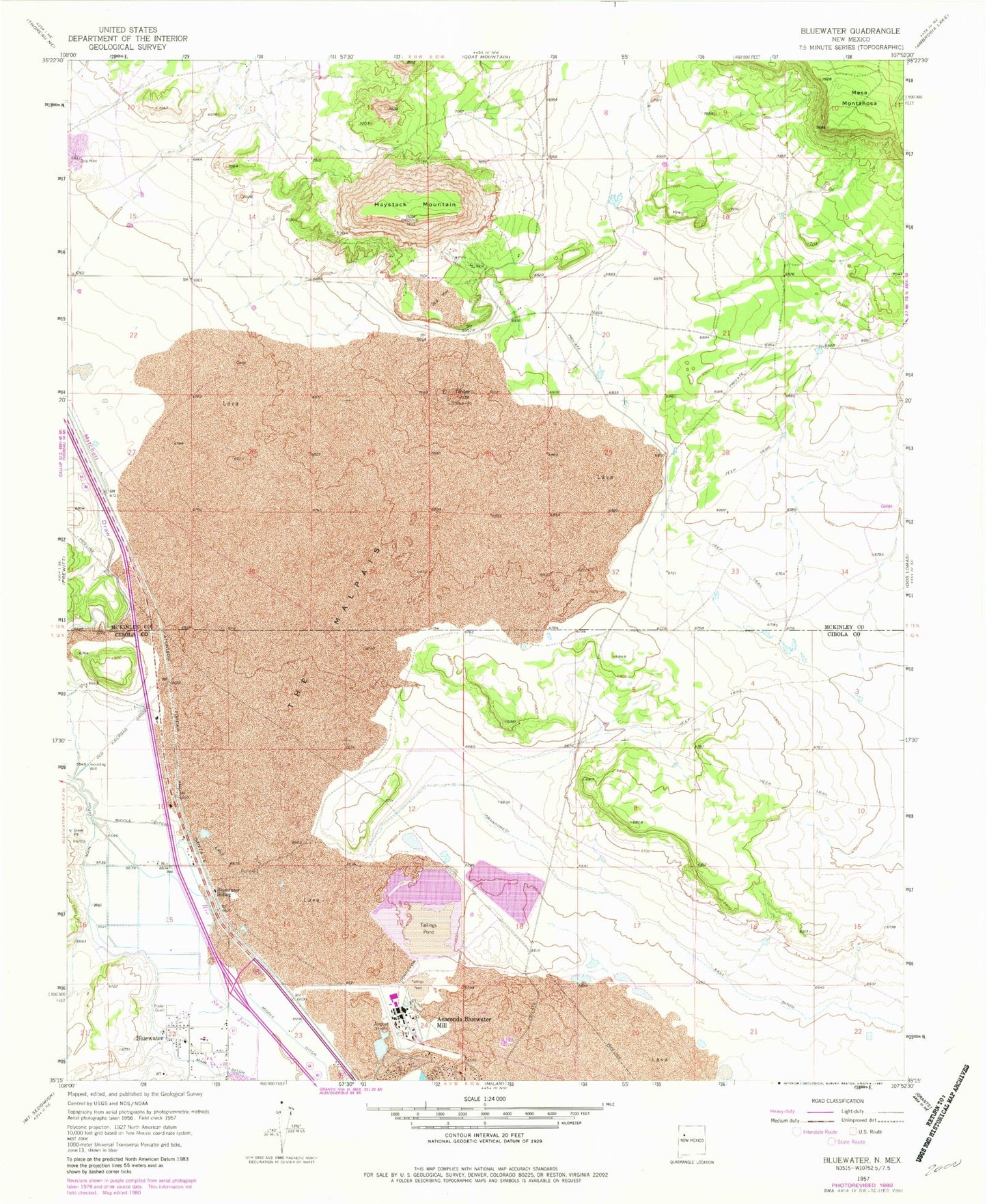
Historical USGS topographic quad map of Bluewater in the state of New Mexico. Map scale may vary for some years, but is generally around 1:24,000. Print size is approximately 24" x 27"
This quadrangle is in the following counties: Cibola, McKinley.
The map contains contour lines, roads, rivers, towns, and lakes. Printed on high-quality waterproof paper with UV fade-resistant inks, and shipped rolled.
Contains the following named places: 10088 Water Well, 10090 Water Well, 10091 Water Well, 10092 Water Well, 10098 Water Well, 10099 Water Well, 16T-552 Water Well, 87005, Anaconda Bluewater Mill, Baca Chapter, Bluewater, Bluewater Creek, Bluewater Post Office, Bluewater Siding, Bluewater Village Fire Department, East Ditch, El Tintero, Elkins Prewitt Pit, Federal Mine, Haystack Census Designated Place, Haystack Mine, Haystack Mountain, Haystack Open Pit, Haystack Underground Mine, Hoskins and Robinson Pit, Main Ditch, Mesa Montanosa, Mitchell Draw, Prop Canyon Site One Dam, Tchalchuitl Mines Historic Site, Uranium Deposit, Uranium Prospects