
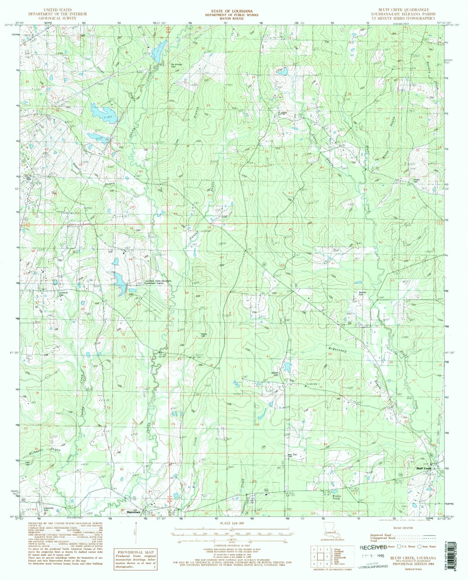
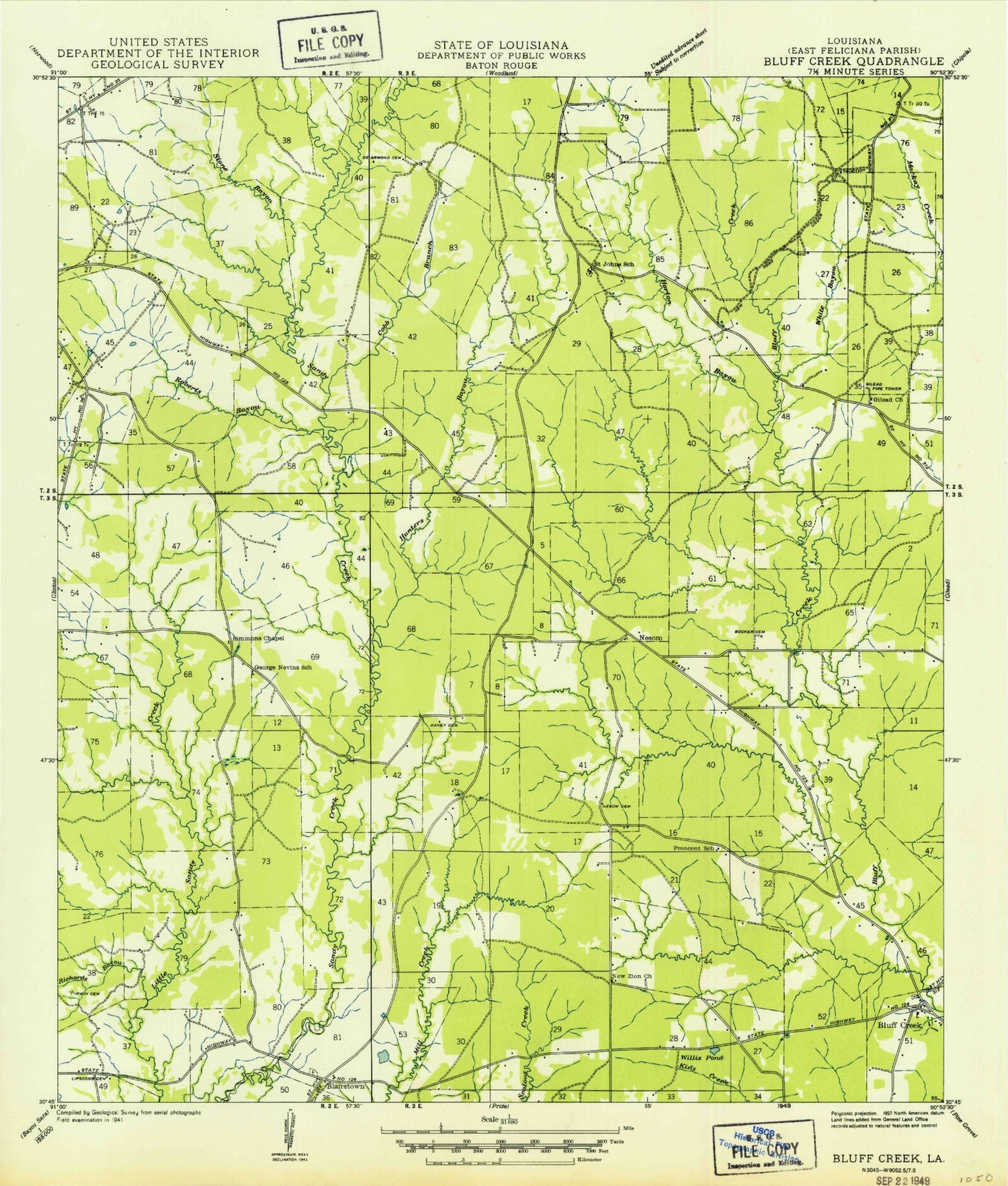
MyTopo
Classic USGS Bluff Creek Louisiana 7.5'x7.5' Topo Map
Couldn't load pickup availability
Historical USGS topographic quad map of Bluff Creek in the state of Louisiana. Typical map scale is 1:24,000, but may vary for certain years, if available. Print size: 24" x 27"
This quadrangle is in the following counties: East Feliciana.
The map contains contour lines, roads, rivers, towns, and lakes. Printed on high-quality waterproof paper with UV fade-resistant inks, and shipped rolled.
Contains the following named places: Booker Cemetery, Cobb Branch, De Armond Cemetery, Gilead Cemetery, Haney Cemetery, Horton Bayou, Irwin Cemetery, Lipscomb Cemetery, McQuinney Branch, Nesom Cemetery, New Zion Cemetery, New Zion Church, Precinct School, Richards Bayou, Roberts Bayou, Saint Johns Church, Stone Bayou, White Bayou, Willis Pond, Ward Six, Gilead Church (historical), Independence Church (historical), Lutheran Church (historical), Nesom (historical), Sunbeam (historical), Wall School (historical), Blairstown, Hunter Bayou, Louisiana State University Experiment Station, Avondale Boy Scout Lake Dam, Avondale Boy Scout Lake, McGee Lake Dam, Idlewild Lake Dam, Idlewild Lake, Nesom Pond Dam, Parish Governing Authority District 6, Bluff Creek Volunteer Fire Department, Bluff Creek Baptist Church


