MyTopo
Classic USGS Bluffton Indiana 7.5'x7.5' Topo Map
Couldn't load pickup availability
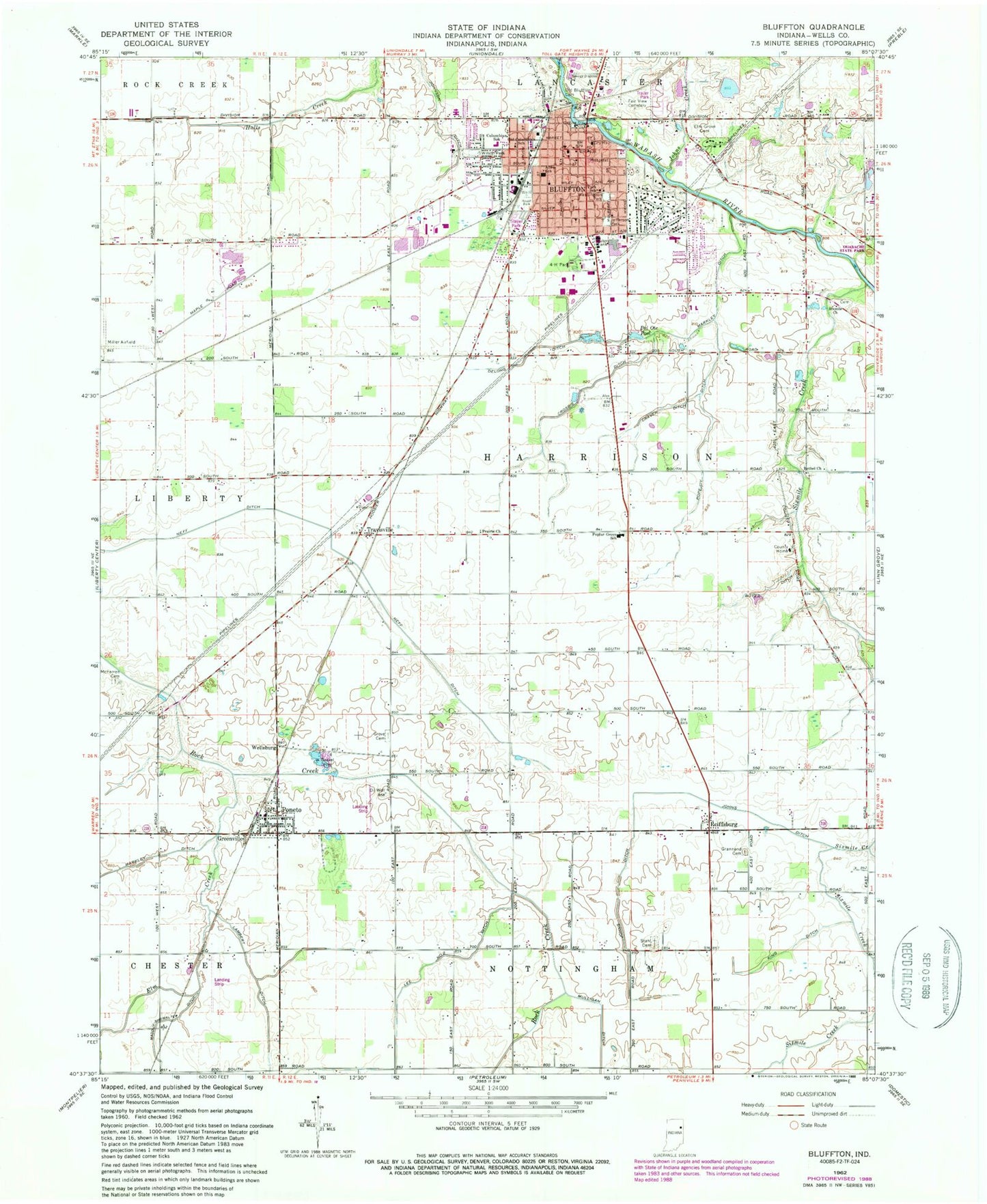
Historical USGS topographic quad map of Bluffton in the state of Indiana. Map scale may vary for some years, but is generally around 1:24,000. Print size is approximately 24" x 27"
This quadrangle is in the following counties: Wells.
The map contains contour lines, roads, rivers, towns, and lakes. Printed on high-quality waterproof paper with UV fade-resistant inks, and shipped rolled.
Contains the following named places: 4-H Park, Allen School, Bethel Church, Bluffton, Bluffton Fire Department, Bluffton Police Department, Bluffton Post Office, Bluffton Regional Medical Center, Boyer Ditch, Brinnemans Headacres Airport, Central School, City of Bluffton, Columbian Elementary School, Craven Ditch, Crosbie Ditch, Delong Ditch, East Side Elementary School, Elm Creek, Elm Grove Cemetery, Fairview Cemetery, Gearnand Cemetery, Greenville, Grove Cemetery, Irvin Ditch, Jefferson Park, Johns Creek, Johns Ditch, Johnson Ditch, King Ditch, Lambert Ditch, Lee Number Two Ditch, Maddux-Showalter Ditch, Markley Ditch, McFarren Cemetery, Miller Airport, Old Bluffton Cemetery, Old Columbian School, Park School, Poneto, Poneto Post Office, Poneto Volunteer Fire Department, Popejoy Ditch, Popular Grove School, Prairie Church, Reiffsburg, Sixmile Church, Sixmile Creek, Stahl Cemetery, Town of Poneto, Township of Harrison, Travisville, Washington Park, WCRD-FM (Bluffton), Wells County, Wells County Emergency Medical Services - Bluffton Station, Wells County Sheriff's Office, Wellsburg, ZIP Code: 46714