MyTopo
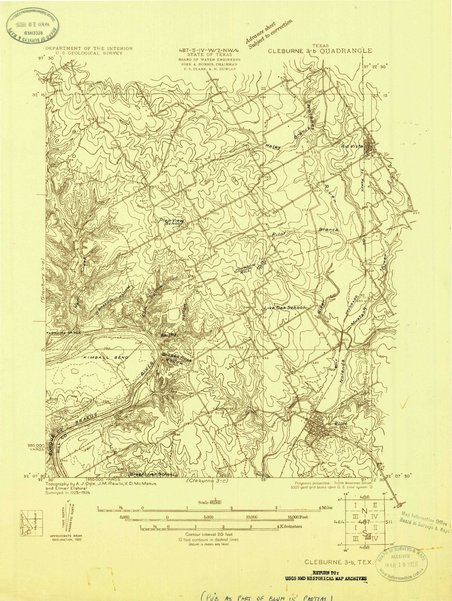
Classic USGS Blum Texas 7.5'x7.5' Topo Map
Couldn't load pickup availability
Historical USGS topographic quad map of Blum in the state of Texas. Map scale may vary for some years, but is generally around 1:24,000. Print size is approximately 24" x 27"
This quadrangle is in the following counties: Bosque, Hill, Johnson.
The map contains contour lines, roads, rivers, towns, and lakes. Printed on high-quality waterproof paper with UV fade-resistant inks, and shipped rolled.
Contains the following named places: Bailey Hollow, Belnap Creek, Big Ham Hole Spring, Bluff Mills, Blum, Blum City Offices, Blum Post Office, Blum Volunteer Fire Department, Broke Rock, Broke Rock Hollow, Chisholm Trail Park, Circle 'A' Ranch Airport, Darr Branch, Elm Hollow, Falls Branch, Fishermans Paradise, Gourd Neck Branch, Grand Valley Lands Airport, Grange Hall Cemetery, Haley Branch, Ham Creek, Ham Creek Park, J T Baker Farmstead, Kimball Bend, Kyle - Bullard Cemetery, Little Ham Hole Spring, Live Oak Cemetery, Lowell Smith Jr Airport, Mustang Creek, Opossum Hollow, Owl Hollow, Pilot Branch, Retreat, Rio Vista Civic Center, Rio Vista Police Department, Rio Vista Post Office, Rio Vista Volunteer Fire Department, Town of Blum, ZIP Code: 76093