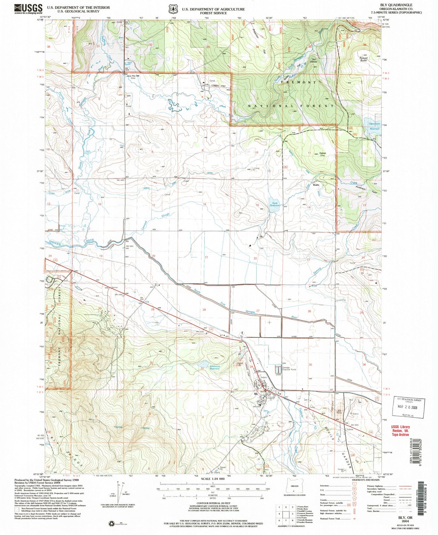
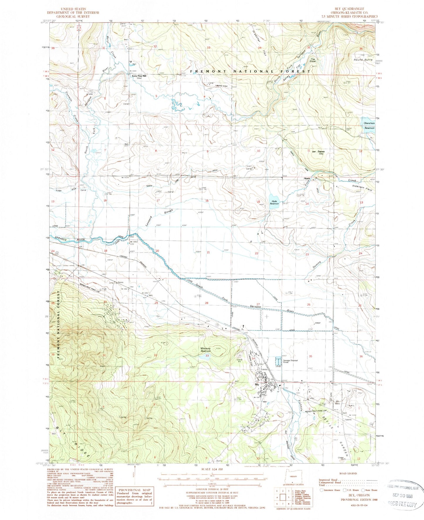
MyTopo
Classic USGS Bly Oregon 7.5'x7.5' Topo Map
Couldn't load pickup availability
Historical USGS topographic quad map of Bly in the state of Oregon. Map scale may vary for some years, but is generally around 1:24,000. Print size is approximately 24" x 27"
This quadrangle is in the following counties: Klamath.
The map contains contour lines, roads, rivers, towns, and lakes. Printed on high-quality waterproof paper with UV fade-resistant inks, and shipped rolled.
Contains the following named places: Allen's Airstrip, Bailey Flat, BK Ranch, Bly, Bly Branch Library, Bly Census Designated Place, Bly Post Office, Bly Ranger Station, Bly Rural Fire Protection District, Bly Sanitary District Treatment Lagoons, Bly Siding, Bly Trailhead, Campbell Ranch, Deming Creek, Elder Ditch, Fishhole Creek, Fishhole Substation, Fivemile Creek, Fritz Creek, Fritz Creek Dam, Garner Post Office, Gearhart School, Hyde Airstrip, Hyde Reservoir, Ivory Pine Mill, Lee Adkins Place, Leonard Slough, Meryl Creek, North Fork, North Fork Ditch, North Fork Ranch, North Fork Sprague River, Northfork, Obenchain Dam, Obenchain Ranch, Obenchain Reservoir, Round Butte, South Fork Sprague River, The Elbow, Watts, Whiskey John Flat, Whitmore Reservoir, ZIP Code: 97622