MyTopo
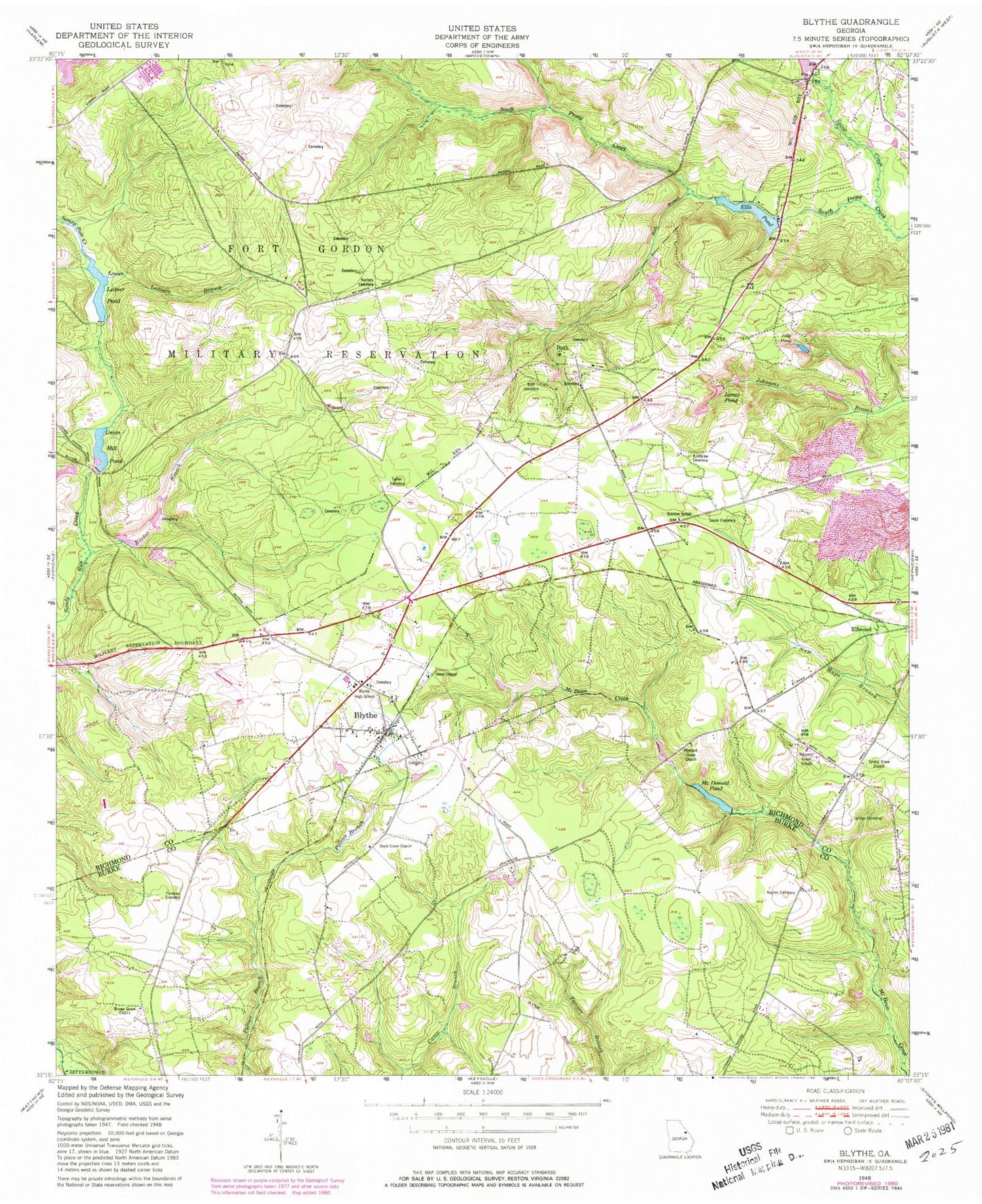
Classic USGS Blythe Georgia 7.5'x7.5' Topo Map
Couldn't load pickup availability
Historical USGS topographic quad map of Blythe in the state of Georgia. Map scale may vary for some years, but is generally around 1:24,000. Print size is approximately 24" x 27"
This quadrangle is in the following counties: Burke, Jefferson, Richmond.
The map contains contour lines, roads, rivers, towns, and lakes. Printed on high-quality waterproof paper with UV fade-resistant inks, and shipped rolled.
Contains the following named places: Augusta Fire Department Station 14, Bath, Bath Branch, Bath Cemetery, Blythe, Blythe Elementary School, Blythe High School, Blythe Police Department, Blythe Post Office, Branton School, Brown Grove Church, City of Blythe, Doyle Grove Church, East Georgia Police Academy, Edie, Ellis Pond, Ellis Pond Dam, Ellwood, Fort Gordon, Fort Gordon Division, Freeman Cemetery, Fulchers Mill, Gordon Lake, Gordon Lakes Dam, Hoods Chapel, Hughes Cemetery, James Pond, Jolly Pond, Jones Chapel, Killebrew Cemetery, King Spring School, Lake Inez Dam, Leitners Branch, Lower Leitner Pond, McDonald Pond, Palmer Academy, Pea Patch Aerodrome, Pleasant Grove Church, Pleasant Grove School, Rachel Branch, Rachels Cemetery, Saxon Cemetery, South Prong Creek, Spirit Creek, Spring Grove Church, Springs Cemetery, Tarver Cemetery, Teal Airpark, Union Mill Pond, ZIP Code: 30805