MyTopo
Classic USGS Blythewood South Carolina 7.5'x7.5' Topo Map
Couldn't load pickup availability
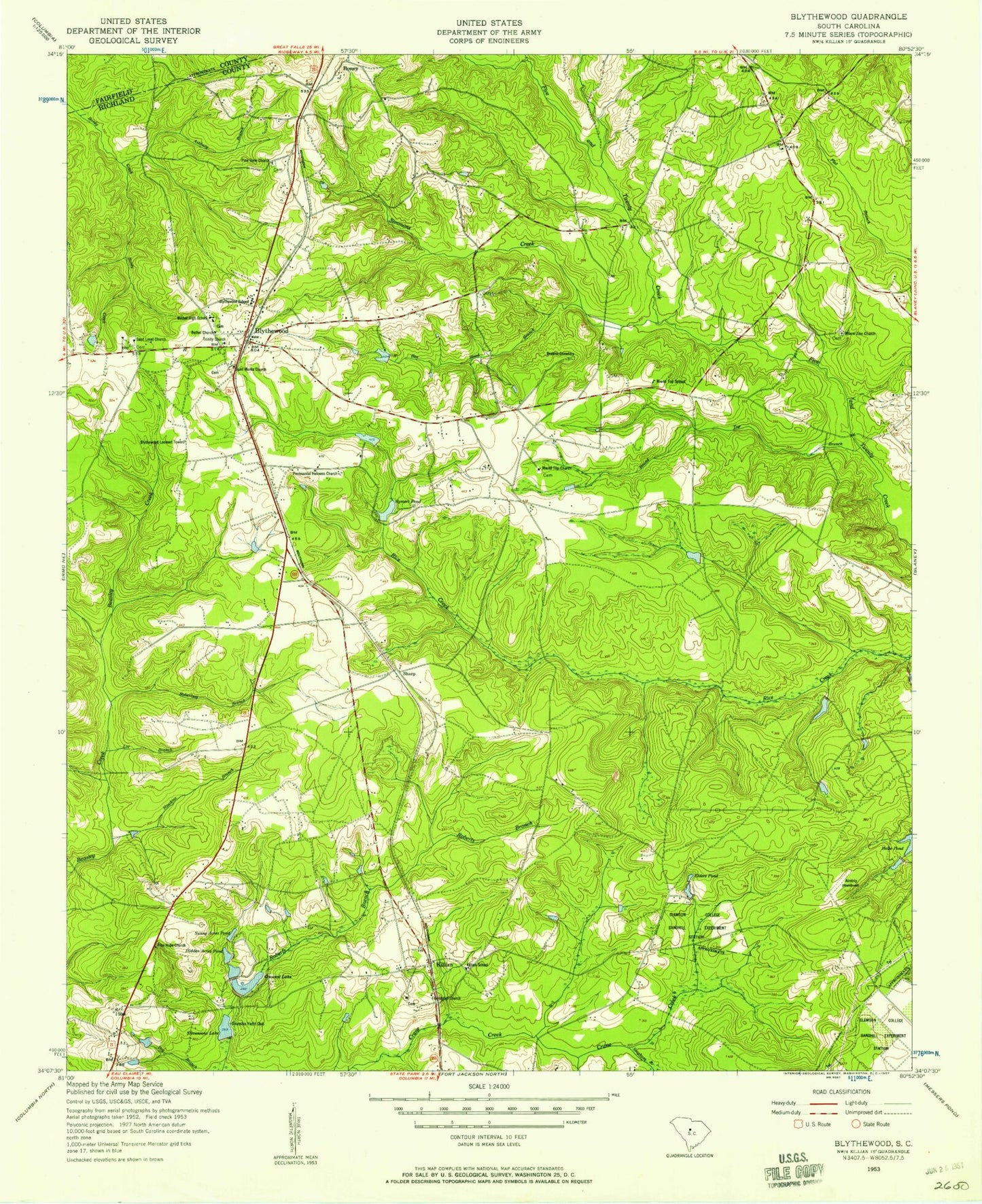
Historical USGS topographic quad map of Blythewood in the state of South Carolina. Map scale may vary for some years, but is generally around 1:24,000. Print size is approximately 24" x 27"
This quadrangle is in the following counties: Fairfield, Richland.
The map contains contour lines, roads, rivers, towns, and lakes. Printed on high-quality waterproof paper with UV fade-resistant inks, and shipped rolled.
Contains the following named places: Ashbury Branch, Barnnets Pond, Barnnets Pond D-0392 Dam, Bethel Church, Blythewood, Blythewood Division, Blythewood Elementary School, Blythewood Lookout Tower, Boney, Boney Creek, Browns Cemetery, Clarks Pond D-0411 Dam, Columbia - Richland Fire Station Bear Creek, Columbia Country Club, Columbia Richland Fire Department Killian, Columbia Richland Fire Station Blythewood, Covingtons Lake D-0545 Dam, Crane Creek Church, Crescent Lake, Duke School, Elders Pond, Epworth Pines D-0362 Dam, Flat Branch School, Franklin Memorial Garden, Free Hope Church, Free Hope School, Friendship Church, Fuller Pond Dam D-1592, Green Springs, Hanbury Junior High School, Hawkins Branch, Hidden Acres Pond, Holiness Church, Hood Branch, Hospitals Lake, Hospitals Lake D-0413 Dam, Killian, Killian School, Lake Ashley D-1590 Dam, Lake Columbia, Lake Columbia D-0549 Dam, Langfords Crossroads, Lot Branch, Mount Zion Church, North Crossing, North Pines, North Spring Lake, North Spring Lake D-0550 Dam, North Springs, North Springs Elementary School, Pine View Church, Progressive Church, Roberts Branch, Roberts Pond, Robertson Branch, Rose Creek, Round Top Branch, Round Top Church, Round Top School, Rymers Pond, Saint Marks Church, Saint Mary Church, Sand Level Church, Sand Level School, Sandfield Church, Sandhills Post Office, Shady Grove School, Sharp, Simmons Creek, Sorghum Branch, Stevensons Lake, Stevensons Lake D-0546 Dam, Sunny Acres Pond, Town of Blythewood, WNOK-FM (Columbia), Woodlawn Cemetery, ZIP Codes: 29016, 29229