
MyTopo
Classic USGS Blyton Illinois 7.5'x7.5' Topo Map
Couldn't load pickup availability
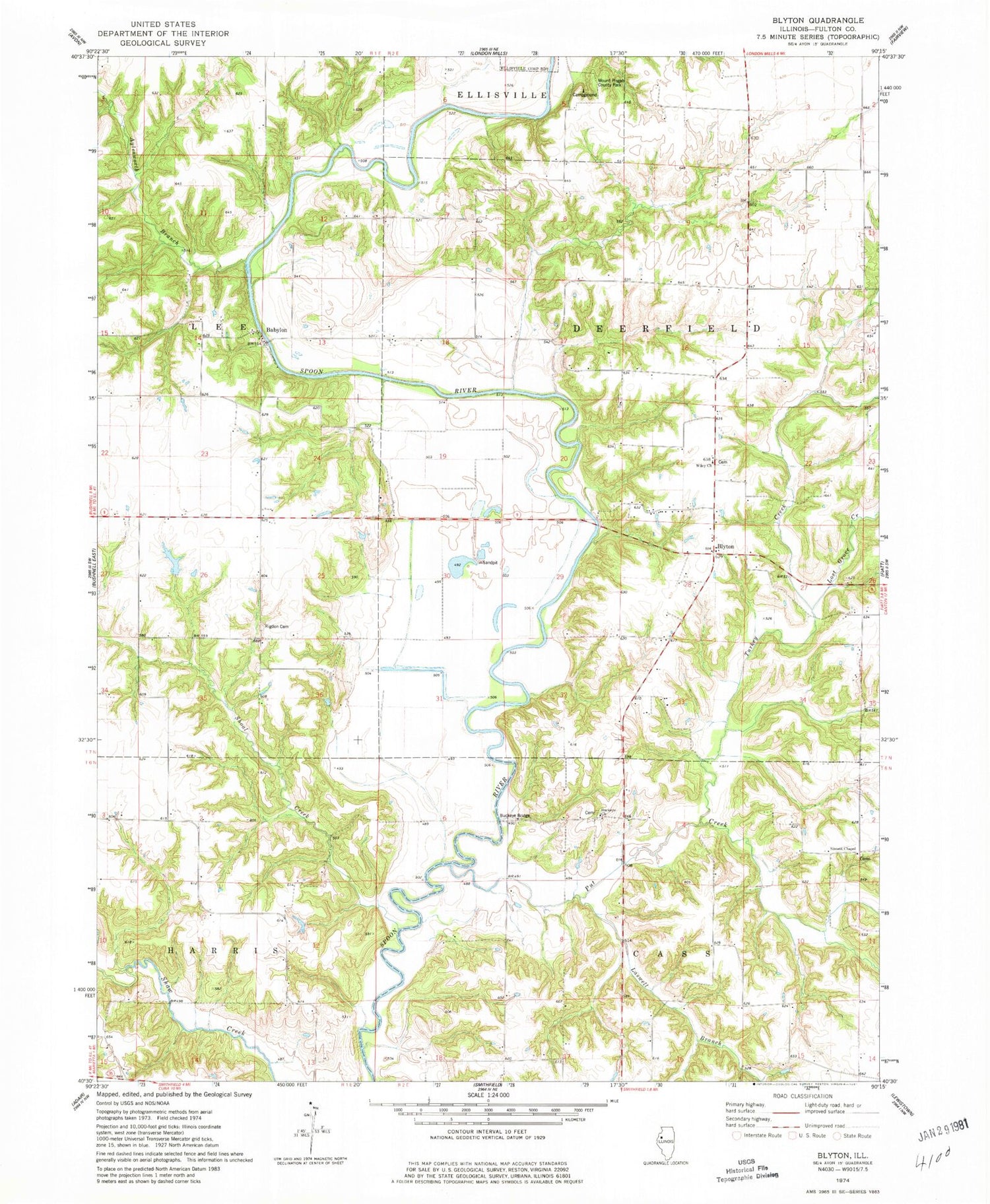
Historical USGS topographic quad map of Blyton in the state of Illinois. Map scale may vary for some years, but is generally around 1:24,000. Print size is approximately 24" x 27"
This quadrangle is in the following counties: Fulton.
The map contains contour lines, roads, rivers, towns, and lakes. Printed on high-quality waterproof paper with UV fade-resistant inks, and shipped rolled.
Contains the following named places: Aylesworth Branch, Babylon, Babylon Bend Bridge, Babylon School, Baughman School, Big Hollow, Blout Centennial Farm, Blyton, Blyton Post Office, Buckeye, Buckeye Bridge, Buckeye Cemetery, Buckeye Church, Buckeye School, Clyde Darst Pond, Clyde Darst Pond Dam, Franklin School, Henderson Cemetery, Henderson School, Laswell Branch, Lost Grove Creek, Mount Pisgah County Park, Mount Pleasant School, Pleasant Valley School, Put Creek, Rigdon Cemetery, Shoal Creek, Shoofly School, Sinnett Chapel, Sinnett Chapel Cemetery, Sweeney School, Sweeneys Pond, Sweeneys Pond Dam, Templars Hall, Township of Deerfield, Turkey Creek, Victory School, Whiteoak Grove School, Whites Ferry, Wiley Cemetery, Wiley Evangelical Lutheran Church, Wiley School, Williams School, Ziltz Bridge, ZIP Code: 61431


