
MyTopo
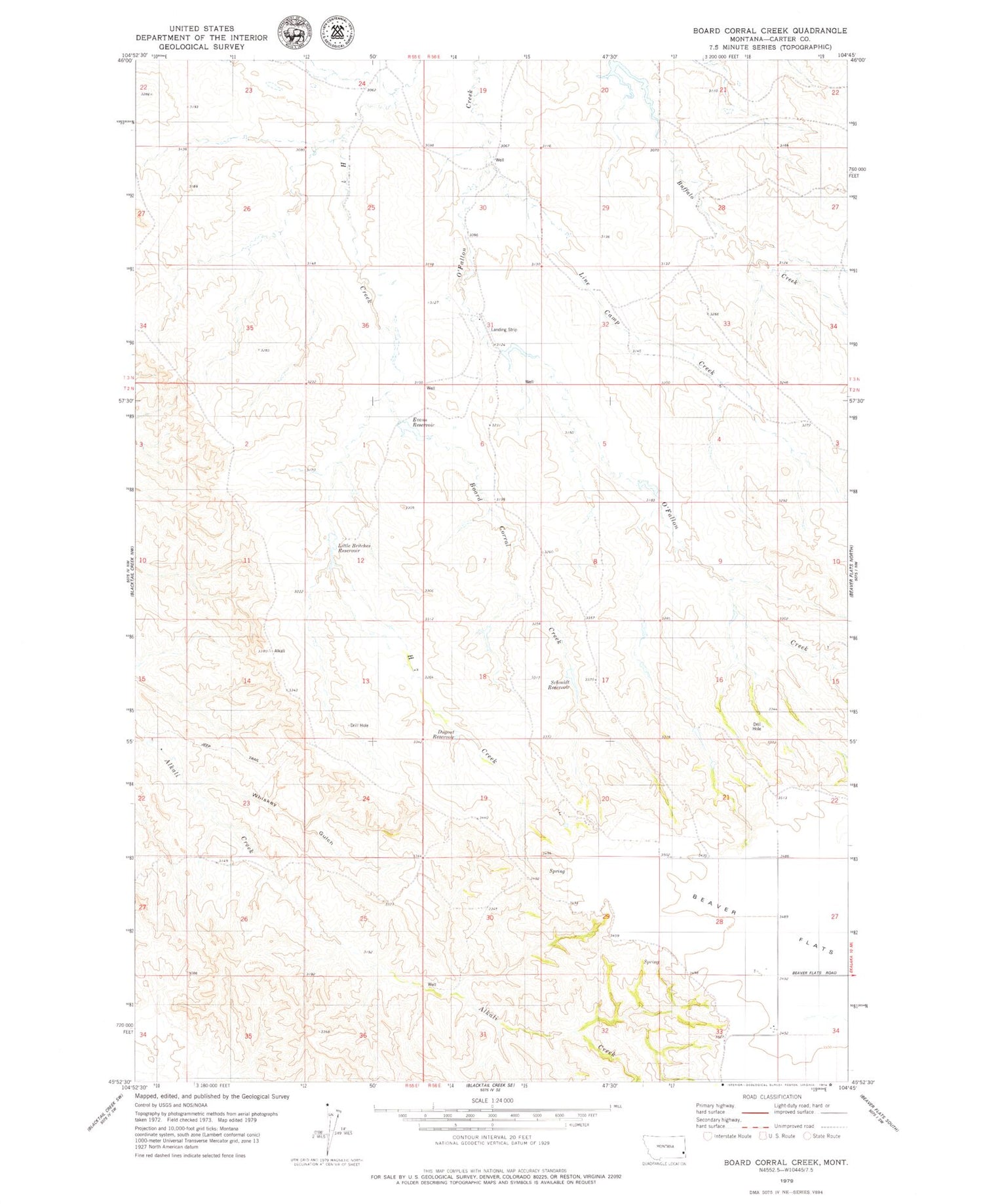
Classic USGS Board Corral Creek Montana 7.5'x7.5' Topo Map
Regular price
$16.95
Regular price
Sale price
$16.95
Unit price
per
Couldn't load pickup availability
Historical USGS topographic quad map of Board Corral Creek in the state of Montana. Map scale may vary for some years, but is generally around 1:24,000. Print size is approximately 24" x 27"
This quadrangle is in the following counties: Carter.
The map contains contour lines, roads, rivers, towns, and lakes. Printed on high-quality waterproof paper with UV fade-resistant inks, and shipped rolled.
Contains the following named places: 02N55E35CAB_01 Well, 02N56E04DCBC01 Well, 02N56E09ACB_01 Well, 02N56E28DDD_01 Well, 03N56E22DDAC01 Well, 03N56E33DC__01 Well, Board Corral Creek, Dugout Reservoir, Evans Reservoir, Line Camp Creek, Little Britches Reservoir, Schmidt Reservoir, Whiskey Gulch


